Full Article
about Villanueva de la Concepción
A town at the foot of the Torcal de Antequera, offering the best views and access to this natural site.
Hide article Read full article
A village shaped by a passage
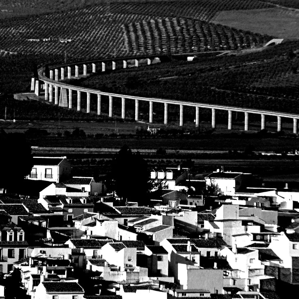
The olive groves suddenly give way to a landscape that looks almost unfinished: stacks of limestone piled up without order, as if a giant had started building and lost interest halfway through. This is the approach to the Paraje Natural del Torcal, just a short drive from Villanueva de la Concepción. From above, the village appears as a white cluster set at around 570 metres above sea level, between the Antequera depression and the Montes de Málaga.
For centuries, this area functioned as a natural corridor between the inland and the coast. That role as a passage helps explain why a settlement took root here and gradually grew. Until relatively recent times, Villanueva de la Concepción also depended administratively on Antequera, reinforcing its connection to that larger town.
An old route between Antequera and the coast
The road that climbs towards El Torcal broadly follows the line of a much older path, once used to connect Antequera with Málaga. Human presence in the area goes back a long way. In Iberian times, there was already activity nearby, with the ancient settlement of Osqva located in the surrounding area. Later, during the Roman period, there are references to rural villas in this territory. The elevated position made it a logical place from which to observe movement along the route to the coast.
On one of the nearby hills are the remains associated with the castle of Xébar, a fortification of Andalusi origin built to oversee the الطريق. Today, only fragments survive: stretches of wall and heavily ruined structures scattered among the olive groves. Even so, they make the purpose clear. This was a place designed to control who passed through this natural corridor.
With the development of the Camino Real linking Málaga with inland Spain during the Early Modern period, the route regained importance. At that time, Villanueva de la Concepción was still a small village under the jurisdiction of Antequera, closely tied to the movement of muleteers and goods along this road.
The parish church of the Inmaculada Concepción was built in the 18th century. The building is simple, typical of rural parish architecture of the period. Its bell tower, visible from much of the surrounding area, acts as a reference point within the sea of olive groves. From the square, the view opens out towards the valley descending in the direction of Málaga.
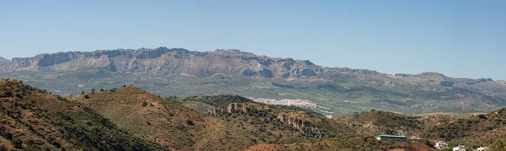
El Torcal: a landscape that defines the area
For many visitors, the main reason to come here is the Paraje Natural del Torcal. It is one of the most well-known karst landscapes in the Iberian Peninsula. The limestone that forms this massif began as marine sediment around 150 million years ago. Over time, the uplift of the Betic mountain ranges and subsequent erosion fractured and reshaped these layers into what can be seen today: flat platforms, deep fissures and stacked rock formations that sometimes look as though they have been deliberately arranged.
The geological value of El Torcal is clear, but it has also influenced how people have moved through and occupied the surrounding area. The massif acts as a natural barrier between the Antequera depression and the coastal strip, channelling movement through the passes around it. Those routes have been used for centuries.
From the visitor centre, several marked walking routes begin, offering different ways to explore the landscape. Some are short circular paths, while others venture deeper into the massif and require more time and suitable footwear. In summer, it is best to start early. The limestone reflects heat, and by midday the sun becomes intense.
Flavours of the countryside
The food in Villanueva de la Concepción reflects the traditions of the Antequera region, closely linked to agricultural work and seasonal practices such as pig slaughter. One of the most typical winter dishes is migas made from candeal bread. Stale bread is moistened and then worked again in the pan, usually served with cured meats, olive oil and, depending on the season, grapes or olives.
Choto al ajillo, goat cooked with garlic, is more often prepared for family meals and festive occasions. It is rich in garlic and typically accompanied by local bread. During the warmer months, porra antequerana is a common choice. This cold dish is thicker than gazpacho and made with tomato, pepper, bread and olive oil.
Must, or mosto, is still produced in some homes during the grape harvest. It is a cloudy drink with a very short fermentation, slightly sweet and served chilled. During the festivities of the Inmaculada, the village’s patron saint, it is traditional to prepare roscos de vino. These are simple ring-shaped biscuits flavoured with aniseed and sweet wine, and they keep well over time.
Getting there and when to go
Villanueva de la Concepción lies to the south of Antequera and just over half an hour by car from Málaga, reached via the A-45 and local roads. When using public transport, the usual approach is to travel first to Antequera and continue from there.
The village itself can be explored comfortably in an afternoon. Many visitors use it as a base for visiting El Torcal or for heading to the dolmens of Antequera.
Spring is often the most pleasant time to walk in the area. Temperatures are mild, the olive groves are at their greenest, and flowers appear among the cracks in the limestone of El Torcal. Around this time, a local celebration is usually held, although details may vary from year to year.