Full Article
about Chiclana de la Frontera
Major tourist destination with long golden-sand beaches and golf courses; blends sun-and-sea tourism with wine-making tradition.
Hide article Read full article
A landscape shaped by water
Tourism in Chiclana de la Frontera makes more sense when seen through its geography. The town sits among marshlands and low rises beside the Bay of Cádiz, where the River Iro reaches the sea after a short, calm course. This position was no coincidence. Activity along this stretch of coast goes back to Antiquity, and remains found around the Cerro del Castillo are often linked to Phoenician presence.
In the early 14th century, during the Middle Ages, the area became part of the domains of the Casa de Medina Sidonia. This followed a settlement charter granted by Fernando IV. For centuries afterwards, Chiclana was defined by salt pans, small market gardens and scattered maritime work. The shift towards tourism connected to the beach is a relatively recent development when set against that long past.
Marks left by time
Chiclana can be read through gradual accumulation. Sand arrives with the tides, salt crystallises in the pans, and sediment settles in the tidal channels of the bay. The marshland landscape is the result of that slow process.
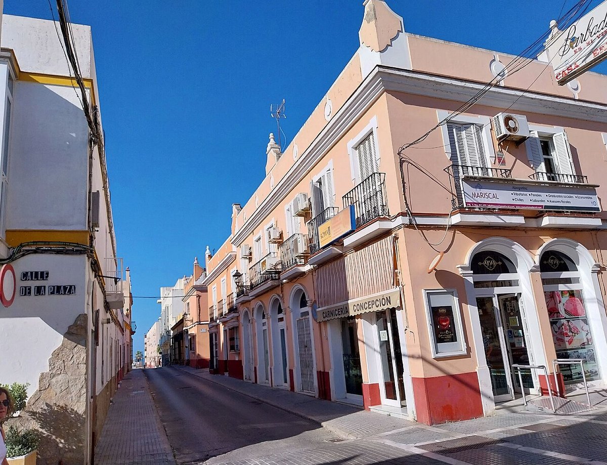
In the historic centre, another form of accumulation appears. The urban layout took shape after the medieval repopulation, with streets still reflecting practical needs of the time. Some are wider, once used for moving livestock, while narrower lanes offer shade during the hotter months. The area is protected as a Bien de Interés Cultural, a designation for heritage sites in Spain.
The Lisbon earthquake of 1755 affected much of the Cádiz coastline and led to widespread rebuilding. Chiclana followed that pattern. Many of the buildings in the centre date from reconstruction or later reforms linked to that event. The Iglesia de San Juan Bautista is one example, with its current appearance tied to those works.
The War of Independence left its mark as well. In 1811, a battle took place nearby between French troops and allied forces. Fighting occurred across different parts of the municipality, forming part of the wider conflict that shaped the bay during that period.
Sancti Petri and the changing coast
Off the coast stands the Castillo de Sancti Petri, built on a small island that guards the natural entrance to the tidal channel. Tradition places an ancient sanctuary connected to Hercules in this location, although the exact site of that temple remains uncertain.
The castle seen today dates from medieval times and served for centuries as a defensive point controlling navigation within the bay. Much later, the surrounding waters became an important centre for the almadraba tuna fishing system. A fishing settlement operated there through much of the 20th century, before being abandoned when the activity moved elsewhere along the coast.
Towards the end of that same century, tourism began to reshape the area with the development of Novo Sancti Petri. The contrast is clear. Spaces once tied to tuna fishing now give way to residential areas, golf courses and large-scale developments associated with La Barrosa beach.
Wine, salt and quieter traditions
The marshes of the bay have long produced more than salt. In the albariza soils of the municipality, palomino grapes have been cultivated for centuries. These are the same grapes used in the Marco de Jerez for fortified wines. Chiclana maintains its own wineries and a winemaking tradition that is less well known than that of other towns in the region, though firmly established.
Traditional salt extraction still continues in some areas. Walking through these esteros, or tidal flats, offers a sense of how an economy once worked by making use of what the tides brought in. Salt, fish and small-scale agriculture along the edges all formed part of that system.
There are also quieter continuities. At the Convento de Jesús Nazareno, the Augustinian Recollect nuns continue to prepare almond sweets using long-standing convent recipes. It is one of those practices that carries on outside the main flow of tourism.
A town that shifts with the seasons
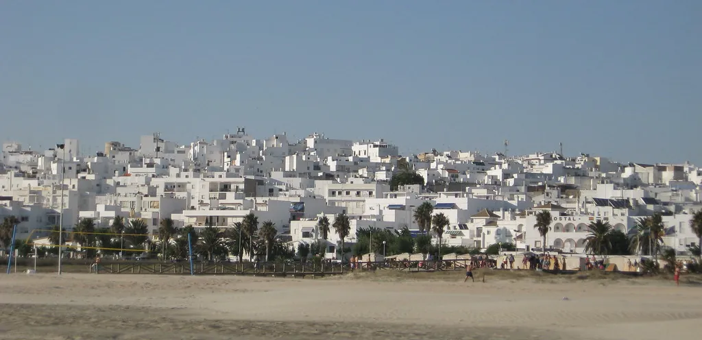
Chiclana has a population of over ninety thousand, yet in summer the number of people rises significantly. Much of this increase gathers along the coast, especially around La Barrosa beach and the nearby residential areas.
The municipality functions as a place spread across several centres. There is the historic core, inland residential districts, and the coastal zone shaped by tourism. This layout helps explain why, even during the busiest months, some parts of Chiclana still move at the pace of a large town within the bay.
Local celebrations also structure the year. Semana Santa has a strong presence in the town centre, with religious processions forming part of the calendar. Summer tends to bring fairs and festivities linked to the patron saint, Nuestra Señora de los Remedios.
Moving through Chiclana
The historic centre can be explored on foot without much difficulty. A visit to the Iglesia de San Juan Bautista offers a clear reference point, and wandering through the surrounding streets reveals how the town developed over time. Beyond the centre, the wider municipality stretches towards marshes, salt flats and the coastline, where the relationship between land and sea continues to define Chiclana.