Full Article
about La Línea de la Concepción
Border town with Gibraltar, open and commercial; long beaches and a wide tapas scene.
Hide article Read full article
A town shaped by the wind and a border
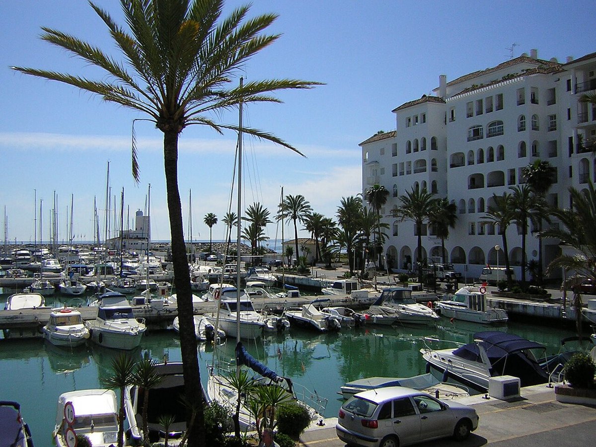
The easterly wind, known locally as levante, often sets the tone here. When it blows hard, the palm trees along the seafront lean towards the isthmus and the Rock of Gibraltar appears so close it feels like part of the same urban landscape. Tourism in La Línea de la Concepción begins with that sense of proximity. The town grew directly opposite Gibraltar, and its history, economy and daily life still revolve around that border.
This is not a typical Andalusian seaside destination. It functions first and foremost as a border town. Its streets carry the accents of the Campo de Gibraltar, and each day workers cross the frontier while the port and the Strait remain constant reference points. Everything feels connected to that narrow strip of land separating Spain from Gibraltar.
Origins facing the Rock
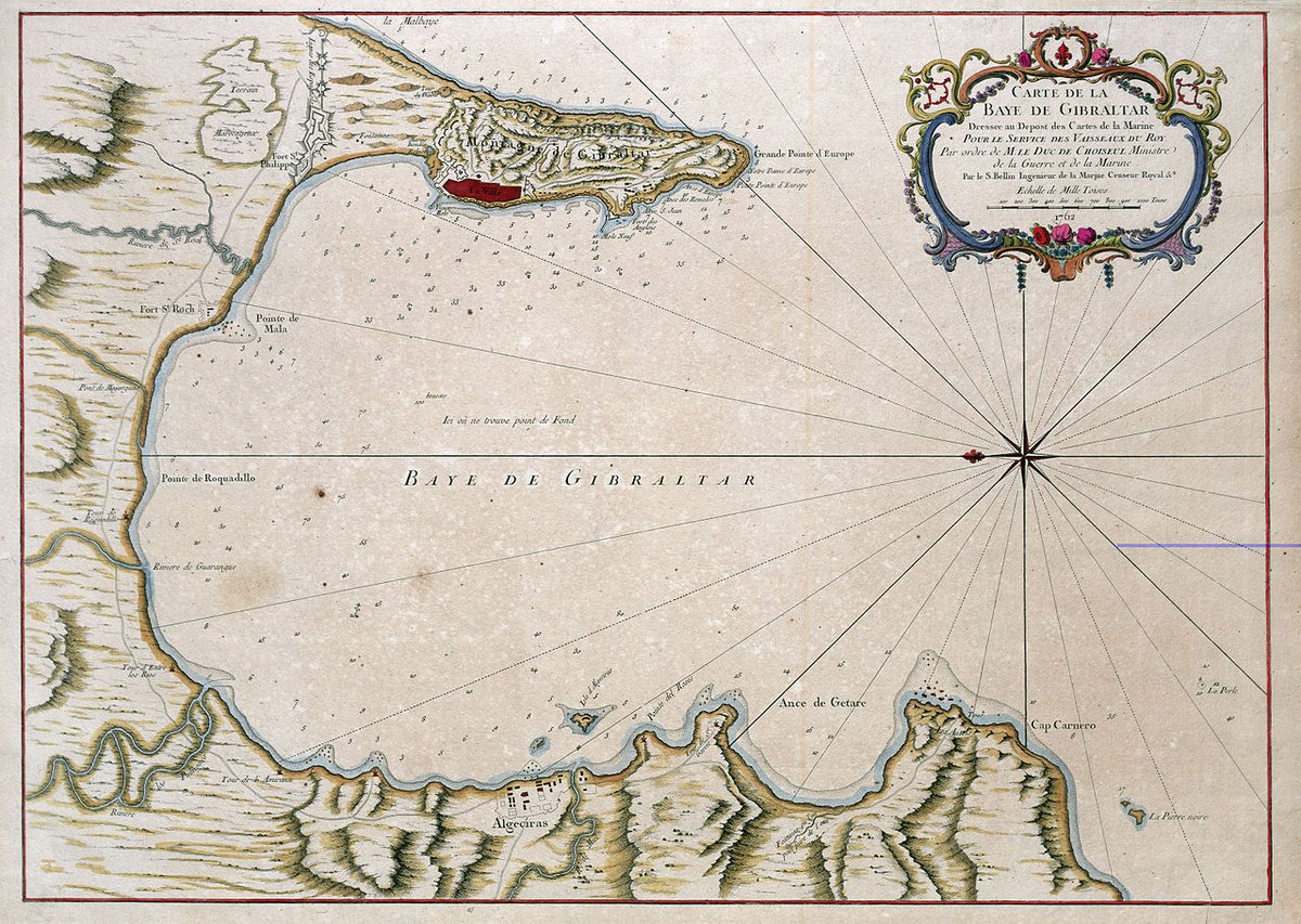
La Línea owes its beginnings to the defensive systems built by Spain after the British took Gibraltar in 1704. During the 18th century, a line of fortifications was constructed to control the isthmus. That “line” would eventually give the town its name.
For much of the 19th century, the area expanded around military camps, roadside inns and small settlements linked to trade with Gibraltar. It was not until the second half of that century that La Línea became an independent municipality, separating from San Roque.
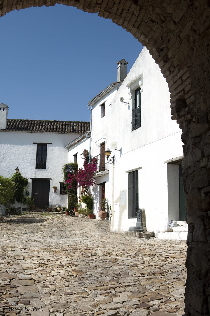
That origin still shows in the layout of the town. The centre has relatively straight, wide streets compared with many nearby places, with open squares and clear axes that look towards the sea or the border. The central market, built in the 19th century with a metal structure, reflects the style of similar markets from that period: functional design, iron framework and large roofs designed for ventilation.
Bunkers along the isthmus
Across the seafront and in different parts of the municipality, numerous bunkers remain from the first half of the 20th century. They formed part of a defensive system built after the Spanish Civil War, at a time when there were fears of a wider conflict affecting the Strait.
Many of these structures are still partially buried among dunes, parks or built-up areas. Some have been restored and signposted, offering a way to understand how this stretch of coastline was once defended. They are austere concrete constructions, designed for resistance rather than appearance, yet they now form part of the town’s historical landscape.
Cruz Herrera and a shared horizon
The Museo Cruz Herrera is dedicated to the local painter José Cruz Herrera (1890–1972), who spent much of his life between Andalucía and North Africa. His work often focuses on Moroccan scenes: markets, portraits of women and domestic interiors.
The collection reflects a relationship that has long been strong in this part of southern Spain. The Strait is close, and for decades La Línea served as a frequent point of departure towards cities such as Tangier or Tétouan.
The museum is housed in a historic building surrounded by gardens. Outside stands a large dragon tree, which locals often point out as one of the oldest in the grounds.
Streets with traces of prosperity
In the centre of La Línea, modest buildings sit alongside a handful of bourgeois houses dating from the late 19th and early 20th centuries. This was a time when economic activity linked to Gibraltar brought a degree of local prosperity.
Details such as iron balconies, decorative tiles and moulded façades echo the urban architecture of Cádiz from that period. There are not many examples, but enough to read a chapter of growth tied to trade and the constant movement across the border.
In recent years, some central streets have been brightened by neighbourhood initiatives. Suspended umbrellas stretched between buildings, crocheted awnings and handmade decorations appear depending on the season. These projects come from local associations and aim to bring more life into these streets.
La Atunara and cooking from the Strait
To the west of the centre lies La Atunara, a former fishing district that long maintained a distinct character from the rest of the town. Its low houses and closeness to the sea reflect its maritime origins.
Local cooking remains closely tied to what comes from the waters of the Strait. Tuna appears in various traditional preparations, and fish stews and fried dishes typical of the Cádiz coast are also common.
The proximity to Gibraltar is noticeable at the table as well. It is not unusual to find combinations that mix Andalusian cooking with popular dishes from the other side of the border. This blending reflects everyday life in a place where thousands of people cross daily for work.
Moving through town and the rhythm of the levante
The levante wind can significantly alter how the climate feels, especially in summer. When it blows strongly, the Levante beach is particularly exposed. At those times, many locals prefer more sheltered areas around the bay.
The town centre is easy to explore on foot, with distances that make walking a natural way to get around.