Full Article
about Cartaya
Coastal municipality that includes the tourist areas of El Rompido and Nuevo Portil; it combines protected pine forests with unspoiled beaches and rich seafood cuisine.
Hide article Read full article
Where river and Atlantic meet
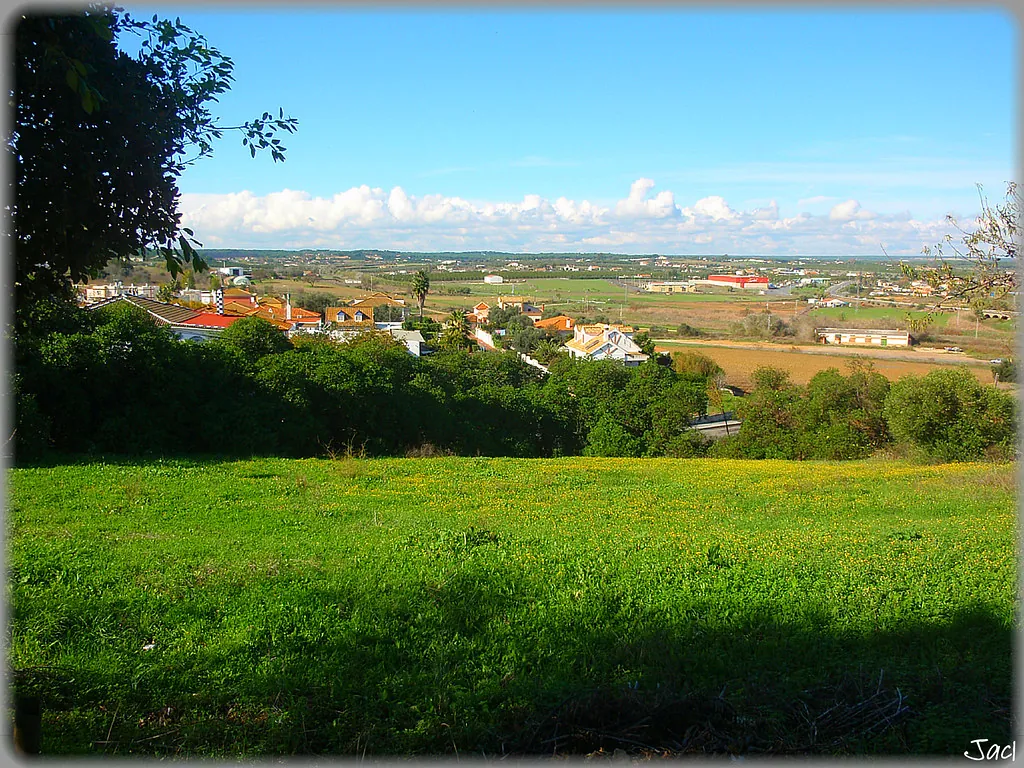
Tourism in Cartaya is closely tied to its geography. The River Piedras widens here into a calm estuary before opening out to the Atlantic, and that stretch between marsh and coast has shaped local life for centuries. It served early on as a natural shelter for small boats moving along this part of the Huelva coastline, with long-standing links to the larger ports nearby.
This meeting point between fresh and salt water still defines the area. The estuary is broad and quiet, its surface often broken only by tides and passing craft, while the surrounding land shifts between wetlands and cultivated ground. It is a landscape that has always demanded adaptation rather than control.
An old landscape of marshes and fields
Human presence here long predates the present town. Along the Huelva coast, archaeological remains linked to Phoenician and Roman settlements have been documented, particularly those connected to salt extraction and fish salting. These activities depended on wide marshlands like those of the Piedras.
Around El Rompido, when the tide goes out, traces of that earlier use of the coastline sometimes appear. They are fragmentary, but enough to suggest how long this environment has been worked and inhabited.
Modern Cartaya took shape in the late Middle Ages. In 1453, Don Pedro de Zúñiga, lord of Gibraleón, ordered the foundation of a town here on the site of an earlier Islamic alquería, or rural settlement. The castle he built, square in plan with towers at each corner, had a clear purpose: to watch over the river mouth and control a territory where fishing, salt and small-scale agriculture were becoming increasingly valuable.
Over time, the building has served very different roles. It has been used for military purposes, as a municipal storehouse, and even as a prison in the 20th century. Today it hosts cultural activities and offers a clear sense of the surrounding geography. From here, the Ría del Piedras can be understood as a whole, along with the sandy formation of the Flecha de El Rompido and, further inland, the pine forests and farmland that now occupy much of the municipality.
The Flecha de El Rompido, a coastline in motion
The Flecha de El Rompido is one of the most distinctive coastal landscapes in Andalucía. It is a long sandbar that has formed gradually in front of the mouth of the River Piedras through the combined action of currents and tides. It is not fixed in place. The sand shifts with storms, and the coastline itself moves over time.
This constant movement explains why the old lighthouse ended up further inland, eventually replaced by another built closer to the sea. Walking along the flecha, when access and conditions allow, makes these processes visible. The terrain is made up of low dunes, salt-tolerant vegetation and protected areas where birds nest, including the Kentish plover, known in Spanish as chorlitejo patinegro.
Opposite, on the other side of the estuary, the small fishing settlement of El Rompido continues to maintain its maritime activity. The gamba blanca, a local white prawn, and other species from the Gulf of Cádiz are still brought ashore using traditional fishing methods that have changed very little over generations.
Cooking shaped by sea and marsh
Local cooking is rooted in what comes from the sea and nearby marshlands. One of the most common dishes in homes is choco stewed with potatoes, choco referring to cuttlefish. Tuna stews also appear frequently, along with fried small fish and rice dishes in which seafood plays a greater role than meat.
Further inland within the municipality, influences from the Sierra de Huelva begin to appear. Cured meats and hams from the Aracena area are widely found, produced in a cooler climate than the coast. To accompany these, white wines from the nearby Condado de Huelva are typical, most often made from the zalema grape.
Cooking here tends to be straightforward and avoids unnecessary elaboration. Ingredients are local, and recipes remain close to the domestic traditions they come from.
Festivities between land and sea
Several local celebrations have their origins in agricultural or fishing life. The romería of San Isidro, held in May, reflects its rural background. For generations, farmers would take part to ask for protection over their crops ahead of the sowing season.
In El Rompido, the celebration of the Virgen del Carmen recalls the town’s connection to the sea. The image is placed on a boat and carried along the estuary, accompanied by other vessels. It is a scene that combines religious devotion with maritime tradition.
The autumn fair has a different origin, more commercial in nature. In the 19th century it functioned as a meeting point for buying and selling livestock and agricultural goods across the region. The atmosphere has changed over time, though it still retains something of its role as a local gathering.
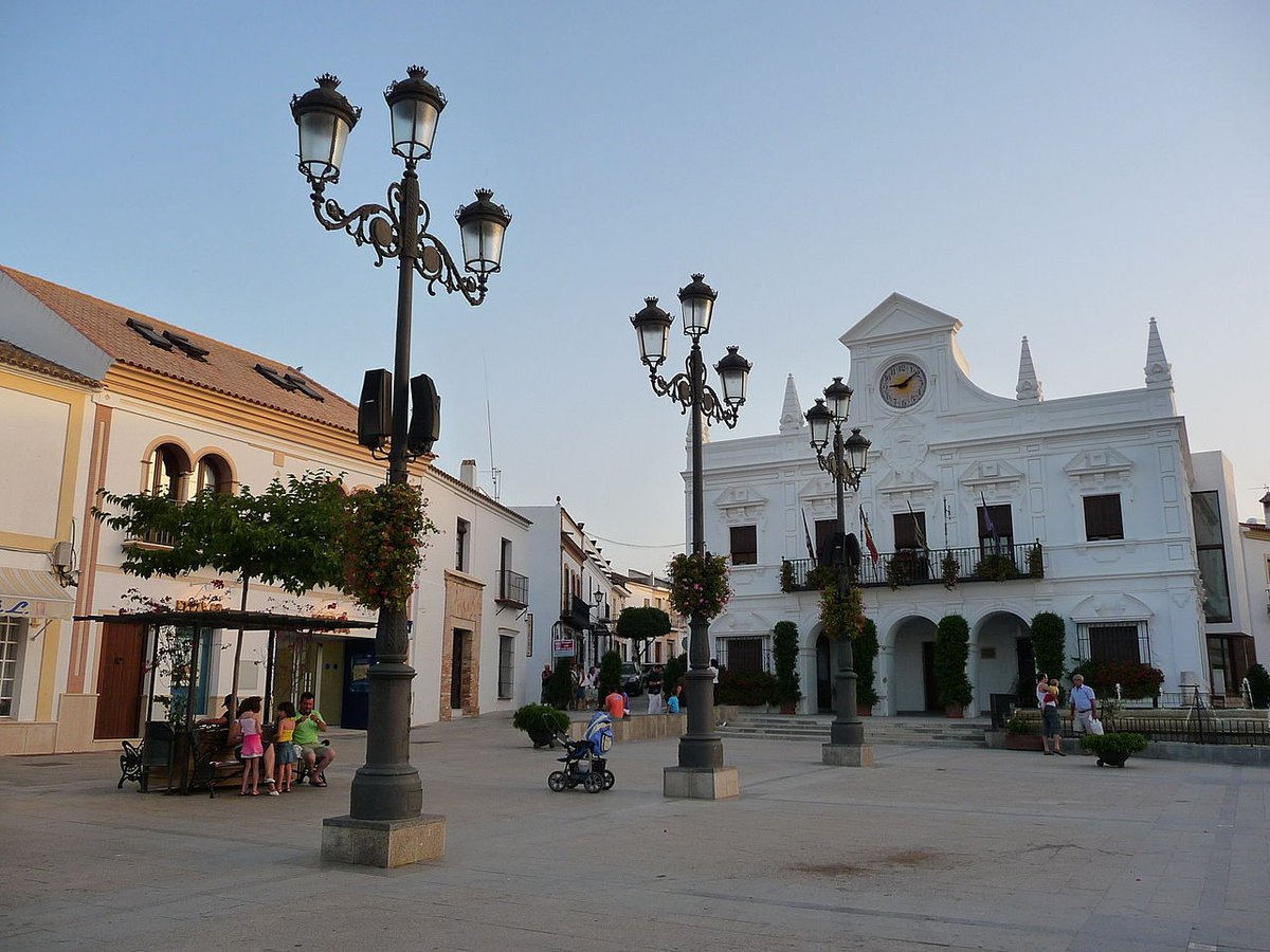
Walking through Cartaya and its surroundings
The town centre of Cartaya can be explored at an unhurried pace without taking long. The castle is the most recognisable landmark, close to the town hall, which is housed in a historic building bearing the coat of arms of the Zúñiga family. Streets in the centre still follow layouts that recall the town’s medieval origins.
To understand the municipality more fully, it helps to head out towards the natural surroundings of the River Piedras. Paths through the marshland pass areas of tamarisk, tidal channels and small lagoons. Water birds are a common sight in these areas, especially in quieter stretches where the landscape feels largely unchanged.