Full Article
about Cortes de la Frontera
Municipality with Spain’s largest cork-oak forest, set between two natural parks and rich in woodland heritage.
Hide article Read full article
A landscape that smells of cork
Cork has a smell when it rains. It rises from the cork oak forests as water touches freshly stripped bark. In Cortes de la Frontera, that detail says a lot about the place. The municipality covers a wide area for its population, and much of that land is made up of dehesa pasture and cork oak woodland. From the main square, where administrative buildings and everyday life gather, the view opens onto a sequence of soft hills that shift in colour with the seasons and with the rhythm of cork harvesting.
This is not a tightly packed village but a broad territory where land use shapes daily life. The surrounding countryside feels open rather than enclosed, with the cork oaks spaced out across gently rolling ground. The result is a landscape that looks worked but not crowded, shaped over time by an activity that still matters.
The logic of cork
Here, cork is not a side activity. For a long time it has organised both the countryside and the way people work. In the hills around Cortes, scattered farmhouses remain, linked to cork oak estates. During summer, when the cork harvesting season begins, the pace of life in the countryside increases. This is when the bark separates most easily from the trunk, and teams work for weeks at a time.
Tree trunks often carry markings that identify ownership. It is an old practice, once used to avoid disputes where several estates shared continuous stretches of woodland. That sense of continuity still defines the area, where boundaries are not always visible but are clearly understood.
Cork production continues to play a significant role in the local economy. It also explains the open character of the dehesa landscape that dominates the area. The spacing of the trees, the condition of the ground and the presence of paths all reflect long-standing use rather than recent change.
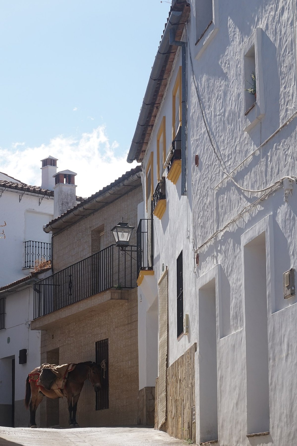
In Cañada del Real Tesoro, one of the municipality’s three main settlements, traces of older ways of working are still visible. Some houses were linked to livestock routes and to the use of mules and carts. Many have been altered over time, but a few doorways still retain heavy iron fittings and wide entrances that once led into yards and stables.
Three settlements across the sierra
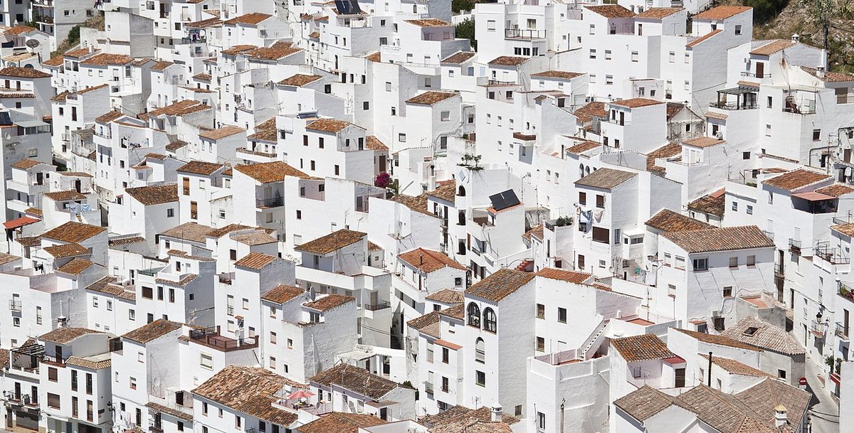
Cortes de la Frontera does not function as a single compact town. Its municipal area includes three main settlements, separated by several kilometres: Cortes, Cañada del Real Tesoro and El Colmenar.
El Colmenar lies in the Guadiaro valley, close to the well-known Buitreras canyon. Its appearance differs from a traditional mountain village. It has more in common with a small railway or industrial settlement, shaped by the arrival of the train and certain factory activities in the late 19th century. This origin still influences its layout and character.
Cañada del Real Tesoro, by contrast, has a more regular street pattern. Its layout reflects planned settlements created after the Castilian conquest of the area. For centuries, it served as a passage point along livestock routes that connected the pastures of the Serranía with the lowlands of Cádiz. That function as a place of movement is still part of its identity.
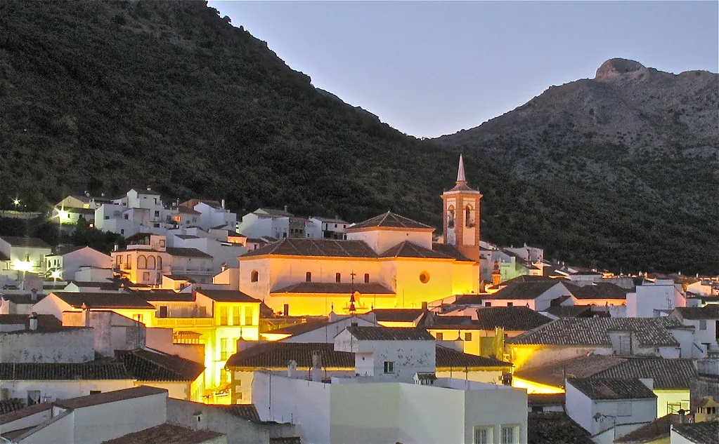
The main settlement of Cortes sits at a higher elevation. Its historic centre is arranged around the parish church and a network of streets that follow the natural shape of the terrain. At one edge of the village stands the bullring, partially carved into rock and built towards the end of the 19th century. The seating takes advantage of the slope of the land, giving it an unusual appearance compared to more conventional arenas.
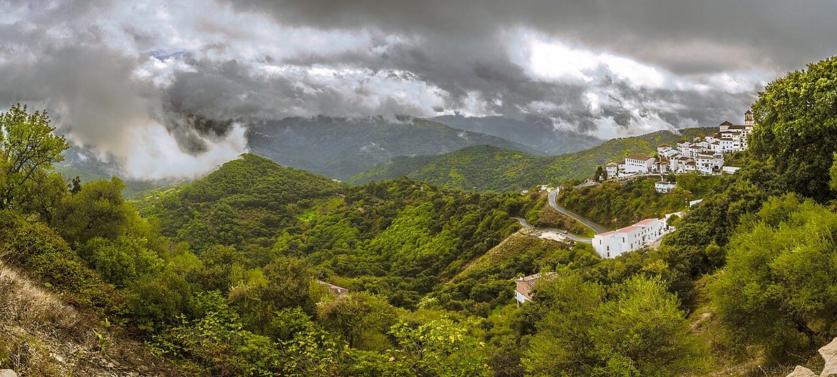
La Sauceda and a wetter corner of the mountains
To the south of the municipality lies one of the best-known areas in the surroundings: La Sauceda. It is not located next to the main village, and reaching it involves forest tracks that pass through dense cork oak woodland.
La Sauceda had a stable population for centuries and was also linked to episodes of conflict in the 19th and 20th centuries. Over time it became depopulated. Even so, the area still preserves remains of older buildings, along with a small hermitage rebuilt in the 20th century.
The climate here is noticeably more humid than in other parts of the Serranía de Ronda. Its position, influenced by proximity to the Strait and the orientation of the mountains, encourages frequent mist. This helps explain the presence of ferns, moss and mushrooms, especially in autumn. For many local residents, this woodland has long been a place for gathering wild fungi and chestnuts.
The change in vegetation is clear when compared with drier areas nearby. Moisture lingers, and the ground supports a different mix of plant life. The atmosphere can shift quickly with the weather, reinforcing the sense that this part of the municipality follows its own rhythm.
Cooking in step with the seasons
Local cooking follows the agricultural calendar. In autumn and winter, more substantial dishes appear, linked to pig slaughter traditions and to hunting in the surrounding hills. Stews made with chickpeas, cured meats and pork remain common in many homes.
Lamb and beef from local livestock farms are also typical, usually prepared simply, either roasted or cooked over a grill. During mushroom season, some dishes incorporate varieties gathered in the nearby woodland.
Traditional sweets include tortas de aceite and other baked goods associated with specific festive dates. These recipes are tied to the calendar as much as to ingredients, appearing at particular moments of the year rather than all the time.
Reaching Cortes and moving through it
Cortes de la Frontera sits at the western edge of the Serranía de Ronda, close to the boundary with the province of Cádiz. The roads that lead here are mountain routes, with frequent bends and changes in elevation, typical of this part of Málaga.
Many visitors use the village as a base for walking routes within Los Alcornocales Natural Park or for exploring the Guadiaro valley. Travelling here is less about covering long distances and more about taking time. Journeys are not especially far in kilometres, but the terrain means they are rarely quick.