Full Article
about Faraján
Quiet village in the Genal Valley, ringed by chestnuts and known for the spectacular Chorreras de Balastar.
Hide article Read full article
A village shaped by the hillside
Faraján sits on a slope like many villages in the Genal Valley, with houses adapted to the incline and streets that rise directly uphill. It belongs to the Serranía de Ronda and has a population of just over 280 people. This small scale defines tourism here. Faraján is a place shaped by agriculture and by a landscape that has always dictated how people build and live.
The layout still reflects its Andalusí past. Narrow streets follow irregular paths that adjust to the terrain rather than impose order on it. Whitewashed façades and tiled roofs respond to practical needs rather than decorative ambitions. For centuries, local life revolved around the use of surrounding woodland, the chestnut groves of the valley, and small cultivated plots.
At around 645 metres above sea level, the village is surrounded by cork oaks, holm oaks, pines and, above all, chestnut trees. This setting is characteristic of the Genal Valley and explains much of the traditional activity in the area.
Walking the village
Faraján’s historic centre is protected as a Conjunto Histórico-Artístico, a designation used in Spain for areas of cultural and architectural interest. It does not take long to cross the village, yet a slower pace helps reveal how a mountain settlement adapts to steep ground.
Streets are short and sometimes stepped. Houses lean against one another to make the most of limited space. Small patios, retaining walls and stairways create transitions between homes, each one adjusted to the slope in a slightly different way.
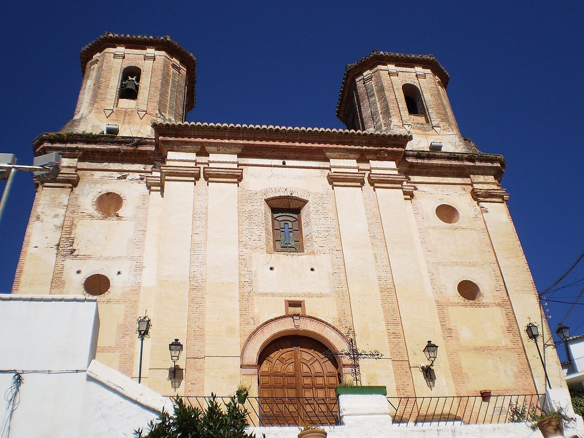
The parish church of San Miguel Arcángel stands on one of the highest points. Its origins are usually placed in the 16th century, although later alterations have changed its appearance. It is not a large building, but its position gives it a clear role in the village skyline when seen from the paths that approach from the valley.
Near the cemetery, an खुलो viewpoint opens onto the surrounding landscape. From here, the Genal Valley stretches out with hillsides covered in chestnut trees. On clear days, the view extends towards other nearby sierras.
A walk without a fixed route is often enough to understand the place. The streets reveal how each house responds to uneven ground, and how the village as a whole grows out of the hillside rather than sitting on top of it.
Paths through the Genal landscape
Faraján lies within an area where traditional paths between villages still make sense. For generations, these routes connected orchards, mills and neighbouring settlements. Some are now signposted, while others remain as older trails that locals have used for years.
One of the better-known natural features nearby is the Tajo de la Madera. This rocky gorge breaks the continuity of the surrounding woodland. Access follows mountain paths with uneven sections, and conditions can vary depending on the stretch. It is advisable to check the route before setting out.
Other paths link Faraján with villages such as Júzcar and Cartajima. These routes help make sense of the agricultural structure of the Genal Valley. Chestnut groves cover the slopes, while small terraced plots and areas of scrubland fill the spaces between ravines.
Food traditions remain closely tied to this environment. Local cooking includes hearty stews, migas and roast kid goat. In autumn, chestnuts take on a central role at the table. Some years also bring wild mushrooms from the surrounding hills, along with honey produced in local apiaries.
A simple calendar of traditions
Festivities in Faraján follow a straightforward calendar rooted in long-standing customs. The celebration of San Miguel Arcángel at the end of September is the main event of the year. Processions pass through the central streets, and neighbours gather in shared spaces.
May brings the Cruces de Mayo, when certain squares and corners of the village are decorated with flowers. The setting is modest, in keeping with the scale of the place.
Semana Santa, or Holy Week, has a restrained character. The steep slopes and narrow streets shape how processions take place, giving them a different rhythm from those in larger towns.
Summer changes the daily routine. Evening gatherings move outdoors as temperatures drop, and open spaces in the village host night-time festivities. Much of social life shifts into the streets after sunset.
Getting there and moving around
The usual approach from Málaga passes through Ronda before continuing towards the Genal Valley along mountain roads. The final kilometres include bends and changes in gradient, which are typical of this part of the Serranía.
Within Faraján, most movement is on foot. Cobbled streets and steep inclines make comfortable footwear a sensible choice. Services are limited, as expected in a small municipality, so basic needs are best considered before arrival.
Faraján does not present itself with grand landmarks or extensive infrastructure. Its interest lies in how closely it reflects its surroundings. The terrain, the chestnut groves, and the long use of the land all remain visible in the way the village is laid out and lived in today.