Full Article
about Villaluenga del Rosario
The highest and smallest village in the province, set in a rocky massif; known for its payoyo cheese and polygonal bullring.
Hide article Read full article
A village shaped by rock
Tourism in Villaluenga del Rosario begins with its setting. The village stands at around 850 metres above sea level, in the limestone massif of the Sierra de Grazalema, within what is now known as the Sierra de Cádiz. Rock defines everything here. It dominates the landscape and dictates the layout of the streets: steep inclines, whitewashed houses fitted to uneven ground, and sheer rock faces that close off the view in places.
With just over 460 inhabitants, Villaluenga operates on a very different scale from other, more visited villages in the area. Its size and setting still reflect a way of life tied for centuries to livestock and the use of the surrounding land. That background explains much of what is seen today: compact homes, narrow streets that offer shelter from the wind, and a constant sense that the village is working with, rather than against, the terrain.
Built against the hillside
Villaluenga forms part of the Parque Natural de la Sierra de Grazalema, one of the wettest mountainous areas in southern Spain. The slopes are covered with holm oaks, gall oaks and Mediterranean scrub, though what stands out most is the ever-present limestone. In several spots, the village appears to rest directly on it.
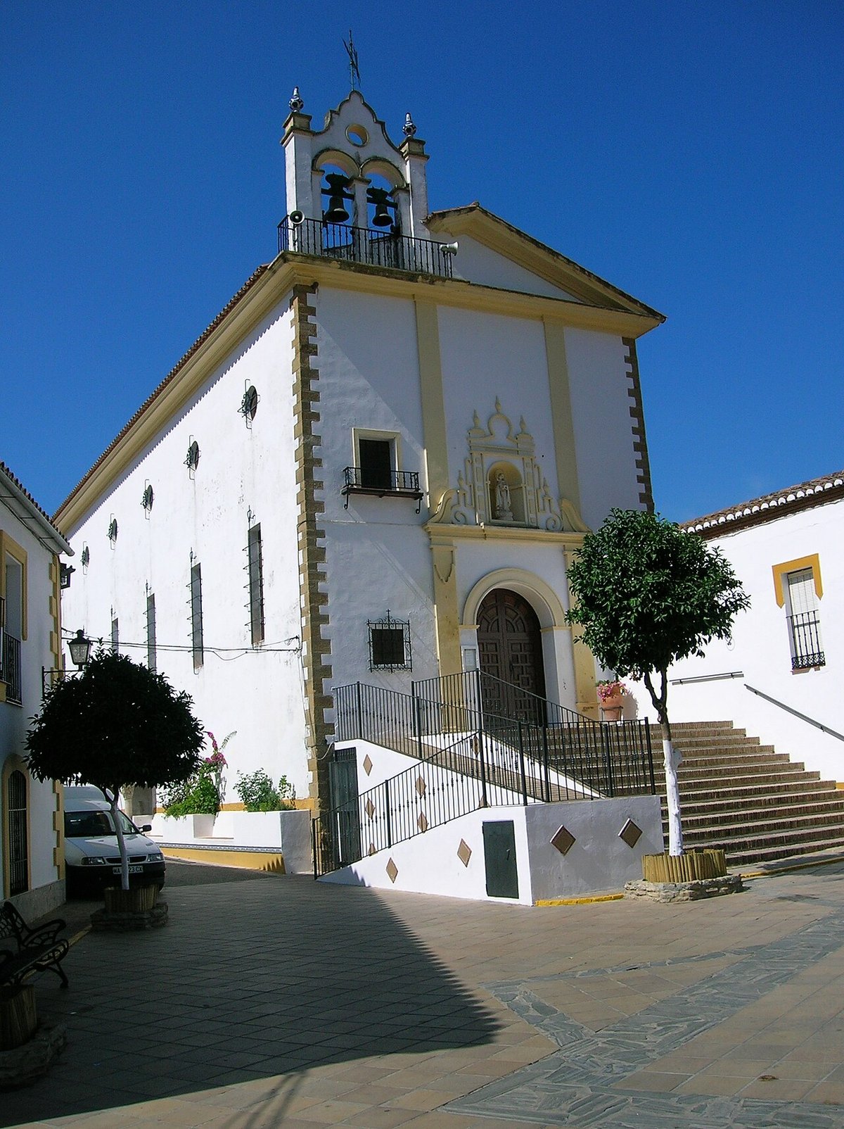
The church of El Salvador dates back to the 16th century, although the current building includes later modifications. It is not a grand monument. Its interest lies more in how it sits within the village layout, anchoring one of the small squares where daily life still gathers.
Close to the centre, there are many details typical of traditional mountain architecture. Iron window grilles, stone doorways and wooden balconies appear throughout. These are practical features rather than decorative ones, designed to ventilate homes and protect them from the mountain climate.
Short streets, steep climbs
The village centre can be explored in a relatively short time, though the slopes should not be underestimated. Streets lead up and down from the main square, threading between tightly packed white houses. In some sections, the rock itself is visible right beside the buildings, a reminder of how limited the available space was when the settlement developed.
Plaza Mayor serves as the main meeting point. Its open space and central fountain contrast with the narrower streets nearby, offering a break from the enclosed feel of the surrounding lanes.
Limestone landscapes of the Sierra de Grazalema
Beyond the village, the terrain rises into walls and hills of limestone that form a kind of natural amphitheatre. This is a karst landscape, where features such as sinkholes, fissures and small cavities are common across the terrain.
Marked walking routes run through the surrounding area, allowing visitors to explore this environment on foot. Some paths are relatively short and manageable, while others venture deeper into the massif and include steeper or more uneven sections. Within the Parque Natural de la Sierra de Grazalema, certain routes require prior authorisation or have seasonal restrictions.
The same limestone formations also attract those interested in climbing and mountaineering, as the rock provides suitable conditions for these activities.
Livestock and local produce
Villaluenga’s traditional economy has long been linked to livestock, particularly goats. This connection is still visible today in one of the area’s most recognised products: cheese made from the milk of the payoya goat, a breed native to the Sierra.
Alongside cheese, other products typical of rural mountain areas can be found, including honey, cured meats and olive oil produced within the wider comarca. Local cooking tends to rely on simple stews and dishes rooted in countryside traditions, reflecting the ingredients available in the area.
Birds and rock faces
The rocky cliffs around Villaluenga provide shelter for several species of birds of prey. It is common to see them gliding above the valley, whether walking along nearby paths or simply stepping beyond the built-up area into more open ground. At certain times of year, migratory birds also pass through the area.
Festivities and daily rhythm
The festive calendar follows patterns shared by many villages in the Sierra. The celebration dedicated to San Miguel Arcángel, the town’s patron saint, concentrates the main religious events. Semana Santa, or Holy Week, is marked in a more restrained way, with shorter processions through the central streets.
During the summer, activities are organised in the main square and other parts of the village, taking advantage of the cooler mountain evenings. In autumn, it is common to see gatherings or events linked to local products, particularly cheese.
Getting there and moving around
Villaluenga del Rosario lies in the interior of the Sierra de Cádiz, connected by mountain roads to nearby towns such as Grazalema and Benaocaz. Reaching it from the Bay of Cádiz or from the surrounding countryside always involves a final stretch of winding roads through the hills.
Travelling by car remains the most practical option. Once in the village, distances are short and it is usually explored on foot. The main factor to bear in mind is the terrain itself, with its constant slopes and uneven ground shaping every walk.