Full Article
about Alozaina
Gateway to the Sierra de las Nieves, known for its table olives and exceptional natural setting.
Hide article Read full article
A village that keeps its own pace
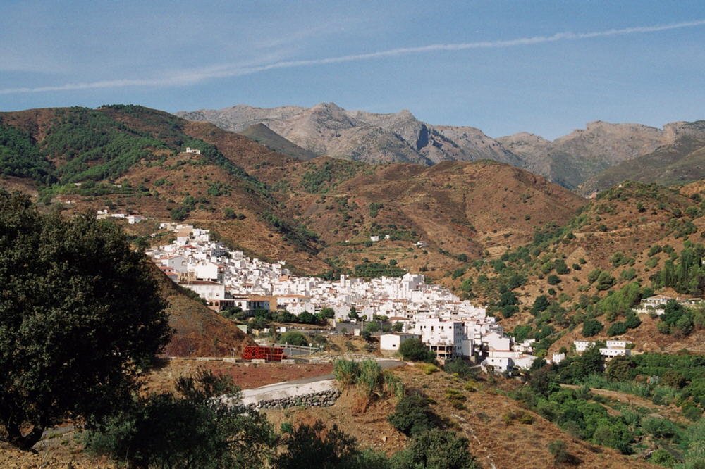
There is no rush in Alozaina. It becomes clear almost immediately: after parking in the first available space, it is not unusual to see neighbours chatting beside a car with the engine still running. Tourism exists here, but it moves at the same unhurried rhythm. The town still functions as a town, shaped by everyday routines rather than visitor schedules. Around forty minutes from the coast, the Sierra de las Nieves forms a quiet boundary between this inland landscape and the busier shoreline.
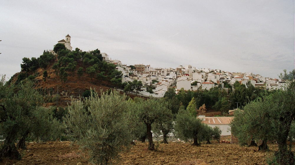
Alozaina sits on a hill at roughly 550 metres above sea level. From this vantage point, the land drops towards the Guadalhorce valley before rising again towards Sierra Prieta. The surroundings are defined by olive groves and low scrub. White houses cluster around what was once a defensive enclosure, still traceable in the layout of the old quarter.
The castle of the beehives
For centuries, the settlement was known as Alhosaina, often translated as “small castle”. Little remains from the Islamic period: a cylindrical masonry tower and fragments incorporated into later buildings. This tower, now called the Torre de María Sagredo, stands at the highest point of the town.
The story most often told here belongs more to oral tradition than to documented history. In 1568, during the Morisco rebellion, the town is said to have been attacked. According to local accounts, a resident named María Sagredo defended the tower by throwing beehives down from above. The scene appears on the municipal coat of arms. Whether events unfolded exactly in this way is difficult to verify, but the story has settled into the shared memory of the place.
The tower still contains its internal cistern and a number of arrow slits. From the top, the strategic position is clear: views stretch across the valley and towards the routes that approach from the mountains.
Santa Ana and the shape of the town
The parish church of Santa Ana stands on the site of an earlier temple built shortly after the Castilian conquest. The current building was completed in the 18th century. Its design is restrained, with a single wide nave and a wooden roof.
The limestone on the exterior has gradually lightened over time, giving the façade an almost white appearance. When sunlight falls directly onto the square, the effect is strikingly bright. The bell tower was added later, in the 19th century. Look closely and it seems to lean slightly to the north, something locals often attribute to the ground beneath it.
The square in front of the church acts as the centre of daily life. Streets meet here, some descending towards the stream, others climbing up towards the tower.
The washhouse by the stream
At a lower level, near the Arroyo de la Cueva, stands the public washhouse built in the mid-20th century. Water still flows through its spouts, and the stone surfaces show the wear of decades of use.
For years, this was a place of both work and conversation. Residents recall informal turns and how each part of the town had its own spot. Today it is used less frequently, but it has not become purely decorative. From time to time, someone still comes here to wash clothes, and the space continues to function as a meeting point.
Cooking from the land and the Olive Fair
Local cooking follows a straightforward logic: produce from the garden, supplies from the valley, and some fish brought up from the coast. Gazpachuelo appears in many households during winter. It is a warm soup made with white fish, thickened with mayonnaise and scented with mint.
Other dishes are tied to traditional home production and small-scale farming. Rabbit cooked with garlic, fried leeks with eggs, and simple stews eaten with day-old bread all form part of the everyday repertoire.
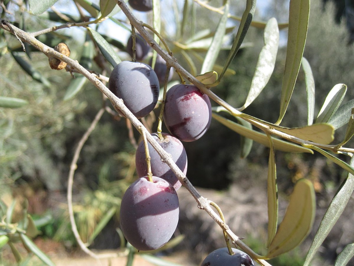
Olives are central to the local economy. The manzanilla aloreña variety is grown in this area, traditionally split and seasoned with herbs. At the beginning of September, the town holds the Feria de la Aceituna, or Olive Fair. For a few days, conversations turn to harvests, mills and olive yields. The event is closely linked to the agricultural calendar of the region.
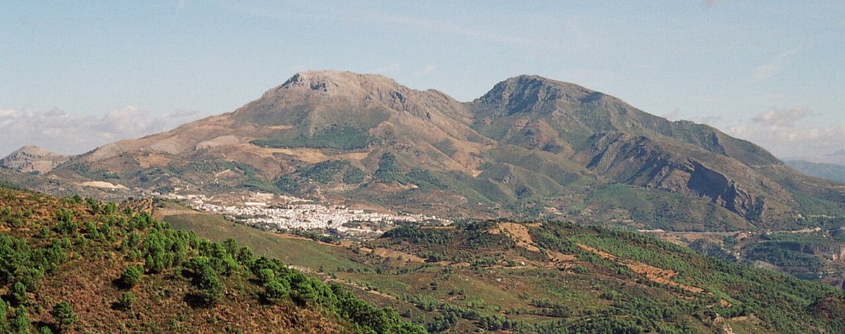
Paths towards Sierra Prieta
The terrain around Alozaina rises quickly towards Sierra Prieta, which reaches around 1,500 metres in altitude. Several walking routes begin near the town and lead into the surrounding hills.
One of the best known climbs all the way to the summit. It is a long route, with the return following the same path. At the top, there are wide views over the Sierra de las Nieves and the Guadalhorce valley.
A gentler option heads into the Jorox valley. This area is relatively humid for this part of Málaga. Along the way, there are remains of old flour mills and small waterfalls which, in colder winters, can sometimes freeze.
Getting there and getting around
From Málaga, the route follows the A-357 inland, then continues along regional roads that cross the valley. The journey usually takes about an hour, depending on traffic.
The town itself is easy to explore on foot. It is best to leave the car in parking areas near the entrances to the old quarter and continue walking through its streets.