Full Article
about Belchite
Hide article Read full article
A town split in two
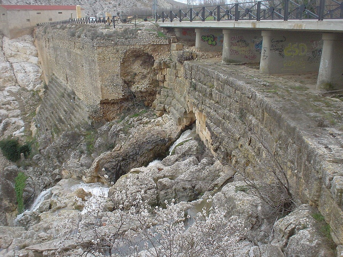
Belchite lies in the Campo de Belchite comarca, set on an open plain in the south of Zaragoza province. It has around 1,500 residents today, yet its name is usually linked to a specific episode of the Spanish Civil War. Few places retain such visible traces of that period. Here, memory is not confined to archives or books, the urban landscape itself shows what happened.
The town is clearly divided into two parts. On one side stands the present-day settlement, built after the destruction of 1937. On the other sits the former town, preserved in ruins just a short distance away. The gap between them is small, but a brief walk is enough to move from ordinary streets to a space marked by absence and damage.
Beyond the built-up area stretches a flat agricultural landscape typical of this part of Aragón. Olive trees dominate, alongside cereals and some almond groves. The dry climate and the constant wind shape daily life and the rhythm of the fields.
The old town and the memory of 1937
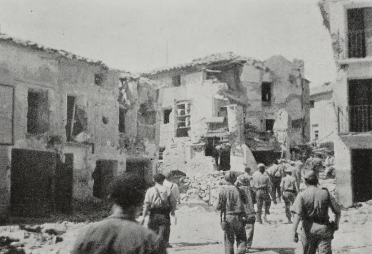
The original Belchite remains as it was left after the fighting of 1937. Streets, broken façades and the remains of houses still follow the historic layout. Rather than a conventional monument, the site works as a large-scale historical record.
The tower of the church of San Martín, still standing, is the most recognisable landmark within the ruins. It was one of the main buildings before the war. Nearby are the remains of the church of San Agustín, another important religious structure in the old centre. Walking through these streets gives a sense of how the town once functioned: closely packed houses, narrow routes and small open squares that can now only be guessed at.
Access to the site is usually arranged through guided visits organised by the municipality. This approach helps make sense of the place. Explanations about the events of 1937 and the later decision to preserve the ruins, rather than rebuild them, add essential context to what is seen on the ground.
The rebuilt Belchite
The current town was constructed after the war, a short distance from the original site. Its layout is wider and more orderly, reflecting mid-20th-century planning. Streets are broader and more regular, creating a clear contrast with the older urban fabric nearby.
At the centre is the main square, where the town hall and the parish church stand. This area functions as the heart of everyday life. It is where administrative activity takes place and where residents gather.
Belchite also has a Centro de Interpretación dedicated to the town’s history and the battle that placed it on Civil War maps. The centre provides background to what visitors later encounter in the old town. It sets out dates, military movements and, above all, the consequences for the local population.
The ermita del Pueyo and the wider landscape
A few kilometres from the town centre stands the ermita de la Virgen del Pueyo. It occupies an isolated hill that overlooks the entire plain, a position of strategic importance long before the 20th century conflict. The sanctuary has medieval origins, although the current building has undergone several changes over time.
From this vantage point, the geography of the comarca becomes clear. Large agricultural expanses stretch in every direction, with towns spaced several kilometres apart and a horizon that remains open and uninterrupted. On clear days, other settlements in the Campo de Belchite can be seen scattered across the plain.
The surrounding area also contains remains from before the Civil War, such as the former convent of San Rafael, now in ruins. These less-visited sites serve as a reminder that the history of Belchite does not begin in 1937.
Routes across the comarca
Belchite is linked to nearby towns such as Azuara and Letux by local roads and agricultural tracks. Many of these routes follow older rural paths that cut through farmland and areas of low scrub.
These are not mountain trails. The terrain is mostly flat or gently rolling, but exposure to the sun is constant. In summer, the heat can be intense and shade is scarce. Carrying water and sun protection is advisable for anyone planning a longer walk.
Festivals and local traditions
The festive calendar in Belchite reflects traditions that remain strong across the comarca. In August, celebrations in honour of San Roque usually take place, with popular events, music and jota performances filling the squares for several days. The jota is a traditional style of song and dance closely associated with Aragón.
Another key event is the romería to the ermita del Pueyo. Residents from Belchite and nearby towns gather for this pilgrimage, combining religious devotion with a social occasion, something typical of rural Aragón.
The olive tree also shapes the yearly cycle. Olive harvesting continues to be an important activity in the area, and much of the local economy revolves around this crop.
When to go
Spring and autumn are generally the most comfortable times to visit. Temperatures allow for exploring the old town and walking the surrounding routes without the strong heat of summer or the cold wind, known locally as the cierzo, that can dominate winter days.
Belchite is not a light destination. Its interest lies in understanding what happened here and how those traces have been preserved. Between the rebuilt town, the ruins and the surrounding plain, the experience is tied to history, landscape and the choices made about how to remember both.