Full Article
about Bubierca
Hide article Read full article
A village shaped by the Jalón
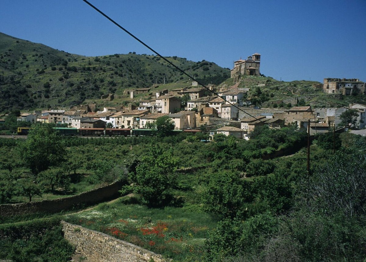
Bubierca sits in the Calatayud area, within the broad depression carved out by the river Jalón. It is one of several small settlements scattered along this valley, places that have largely kept their traditional form and pace rather than adapting to modern tourism. With a population of around seventy people, daily life still revolves around agriculture and fieldwork. That connection remains visible, both in how the land is organised and in the layout of the village itself.
The municipality lies at about 640 metres above sea level, in a natural corridor that the Jalón has gradually opened between gentle hills. The landscape is open and mostly dry farmland. Its colours shift noticeably through the year. Spring brings green cereal fields, summer leaves golden stubble behind, and winter tones become more muted as the cold sets in.
Streets and buildings
The structure of Bubierca follows a pattern common to agricultural villages in the Jalón valley. Streets are short and irregular, shaped more by the terrain than by any formal plan. It is not a monumental town, yet it retains a clear sense of coherence tied to its rural origins.
The parish church, dedicated to San Pedro, occupies the most prominent position. Built in the 16th century and later altered, probably in the modern period, the building is simple in appearance. Stone walls and a tiled roof define its exterior. Decoration is minimal, but the church stands out as a visual reference point. Its tower appears repeatedly while moving through the streets, anchoring the view from different angles.
The houses show a mix of states. Some have been restored, while others have remained closed for years. Features such as rammed earth walls, carefully worked stone doorways and wrought iron balconies can still be seen. A number of wooden doors retain old metal fittings. Many of these homes are only opened at certain times of the year, when people with family ties to Bubierca return.
Fields, river and seasonal change
The immediate surroundings are dominated by dry farming. Cereal crops cover much of the land, joined by almond trees and, in smaller quantities, vineyards. Closer to the Jalón, small irrigated plots appear. These have historically supported modest vegetable gardens.
This type of agriculture has shaped the area over centuries. Tracks, field boundaries and small irrigation channels form part of a structure that may not be obvious at first glance but explains how the territory is organised.
Along the river, stretches of riverside vegetation remain. Poplars, other trees typical of wetter ground and dense undergrowth create a contrast with the dryness of the surrounding hills. During seasonal changes, these cooler areas of the valley often attract bird activity, adding movement to an otherwise quiet landscape.
Moving through the valley
There are no signposted walking routes crossing the municipality, yet a network of agricultural tracks connects fields and plots. These are simple paths, used daily by farming machinery. They can be followed on foot or by bicycle, provided care is taken.
The terrain helps. The valley is relatively open and slopes are usually gentle. From certain stretches, it is possible to appreciate the shape of the Jalón corridor and the continuity of farmland that accompanies the river for kilometres.
These tracks remain working routes. Encounters with tractors or other agricultural vehicles are common, especially during sowing and harvest periods. Anyone moving through the area needs to keep this in mind and treat the paths as part of everyday rural activity.
Shared dates in the calendar
In Bubierca, as in many small villages across Aragón, the festive calendar is closely tied to community life. One of the traditional celebrations is San Antonio Abad, held in winter. It includes the blessing of animals, a custom widely found in rural areas.
The main local festivities usually take place in summer and are dedicated to the Virgen del Rosario. During these days, the village sees the return of people who live elsewhere for most of the year. Religious events, neighbourly gatherings and simple activities fill the streets.
These occasions are not designed as attractions for visitors. Their main role is to bring together those who maintain a connection to Bubierca, reinforcing ties that continue despite distance.
Practical notes for a visit
Bubierca lies in the Jalón valley, not far from Calatayud. The most straightforward access is via the A‑2 and local roads linking the villages along the valley.
Services are limited and can vary depending on the time of year. It is sensible to arrive with some planning in place, particularly if spending several hours exploring the surroundings. The village itself can be walked through quickly and without difficulty. Much of what defines the place lies beyond its streets, in the fields and the wider landscape.
Care is needed when moving around the area. Agricultural access routes should not be blocked, as they are part of daily work for local residents. Respect for these practical aspects helps preserve the rhythm that still defines Bubierca today.