Full Article
about Cedrillas
Hide article Read full article
A high village in the Teruel sierras
Driving north from Teruel towards the mountain ranges, the turning for Cedrillas appears almost without warning. It is the kind of place that makes an impression from the road: elevated, exposed, and clearly subject to the weather. The altitude is noticeable straight away, and the surrounding landscape leaves little doubt that the mountains set the rules here.
With around 650 inhabitants and sitting at more than 1,300 metres above sea level, Cedrillas belongs to that network of villages in the Comunidad de Teruel where daily life remains closely tied to the land. Livestock farming dominates, alongside some agriculture, and many houses face out towards the sierra. This is not a destination built around major landmarks or a grand historic centre that fills guidebooks. Instead, it offers a straightforward way to understand this part of Aragón: small settlements, a tough climate, and long distances between one village and the next.
The urban layout is compact. Streets rise and fall without much planning, creating a slightly irregular feel. Stone is the main material, roofs are steep, and façades show gradual adaptation over time. Cedrillas does not feel like a preserved historical set piece. People live here throughout the year, and that shapes how the place looks and functions.
Walking through the village
The most recognisable building is the parish church of Santa María, which stands above the surrounding houses. Its origins go back to the medieval period, although later alterations are clearly visible. The exterior is fairly plain, something common in mountain villages of this region. If the church happens to be open, inside there are a few altarpieces and wooden elements worth a brief look.
Beyond that, the best approach is simply to walk. Calle Mayor forms the main thread through the village, with smaller streets branching off and climbing towards higher ground. There are modest squares where benches and patches of shade offer a pause. Along the way, details begin to stand out: large doorways designed for barns or storage, iron balconies overlooking narrow streets, and façades that hint at the village’s livestock-based past.
Cedrillas can be explored at an unhurried pace in a short amount of time. A slow circuit, with a couple of detours into side streets, is enough to get a clear sense of how the place works and what daily life looks like here.
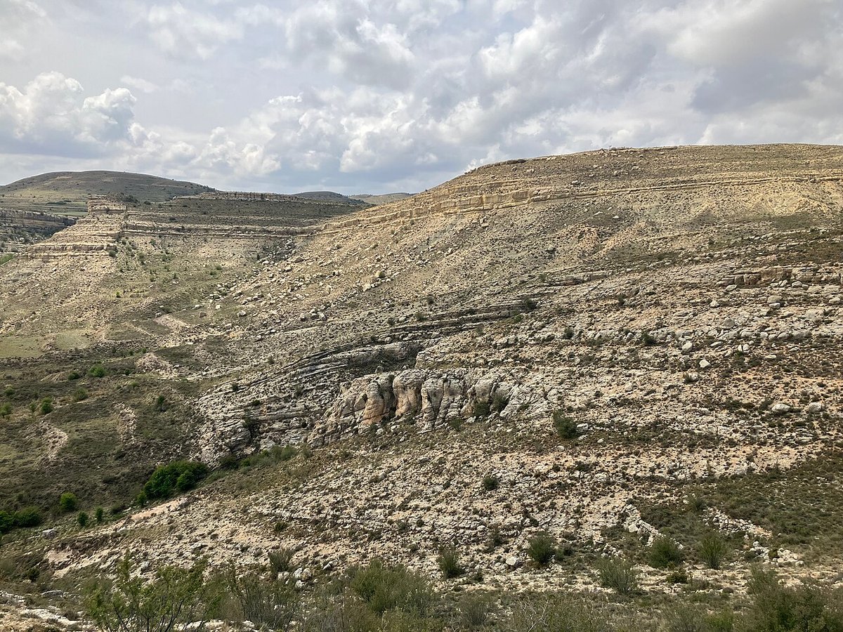
The sierras around Cedrillas
The surroundings are where Cedrillas becomes more interesting. The village lies close to several mountain ranges within the Iberian System in the province of Teruel. The terrain alternates between pine forests, juniper trees, and open expanses that stretch out in all directions.
One of the names that appears on local maps is the sierra de San Ginés. This is not an area with heavily marked trails or the infrastructure of a formal natural park. Instead, what you find are forest tracks, livestock paths and informal routes used by local residents. With a basic map or a simple GPS device, it is possible to walk through these landscapes at an easy pace, surrounded by pine trees and a notable sense of quiet.
On clear days, the higher points offer wide views across the comarca. Rounded hills, shallow valleys and a broad sky define the scene, giving that particular feeling of openness often associated with Teruel.
Mushrooms, cold weather and mountain life
Autumn brings a different kind of activity. After the rains, the area attracts people interested in foraging, as the pine forests are known for níscalos and other types of mushrooms. Knowledge matters here, and it is common to go with someone experienced who can distinguish between species.
Winter changes the rhythm entirely. The altitude makes itself felt, and snow is not unusual in some years. When it arrives, Cedrillas becomes quieter still. Streets are largely empty, chimneys release steady trails of smoke, and outdoor activity is reduced to what is necessary. The sense of isolation increases, shaped by both the weather and the geography.
Festivities and everyday rhythm
The liveliest moment of the year comes with the August fiestas, held around Santa María. During these days, Cedrillas fills up as people return from elsewhere. Traditional events take place alongside music and activities centred on the square and the frontón, a typical court used for ball games in many Spanish towns. As in much of Teruel, these celebrations combine religious elements with informal gatherings among neighbours and families.
Outside the festive period, life settles back into a much calmer pace. Work linked to the land continues, and the long mountain winter defines much of the annual cycle.
Getting there and what to expect
Cedrillas is about 30 kilometres from Teruel city. The usual route follows a road that climbs gradually through small villages in the sierra. It is a straightforward drive, although winter conditions can occasionally complicate things with ice or snow.
Arrival is subtle. A bend in the road reveals a cluster of houses set slightly above the surroundings, with open landscape stretching beyond.
Visiting Cedrillas feels a bit like stopping midway through a mountain journey to stretch your legs. There are no headline attractions or striking monuments competing for attention. The appeal lies elsewhere: in the altitude, the wind, and the quiet presence of the surrounding hills. For those who are drawn to mountain villages as they are, without much embellishment, it is a place that rewards a short, unhurried visit.