Full Article
about Aliaga
Hide article Read full article
First light in the valley
Early in the morning, when the sun still takes its time to rise above the ridges that enclose the valley, the air in Aliaga carries the smell of damp earth and old wood. A car might pass slowly along the road that skirts the village, and little else moves. Tourism in Aliaga often begins like this: in silence, with the rock walls still in shadow and the distant sound of the river threading its way through the ravines.
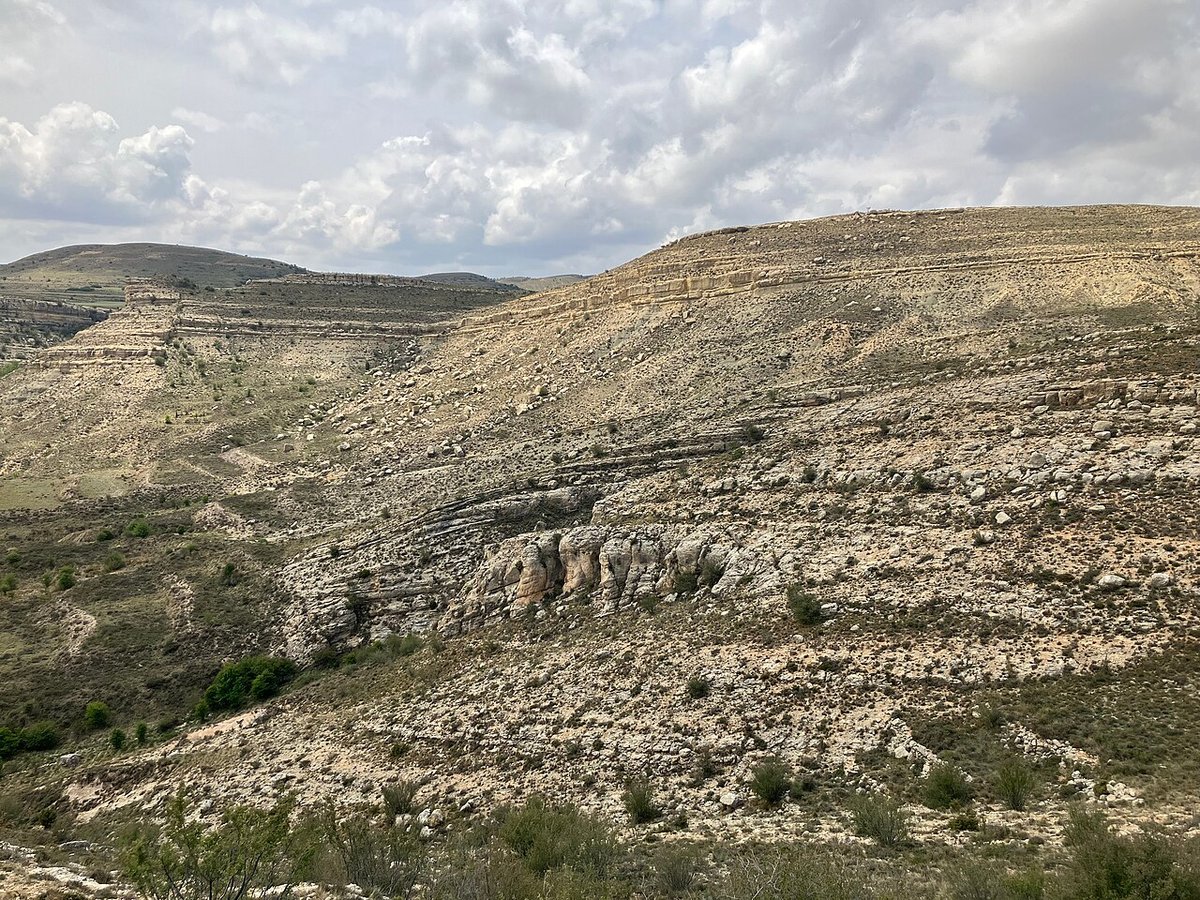
The village sits at 1,105 metres above sea level, in the Cuencas Mineras area of Teruel province. The surrounding landscape is far from gentle or uniform. The ground appears folded and cut into layers, with reddish, grey and ochre tones that shift throughout the day as the light changes. It is not something that reveals itself at a glance. It asks for a pause at a bend in the road, a moment to look more closely and begin to pick out the shapes.
The village on the rise
The houses cluster on a small ارتفاع, easy to spot from the road thanks to the reddish brick tower of the Iglesia de San Pedro, which rises above the rooftops and acts as a reference point when approaching along the winding A‑1702.
Within the village, the streets are short and sloping. There are masonry houses, dark doorways and slightly uneven roofs covered in traditional curved tiles. It is not a large place, and you can cross it quickly, but it rewards a slower pace. On some corners there are still old animal pens or traces of terraced plots attached to the houses, small clues to how daily life once worked when farming and livestock set the rhythm of the year.
By mid-afternoon, light slips in sideways between the buildings and deepens the colour of the brick. For a few minutes, the whole place seems to pause.
Reading the landscape through rock
What truly defines Aliaga lies beyond the village itself. The valley is enclosed by cliffs and ravines where layers of rock appear bent, as if the mountain had been pushed upwards from below. This structure forms part of what is known as the Parque Geológico de Aliaga. Even without knowing the name, it is clear that the terrain here tells a very long story.
From higher points near the village, the course of the river becomes visible, along with the way the valley cuts through the stone walls. At sunrise and sunset, when the light falls low across the land, shadows emphasise the folds in the terrain. Colours become sharper: deeper reds, bluish greys and patches of green where pine trees hold on.
Walking out into the surroundings
Several paths lead out from the village towards old farmhouses and areas of scrubland. Some sections are signposted, others less so, so it is sensible to carry a map or a downloaded track if planning a longer walk.
The routes cross ravines, small pine woods and stony ground where the colour of the soil shifts every few metres. It is common to see griffon vultures circling high above, carried by the rising air currents from the valley.
Spring and early autumn tend to be the most comfortable times to explore the area, with milder temperatures and a little more activity in the countryside. In summer, the sun can be intense at midday and shade is limited in certain stretches.
Local rhythms and the road in
The village calendar still revolves around San Pedro in June, when religious events and neighbourhood gatherings bring more life to the streets. In January, the blessing of animals continues, a tradition linked to the area’s pastoral past.
During summer, small cultural activities appear, such as talks, exhibitions or modest concerts. These often coincide with the return of residents who spend much of the year elsewhere.
Aliaga lies about 75 kilometres from Teruel along the A‑1702. The road is winding and crosses fairly mountainous terrain, so the journey takes longer than the map might suggest. Travelling slowly helps, not just for safety but to take in how much the landscape changes along the way.
Winter can be harsh here, with wind, low temperatures and very short days. Anyone planning to walk in the surrounding area should carry water, wear shoes with good grip and take extra layers, even outside the coldest months. Some paths include loose stone, and the terrain can be deceptive.
Aliaga does not revolve around major monuments or busy streets. What remains instead is something quieter: rock, silence, open ravines and a small village set into the valley, facing a landscape that began to form long before its first houses appeared.