Full Article
about Nueno
Hide article Read full article
Between plain and mountain
Tourism in Nueno begins with a simple question: where exactly is it? The municipality lies in the Hoya de Huesca, right at the point where the flatlands begin to lift towards the sierra de Guara. The road from Huesca, about fifteen kilometres away, gradually leaves behind cereal fields and approaches low hills covered with pine. At around 760 metres above sea level, Nueno appears without ceremony: stone houses, sloping roofs and a layout shaped more by agricultural life than by any formal planning.
This is a landscape in transition. It is not yet mountain, yet the terrain already hints at what lies ahead. That in-between quality explains much of its past. For centuries, this has been a place of passage, dry farming and small scattered settlements.
Latin echoes in stone
The name Nueno is often linked to the Latin expression novem milia, meaning nine miles, possibly referring to a distance marker on an ancient Roman road that connected this area with Caesaraugusta, present-day Zaragoza. This interpretation appears frequently in local studies, though historians do not all agree on the exact detail.
Medieval records are more precise. The village is mentioned in 1029 in connection with the monastery of San Juan de la Peña, an important religious institution that held land across much of what is now Alto Aragón for centuries.
The parish church of San Martín preserves Romanesque remains in its apse, likely dating from the 12th century. The architecture is restrained, with thick walls and small openings. The tower, built several centuries later, uses brick and Mudéjar techniques, which made structures lighter compared to solid stone. It is not a monumental building, yet it clearly shows how rural churches evolved over time while retaining their medieval foundations.
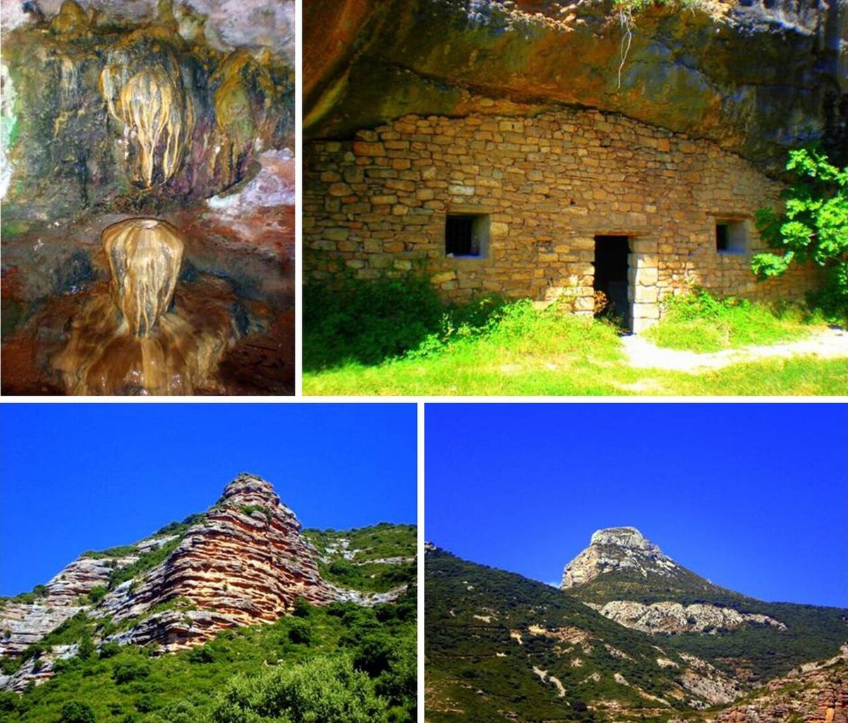
Other Romanesque churches are scattered across the municipality’s smaller villages. In Sabayés, the church of San Andrés features a solid tower that also served as a refuge for centuries, as suggested by its arrow slits. The hermitage of Nuestra Señora de Ordás, once a female monastery documented in the 12th century, now retains only part of its walls. Its elevated position helps explain both the defensive and symbolic logic behind such sites.
Further north, in the valley of Nocito, stands the sanctuary of San Úrbez. It is closely tied to the popular religious traditions of the sierra de Guara. For generations, local inhabitants made pilgrimages here to ask for rain during periods of drought.
Traces of vanished castles
During the centuries when Christian kingdoms and al-Andalus shared shifting frontiers, these hills formed part of a network of surveillance points protecting access to Huesca. These were not grand castles but modest towers and enclosures linked to the control of agricultural land.
In Sabayés, remains of a former castle attributed to the time of King Pedro I can still be seen. It was built to watch over the route towards the city from the Guatizalema valley. Today, fragments of walls survive alongside excavations in the rock that locals later adapted as wine cellars.
The site of Ordás is even more understated. A stretch of wall with a lintelled doorway can still be identified, suggesting it may have been more of a fortified house than a castle in the traditional sense.
The surrounding landscape helps make sense of these structures. Dry farmland dominates, with cereal fields divided by dry stone walls that trace irregular plots. To the north, the sierra de Guara rises abruptly above this gentler terrain, marking a clear shift in scale and character.
Water shaping the land
One of the best-known access points to the sierra from the municipality is the Belsué reservoir. The original dam, built at the beginning of the 20th century, suffered from leakage problems due to the limestone terrain. This led to the construction of another structure downstream, at Cienfuens.
Today, the area is mainly a starting point for walking routes. From here it is possible to reach the Gorgas de San Julián, where the river Guatizalema has carved small pools between conglomerate rock walls. In summer, people often come here to bathe, while outside that season the area is generally quiet.
Further north, in the valley of Nocito, the Pillera ravine is known among those who practise canyoning. The Tozal de Guara, at 1,807 metres, is also climbed from this area via long routes that cross woodland and rocky slopes before reaching the summit.
In many stretches, signage is limited, which is common on the northern side of Guara. It is advisable to check routes and weather conditions carefully before setting out.
A municipality of small villages
Nueno is not just a single settlement. The municipality includes several villages in addition to the main nucleus, among them Sabayés, Belsué, Arascués, Ordás, Santa Eulalia de la Peña and Nocito. Each has its own character, and all have very small populations, especially in winter.
In some cases, daily life depends largely on second homes. Other villages maintain a handful of year-round residents. Stone houses continue to line narrow streets, reflecting a way of life closely tied to the land and to seasonal rhythms.
Across these villages, the sense of continuity is quiet but clear. The buildings, the fields and the paths all speak of long-term adaptation to a landscape that sits between plain and mountain, shaped as much by what it is becoming as by what it has been.