Full Article
about Barrachina
Hide article Read full article
Barrachina: a village on the Teruel plateau
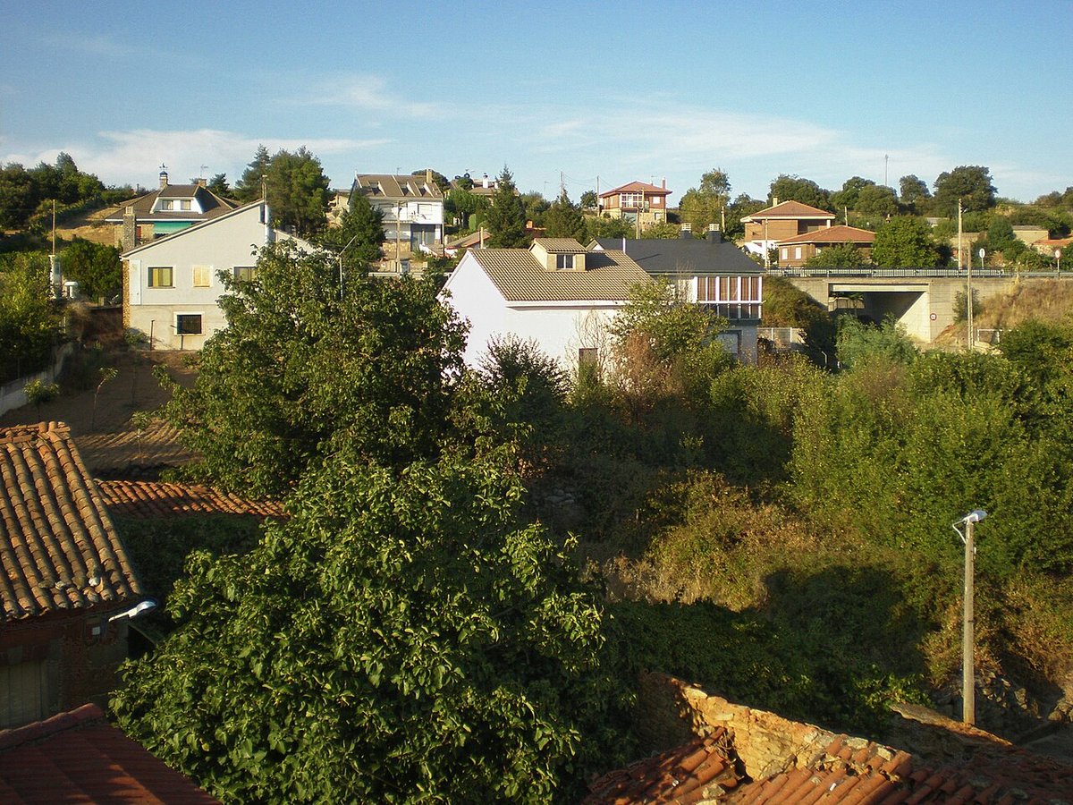
Barrachina sits at over a thousand metres in the upper Jiloca comarca of Teruel. Its population, just over a hundred, reflects a wider pattern across this part of the Teruel plateau. Settlements here grew close to farmland and the seasonal streambeds known as ramblas. The village is not a destination in itself, but a clear example of how these elevated, agricultural communities in inland Aragón are organised.
The layout is irregular. Houses combine stone, rammed earth and adobe, materials that speak of a landscape where timber was scarce but earth was plentiful. You notice the wide gateways, built for carts, and the interior courtyards that were part of a domestic economy tied to livestock and crops.
The parish church of San Miguel
The parish church of San Miguel Arcángel provides the main visual reference in Barrachina. The current building has a 16th-century base, altered over time like many churches in the Jiloca area. Its tower, with simple lines, is visible from the roads approaching the village.
The church does not stand as an isolated monument. It anchors the social centre of the village, with the surrounding streets holding some of the older houses and open spaces used for neighbourhood gatherings. The relationship between the building and the public space around it is direct and unpretentious.
Architecture of necessity
You can walk Barrachina’s streets in under an hour. The interest is in the construction details that respond to the climate and rural work. Look for walls of rammed earth with stone reinforcements at the corners, large doorways that led to tool sheds or animal pens, and the pronounced eaves on some houses, designed to protect façades from winter snow.
There is no historic quarter in a conventional sense. The coherence comes from the repeated use of local materials and a consistent, practical logic. The architecture here was built to serve, not to impress.
The surrounding landscape
The land around Barrachina is open and predominantly flat, given over to cereal fields. Their colour shifts decisively with the seasons: green in spring if rains come, turning to a dry gold by summer. Between the fields lie shallow ravines and patches of low vegetation—thyme, rosemary, and other shrubs adapted to the cold winters and dry summers.
Wind is a constant feature. It shapes the stunted growth of the plants and is part of daily life. This is not dramatic terrain, but one defined by breadth and subtlety. The horizon stretches far, and small changes in elevation become noticeable when you pay attention.
Paths to neighbouring villages
Agricultural tracks and older paths connect Barrachina to nearby settlements like Cella and Tramacastilla. These are not signposted hiking trails but working routes, used for farming. They cross cultivated land and gentle rises, offering a clear view of the Jiloca valley’s scale.
Walking them is straightforward, with minimal gradients. Their condition can vary, so it’s wise to ask locally before setting out. The experience is one of moving through the agricultural landscape itself.
Local rhythms and festivities
The village’s rhythm is tied to the agricultural calendar and family cycles. The main celebration is for the patron saint, San Miguel Arcángel, traditionally held at the end of September as summer fieldwork concludes.
In August, activity increases noticeably. Many people with family ties return for a period of reunion, filling streets that are otherwise quiet for much of the year. It is a social rather than a tourist event.
A brief stop on a wider route
Barrachina is typically visited as part of a broader exploration of the Jiloca comarca. A stop involves a walk through the village and time to observe the surrounding plateau. Spring and early autumn are the most temperate seasons for a visit; winters are cold and windy, while summers are dry and hot.
You will not find monumental attractions here. What Barrachina shows is how a settlement has been built and sustained in the high, open lands of Teruel, maintaining a scale and pace directly linked to its land.