Full Article
about Sigüés
Hide article Read full article
At the edge of Aragón
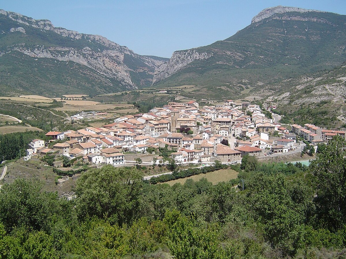
Sigüés sits in the north-east of Zaragoza province, where the Jacetania region meets the border with Navarra. Its location has always been its defining feature, positioned on the natural corridor of the Aragón River valley. Historically, this made it a minor waypoint, a place shaped more by the flow of river and road traffic than by any grand local power. Today, around seventy people live here, a number that speaks to its past as a settlement rooted in the management of its immediate land: crops on the lower terraces, livestock on the slopes.
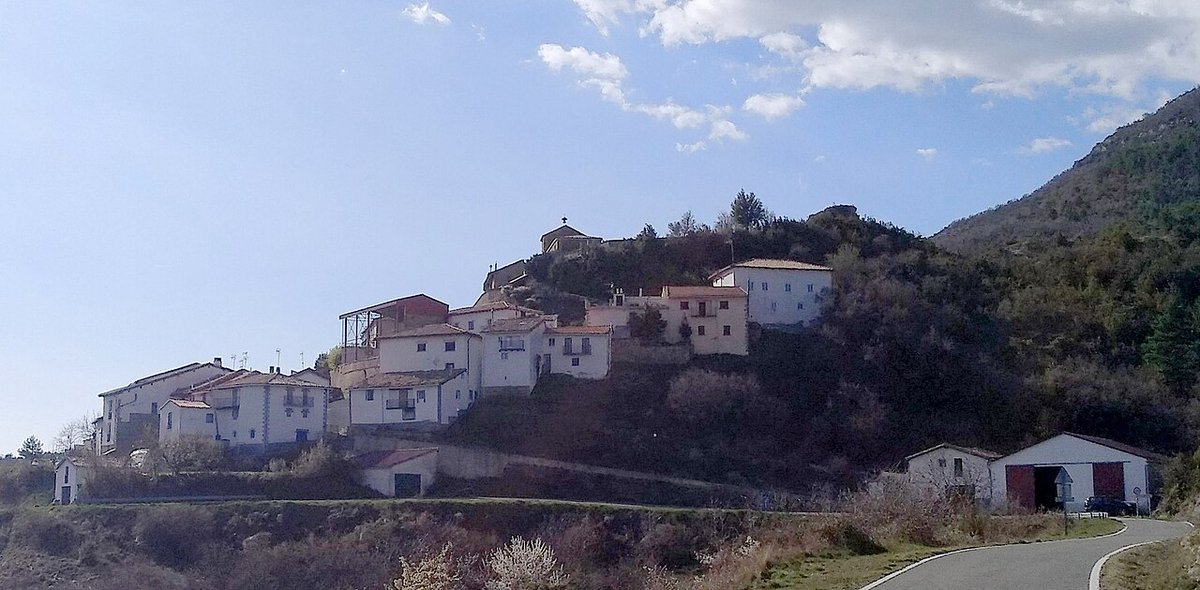
That practical origin is still visible in the layout. There is no planned grid or central plaza designed for ceremony. The stone houses gather in clusters, following the contours of a hillside that drops towards the river. The streets are short, often turning at sharp angles or ending at a field wall.
A medieval corridor
The Aragón valley has been a transit route since at least the 11th century, as the Kingdom of Aragón expanded. Sigüés appears in medieval documents not as a fortress or market town, but as one of many small settlements dotting this corridor. It was part of a denser human landscape than the one you see now, with more hamlets and cultivated fields filling the valley floor.
The parish church, dedicated to San Esteban, is a record of this continuity. The building shows modifications from different centuries—a rounded apse that may be Romanesque in origin, later Gothic vaulting, and an 18th-century baroque altarpiece inside. Its tower, built from the same rough stone as the houses, remains a fixed point in the landscape, visible for miles from the surrounding farmlands.
Architecture of use
The building style here is vernacular and direct. Walls are made of local stone, laid without ornament, and roofs are of curved terracotta tile. Some doorways are large enough for a cart to pass through, leading to interior courtyards that once housed animals and tools. The restoration work visible on some houses tends to be careful, using matching materials.
The village expands organically from its core. You’ll find narrow passages between buildings that open suddenly onto views of the valley, and streets that become dirt tracks leading to barns on the outskirts. These casetas, built for storing hay or sheltering sheep, are the clearest architectural evidence of the livestock economy that sustained Sigüés for generations.
Paths with a purpose
The walking paths that start at the village edges were not laid for recreation. They are the old connections to fields, pastures, and neighbouring villages like Tiermas or Escó. Following one, you walk on history: you’ll pass abandoned cultivation terraces, now grassy shelves, and margenes—dry-stone walls that once marked property lines. The woodland here is mostly pine and oak, slowly reclaiming old pastures.
These are quiet walks. The most movement you’re likely to see is overhead: common buzzards and kestrels riding thermals above the fields in search of rodents. Go early in the morning or late in the afternoon for the best light, which catches the texture of the stone and the long shadows of the sierra.
Calendar and kitchen
Life in a village this size revolves around home and the seasonal calendar. The local cooking is that of the rural Aragón valley: substantial, based on what could be raised or preserved. Dishes like chilindrón (a stew often made with lamb or chicken), or pulses cooked with pork, belong to a domestic tradition for cold winters and long workdays.
The social year peaks during the summer fiestas patronales, usually around mid-August for San Roque. This is when former residents return. The program typically includes a mass, a communal meal in the streets, and an open-air dance. It feels like a family reunion—because it is—rather than an event staged for outsiders.
Getting there and getting around
Sigüés is reached by turning off the A-21 highway that runs through the Aragón valley, onto the local A-1602 road. There’s a small parking area at the entrance to the village.
You can walk every street in Sigüés in under an hour. To understand it, spend another hour or two on one of the outward paths towards the surrounding fields. Wear sturdy shoes; the terrain is uneven and can be stony. What you’re seeing is the form of a village that was built for work, not for show, and that has quietly endured on the margins of a busy corridor.