Full Article
about Benasque
Hide article Read full article
A village shaped by water and height
At seven in the morning, the river Ésera rushes through Benasque, heavy with meltwater, its sound drifting through the windows of houses in the old quarter. In Benasque, that constant presence of water matters more than it might seem. Life here is tied closely to the mountains and to what flows down from them.
Even at that early hour, mountaineers cross Plaza Mayor with poles and backpacks, heading towards the Maladeta massif and Aneto. Almost everyone passes through the village before going higher. Benasque acts as the last sizeable settlement in the valley before the peaks known as the three-thousanders.
A valley that never emptied
Benasque owes its current form to geography. The valley is long and narrow, enclosed by high mountains, with little flat land suitable for farming. For centuries, life relied on livestock and a subsistence agriculture that never produced much surplus.
Like much of the Aragonese Pyrenees, the 20th century brought depopulation, with many residents leaving for cities such as Huesca, Zaragoza or Barcelona. What sets Benasque apart is that the process never fully emptied the village. From the second half of the century onwards, mountain-related activity began to create work. Skiing developed in nearby Cerler, followed by mountaineering, mountain huts and the services that support life in the valley.
Today, the municipality has a population of just over two thousand people and remains active throughout the year, something increasingly rare for Pyrenean villages of this size.
Built for snow and survival
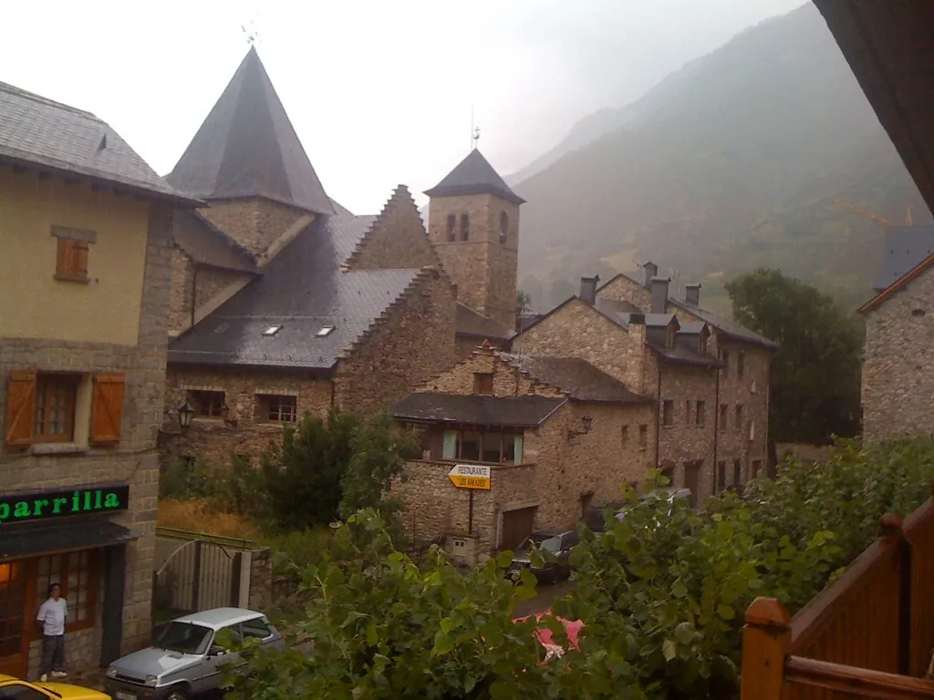
The church of Santa María la Mayor offers a clear sense of how building adapted to a place where snow is a serious weight. Its origins are Romanesque, probably dating back to the 11th century, although it has undergone later alterations, particularly after a fire in the 20th century. The structure is simple, with thick walls designed more to endure than to impress.
Nearby stands a defensive tower from the 16th century, part of a type of fortified house that once served both as residence and refuge. Its solid appearance reflects that dual purpose, and the small openings in its walls hint at a time when protection was a priority. It remains privately owned and is usually seen only from the outside, but walking around it helps place it within the historic core of the village.
The surrounding streets reveal more features of Ribagorzan architecture: carved stone doorways, wooden balconies and steeply pitched roofs that prevent snow from settling.
The pull of Aneto and the Maladeta
From various points in the valley, the mass of Aneto comes into view. At 3,404 metres, it is the highest peak in the Pyrenees. Beneath its north face, a glacier still persists, although like others in the range, it has been shrinking for decades.
The usual approach to the mountain begins at La Besurta, at the head of the valley. From there, the walk to the Refugio de La Renclusa takes less than an hour. Reaching the summit of Aneto itself is a full day in high mountain terrain, ending with the well-known Paso de Mahoma. This narrow ridge of granite blocks requires careful progress using both hands.
For those not aiming for the summit, other side valleys offer alternatives. Estós and Vallibierna provide routes through pine forests and grazing land, gradually leading into granite landscapes marked by glacial lakes.
Food shaped by climate
The traditional cooking of the valley reflects its conditions. Dishes are filling and designed for long, cold days or physical work outdoors.
Lamb appears frequently in slow stews with potatoes and vegetables. Trout from the Ésera is also common, usually prepared simply on a hot surface. During winter, the pig slaughter remains a domestic practice in many households, producing longanizas, chorizos and other preserved foods.
Among the best-known desserts is the tarta de Benasque, a cake made with sponge, cream and meringue that recalls certain pastries from the northern side of the Pyrenees.
Getting there and moving around
Benasque sits at the northern end of the Ribagorza region. There is no railway access, so the usual approach is by road from Barbastro, following the course of the Ésera valley.
The old quarter is easy to explore on foot. During busy periods, traffic is regulated in parts of the centre, and many visitors leave their cars in parking areas at the entrance to the village.
Access to the upper valley, towards La Besurta, can be restricted for private vehicles during the busiest times of year. In those cases, shuttle transport operates from different points along the valley. Anyone planning to walk in the mountains should carry a detailed map. The terrain is complex, and the weather can change quickly, even on days that begin calmly.


