Full Article
about Miravete de la Sierra
Hide article Read full article
The first sound is often the wind, a low hum through the juniper that fills the space between stone houses. Then, perhaps, the scrape of a shutter being opened. Miravete de la Sierra, a village of thirty-some souls in the Maestrazgo of Teruel, operates on a different frequency. Time here isn’t something to fill; it’s something you notice passing, marked by the angle of light on a wall or the arrival of a single car on the road below.
At over twelve hundred metres, the air has a thin, clarified quality. It smells of pine resin and dry earth, and after a cold night, it feels sharp in the lungs. The one-hour drive from Teruel city feels longer, the landscape shedding any softness for ridges and deep-cut barrancos.
The weight of stone
You walk where the ground tells you to. The village is a brief collection of lanes that slope gently between masonry houses built with a stark practicality. Their small windows and heavy lintels speak of winters that are long and serious. The church of San Joaquín sits squarely in view, a plain structure that seems grown from the hill itself.
In the small plaza, a bench sits in the shade of a tree. It’s not uncommon to see a resident there in the late afternoon, watching the road. The pace invites you to do the same—to notice how the stone of a wall darkens where water runs, or to catch the scent of burning oak wood as the afternoon cools.
Where the paths give way
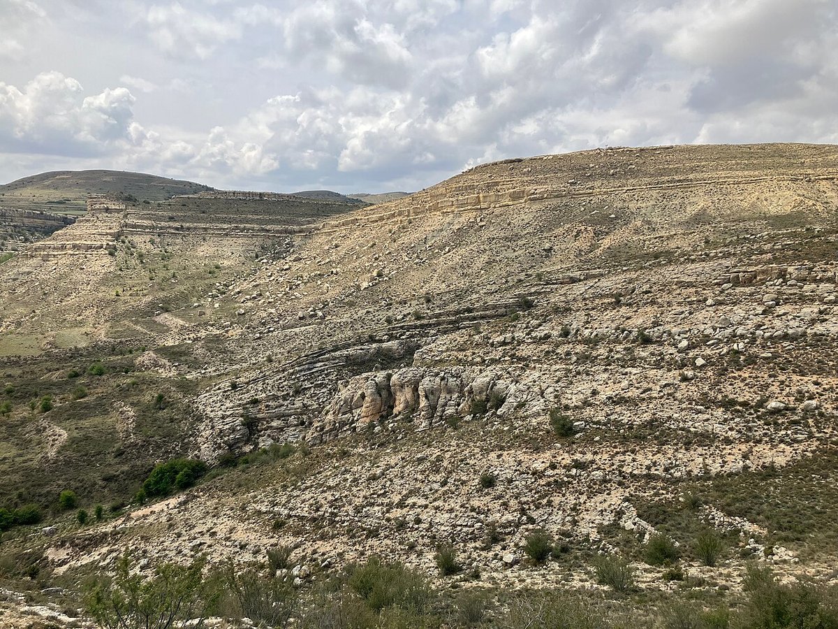
The village ends abruptly. Beyond the last house, the land opens into a network of dirt tracks and shepherd’s paths. They lead to forgotten fields and masías, their roofs often collapsed but their stone shells enduring against the sky.
There are no official viewpoints. Instead, you find them by accident: a bend in a path where the Guadalope valley suddenly appears below, or a clearing that frames kilometres of pine-covered sierra. The light here is expansive, laying everything bare. The long-distance GR-8 trail passes nearby, useful for orienting a longer walk toward Villarroya de los Pinares or Cantavieja.
Carry water. Even in summer, the sun at midday is intense, but a wind can rise without warning, and the temperature will fall sharply as soon as the sun dips behind the ridges.
A landscape of quiet endurance
The story of this place is written in its terraces. Stepped fields, now grassed over or returning to scrub, climb the hillsides. Scattered farmsteads dot the view, some with restored roofs, many more standing as silent ruins with their stone pens and threshing floors intact. It’s a geography shaped by subsistence farming and a gradual departure of people that accelerated last century.
Life persists, just quietly. You might see a small flock of sheep moving along a track in the morning, or find vegetable gardens tucked closer to the river, their green a surprise against the grey-green of the hills.
The depth of the dark
Nightfall is an event. The few streetlights cast small pools of amber, leaving vast stretches to the dark. When your eyes adjust, the sky reveals itself—a dense sprawl of stars with a clarity that feels physical. You’ll want a jacket by August evening; the day’s heat drains quickly into that high-altitude sky.
For seeing the place at its most vivid, come at first light. Mists often settle in the valley floor, leaving the village islanded above them. Late afternoon is just as potent, when the low sun turns the stone facades a deep, glowing ochre.
Practicalities and pace
Summer weekends in August see a slight shift. Families return to second homes, and the local fiestas unfold—modest gatherings that feel private, meant for those who belong here. Winter is profoundly still. Frosts are common and snow can close the roads for a time; check conditions before coming.
You arrive on regional roads that coil through empty pine forests and past solitary farms. The final approach is all curves and elevation gain. Drive them slowly. That unhurried rhythm isn’t just advice for the journey; it’s the condition of the place itself.