Full Article
about Fórnoles
Hide article Read full article
At the eastern edge of Matarraña
Fórnoles sits at the eastern end of the Matarraña region, close to the line that separates Aragón from Catalonia. It is a very small municipality, with around seventy residents today, set at roughly 700 metres above sea level. The village stands on a gentle rise, and beyond it stretches the familiar landscape of this part of the comarca: olive groves, some almond trees, and dry farmland that changes little over time.
This sense of continuity shapes the place. The surroundings are not dramatic or constantly shifting. Instead, they reflect a steady agricultural rhythm, where the land has been worked in much the same way for generations.
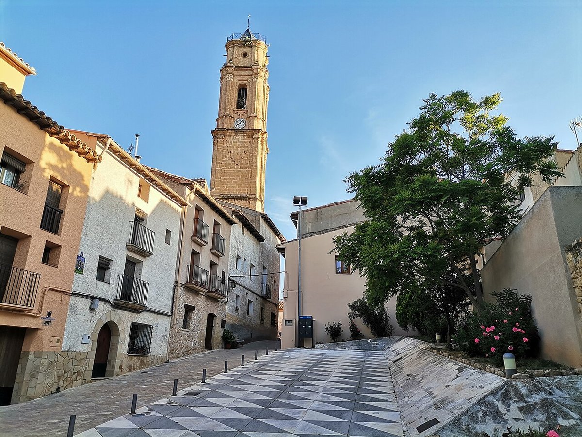
A compact village with an older layout
The centre of Fórnoles remains tightly arranged. Narrow streets run between stone houses that line up neatly, some with arched doorways built from carefully cut voussoirs, hinting at alterations made in later centuries. Here and there, carved coats of arms appear on façades. These details usually point to former family homes that once held a certain standing within the local community.
At the heart of the village stands the parish church, dedicated to the Asunción de Nuestra Señora. Its origins are medieval, though what can be seen today reflects later modifications. This is typical across Matarraña, where churches were expanded or reshaped as populations grew between the 16th and 18th centuries. Inside, the space is simple and restrained.
The church still defines the rhythm of the village. Its central position and its long-standing role mean it continues to anchor daily life, just as it has done for centuries.
Olive groves and an open horizon
The municipal area of Fórnoles is relatively large compared to the size of the village itself. Paths lead out from the centre towards plots of olive trees that have often remained in the same families for generations. In spring, almond trees briefly break up the grey tones of the fields with their blossom, but the dominant presence is always the olive grove.
From certain points in the surrounding land, especially along paths that climb slightly higher, the view opens out towards the west. On clear days, the outline of the Puertos de Beceite can be made out in the distance. These mountains provide a useful reference for understanding the geography of Matarraña: gentler agricultural land that eventually meets a much more rugged relief.
The contrast is subtle but important. Fórnoles belongs to that quieter, cultivated side of the region, where the land is shaped less by steep slopes and more by long-term use.
Walking the agricultural tracks
Several tracks and paths connect the village with scattered masías and older cultivated plots. These are working routes rather than signposted walking trails. Even so, they can be followed on foot without much difficulty when the ground is dry. After periods of rain, some stretches tend to become muddy, which is typical of dirt tracks in the area.
Walking along these paths brings you close to one of the defining features of the Matarraña landscape: dry stone walls. These low boundaries, built without mortar, divide fields and mark ownership. They are practical structures, but they also give the countryside its particular texture and pattern.
The experience of moving through this network of paths is less about reaching a specific destination and more about observing how the land is organised and used.
Olive oil and dryland farming
The local economy has long revolved around the olive tree. Olive oil is part of everyday life in Fórnoles, not as a speciality product set apart from daily routines, but as something embedded in them. Almond trees also appear, and there are small kitchen gardens where the terrain allows.
This is dryland farming, shaped by climate and by limited water availability. Crops depend on seasonal conditions, and the landscape reflects that constraint. It is not intensive agriculture, but a system adapted to what the environment can support.
Festivities rooted in tradition
Celebrations in Fórnoles follow the traditional religious calendar seen in many villages across Aragón. In August, the community honours the Virgen de la Asunción, the patron saint of the municipality. In January, San Antonio is usually marked with events linked to local custom. Semana Santa, or Holy Week, also has a presence here, observed through simple celebrations.
These occasions are less about large-scale events and more about continuity. They maintain links with longstanding practices that still shape the village’s social life.
Getting there and taking it in
Fórnoles lies a short distance from other towns in Matarraña, connected by local roads that pass through cultivated fields. These roads are generally quiet, though they include bends and the occasional presence of agricultural machinery.
The village itself can be explored in a short amount of time. It is best approached slowly, paying attention to the details: the stonework of façades, the alignment of the streets, the small architectural features that reveal changes over time. In those elements, the history of Fórnoles becomes clearer.
It has never been a large settlement, and it does not try to present itself as one. What it preserves instead is the logic of rural life in Matarraña, where the relationship between the village, its fields and its traditions remains visible in everyday surroundings.