Full Article
about Torla-Ordesa
Hide article Read full article
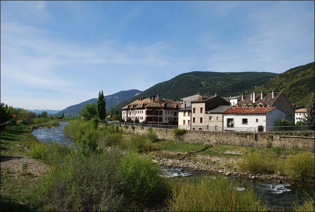
A village at the edge of Ordesa
Early in the morning, before the sun reaches the valley floor, Torla-Ordesa carries the smell of cold wood and damp grass. Stone façades remain in shadow, while the main sound comes from the River Ara rushing past just below. At that hour, the village feels almost paused, set between two steep mountain walls that rise abruptly, as if the valley closes in at this exact point.
This is the setting for tourism in Torla-Ordesa: a small place of just over three hundred residents, positioned at the gateway to the Ordesa y Monte Perdido National Park. For much of the year the pace stays calm, though summer and certain weekends bring a noticeable change as walkers and visitors arrive.
From the entrance to the village, the landscape opens into something sharply vertical. Grey rock faces dominate the view, with slopes covered in beech and fir forests, and the Ara winding below. It does not take long to realise that this has always been a place of passage. Shepherds once moved livestock between valleys here, travellers crossed towards France, and mountaineers found their way into the Monte Perdido massif.
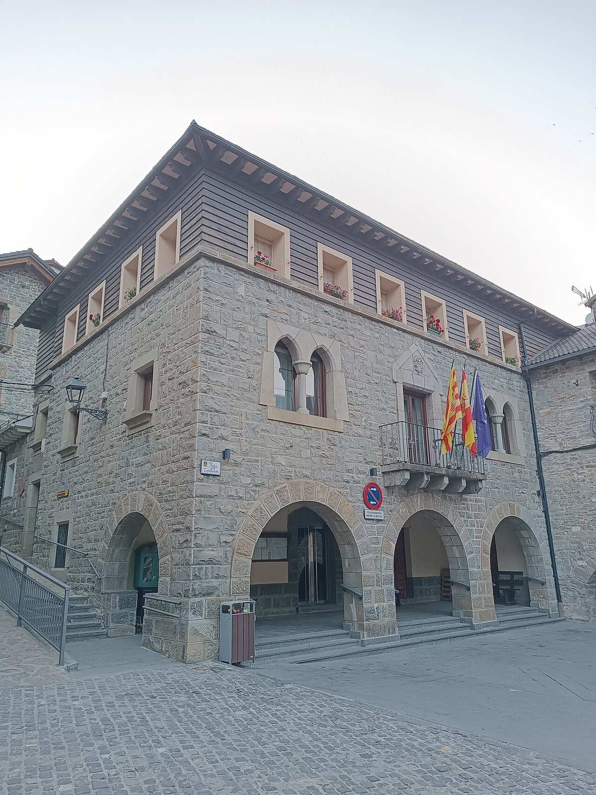
Streets that keep their character
The old quarter can be explored in a short time, though it rewards a slower walk. Houses follow the traditional architecture of Sobrarbe, a comarca in northern Aragón: thick stone walls, dark slate roofs, and wooden balconies where flowers or washing are often left out in the sun. Some façades still show truncated conical chimneys topped with espantabrujas, a distinctive Pyrenean feature once believed to ward off evil spirits.
Near the centre stands the church of San Esteban. The current building reflects different periods of construction, yet it retains older elements that recall the Romanesque churches found across the Pyrenees. Its tower is visible from most points in Torla and acts as a simple reference when navigating the narrow streets.
A few kilometres away, the Ordesa valley begins. Here the scale shifts dramatically. Limestone walls rise more than a thousand metres above the valley floor, and dense woodland turns shades of yellow and copper in autumn. Walking alongside the River Arazas reveals several waterfalls, including the Estrecho and the Cola de Caballo, which tend to run strongly in spring as the snow melts.
From Torla there is also access to the valley of Bujaruelo, usually quieter by comparison. The River Ara flows freely here, without dams, crossing wide meadows where traces of old routes towards France can still be seen. A stone bridge of medieval origin, restored at different times, continues to span the river near what was once a pilgrims’ hospital.
Walking routes and mountain terrain
Most visitors come for walking. Within the Ordesa valley there are straightforward routes, with broad paths following the course of the river. Others are far longer and climb towards glacial cirques or up to the summits of the Monte Perdido massif, one of the highest mountain groups in the Pyrenees.
At the valley floor, the landscape changes constantly. Ferns line damp sections of the path, fallen trunks are covered in moss, and the sound of water is never far away. Summer brings a steady flow of walkers, especially from mid-morning onwards.
One practical detail matters here. During the busiest months, access by car to the Ordesa valley is often restricted. The usual approach is to leave the car in Torla and continue by shuttle bus. Arriving early helps, as the village car park fills up and the quieter atmosphere fades once the day gets going.
Those who prefer less frequented routes often look towards Bujaruelo or choose paths that begin directly from the village. These walks may seem less striking at first glance, yet they offer a closer sense of how this landscape is used. Enclosed meadows bordered by stone walls, scattered bordas, which are traditional rural buildings, and grazing livestock shape the surroundings.
Winter brings a complete shift. Snow covers paths and pastures, and activity turns towards ski touring or snowshoe routes. Conditions can change quickly when the weather turns, so careful planning becomes important in this terrain.
Local traditions still in motion
At the end of August, Torla comes alive with its patron saint festivities. Squares fill with residents, jota music is played, and traditional dress appears, kept and worn by many families. During these days, attention turns inward, with the village focusing more on its own community than on visitors.
In September, a livestock fair usually takes place. Local breeds of cattle and sheep are brought together, not as a spectacle but as a meeting point for farmers from the surrounding area.
Spring brings the romería to the Virgen de Ordesa, a pilgrimage that links the village with the interior of the valley. The route passes through meadows that are beginning to turn green, while patches of winter snow still linger on the higher ground.
Reaching Torla-Ordesa
Torla-Ordesa lies within the Sobrarbe comarca, in the north of Aragón. Its position at the entrance to the Ordesa valley defines both its character and its rhythms. Access is straightforward, though conditions and visitor numbers can influence how the final stretch into the national park is managed.
What stands out most is the relationship between the village and its surroundings. The mountains are not a distant backdrop but a constant presence, shaping daily life, movement, and the flow of visitors throughout the year.