Full Article
about Gozón
The northernmost point
Hide article Read full article
A harbour shaped by the land
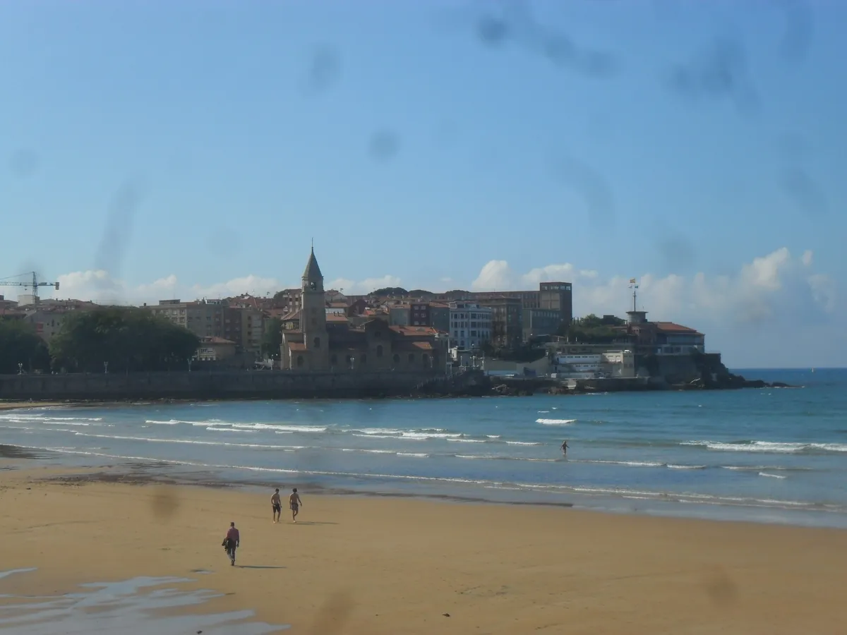
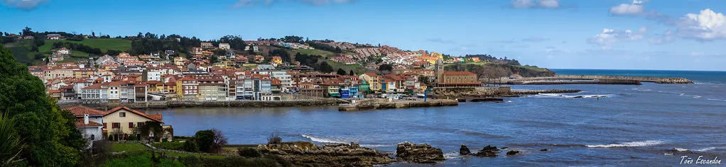
Tourism in Gozón usually begins in Luanco, the capital of the municipality. The town sits around a small bay sheltered from the Cantabrian Sea. Its layout makes immediate sense: where the terrain allowed it, houses spread out along the curve of the water, and where it did not, they climbed the slope behind. The result has something of an amphitheatre feel, with the harbour at its centre.
That harbour is quieter today than it once was, yet for centuries it set the rhythm of daily life. Fish arrived here and boats departed to work along this stretch of the Asturian coast. The link between the town and the sea is still visible in how everything faces the water, even if the pace has softened.
A coastline that resists straight lines
Gozón is the northernmost municipality in Asturias, and that fact is best understood at Cabo Peñas. This headland projects into the Cantabrian Sea as a broad platform of cliffs, marking the region’s most northerly point. From here, the character of the coastline becomes clear.
This is not a continuous run of beaches. Instead, the shore breaks into rocky points, small inlets, and stretches of pasture that end abruptly at the sea. The land feels cut and shaped by exposure, rather than smoothed out.
Coastal villages such as Luanco, Bañugues and Verdicio developed with their gaze fixed on the water. For a long time, the sea was the main route for both work and communication. Inland, the pattern shifts. Parishes are scattered among gentle hills and cultivated land, with older houses still showing south-facing balconies. These were designed to dry maize or air the harvest, a reminder that agriculture and fishing coexisted here until relatively recently.
Near Verdicio, the coastline shows how changeable this environment can be. The dunes and beach alter noticeably after winter storms. Wind can move the الرمال from one year to the next, reshaping the outline of the shore in ways that are easy to spot.
Stones and memory
The church of San Jorge de Manzaneda preserves a Romanesque doorway usually dated to the 12th or 13th century. It is a small rural building, part of the network of medieval parishes that once organised the territory. Later alterations have modified much of the structure, which is common in buildings of this type, yet the doorway retains the restrained stonework typical of late Asturian Romanesque.
In Luanco, the church of Santa María occupies the highest point of the old town. The current building reflects mainly later reforms, from a time when the town had achieved a certain prosperity through fishing. Close by stands the Torre del Reloj, a civil construction that has become one of Luanco’s defining features. Its bell carries a Latin inscription that recalls the older name of the place: Gauzon or Gauzón, a form that appears in several medieval documents.
That name connects with the former castle of Gauzón, located on the nearby peninsula of Raíces, outside the present municipal boundaries but closely tied to the wider area’s history. According to tradition, this is where the Cruz de la Victoria was made, now one of Asturias’ best-known symbols.
Cooking close to the sea
Local cooking remains closely tied to what comes from the water. Rock fish such as chopa, sargo and cabracho are commonly prepared simply, opened out and cooked on a griddle or in the oven. The seasoning tends to be minimal, usually garlic with oil and a touch of vinegar. These are straightforward recipes that grew out of fishing households.
Another familiar dish is xaragu, a thick fish soup served very hot. It appears during summer celebrations in Luanco and varies from one family to another, though the base is typically fish stock combined with tomato and paprika.
Bollo preñao also has its place, especially at outdoor gatherings and romerías, which are traditional festive outings. This bread, baked with chorizo inside, is practical food: easy to carry and easy to eat without much fuss.
Walking towards Cabo Peñas
The area around Cabo Peñas can be explored through a series of paths that follow the cliffs. There is no single continuous route, but sections can be linked on foot, passing through meadows, natural viewpoints and small indentations along the coastline.
The lighthouse at Cabo Peñas, built in the 19th century and later modified, is still in operation. An adjacent building houses an exhibition space dedicated to the coast and navigation in this part of the Cantabrian Sea. From the esplanade, the view opens onto a wide stretch of open water, and on clear days other parts of the Asturian coastline can be made out in the distance.
Further east, near Verdicio, lie the remains of the castro of El Castiellu. The site occupies an elevated position above the sea, typical of Iron Age settlements that sought to oversee both territory and coastal routes.
Reaching Gozón and moving around
Gozón is about a half-hour drive from Oviedo and very close to Avilés. The road leads directly to Luanco, which acts as the centre of the municipality.
The old town is best explored on foot. Streets are narrow, and in summer traffic becomes more complicated, so it is often easier to leave the car in parking areas at the entrance to the town.
July and August bring the greatest activity along the coast. Outside those months, the atmosphere is calmer, although the weather can change quickly and the sea can turn rough. When autumn storms arrive, Cabo Peñas shows a different side, with cliffs exposed to strong winds and the Cantabrian Sea in a more forceful mood.