Full Article
about Tacoronte
Land of wines par excellence; farming town with a cliff-lined coast and the popular El Pris neighborhood.
Hide article Read full article
Between hillside and ocean
Tacoronte stretches across a broad strip in the north of Tenerife, within the Acentejo area, between the upland slopes and the Atlantic. From the mid-altitudes down to the coast, vineyards shape almost everything you see. They are especially clear when approaching Tenerife North Airport, with entire hillsides under cultivation, a view that hints at how deeply wine has influenced the local story. Vines arrived soon after the conquest and went on to organise both the economy and the landscape across this part of the island.
That continuity still defines the place. The terrain is divided into small plots, often edged with stone walls, and the pattern of cultivation has changed little over time. Tacoronte is not a single compact setting but a sequence of spaces, moving from cultivated slopes to built-up areas and then towards the sea.
The wine that shaped the land
Wine is central to understanding Tacoronte. The Tacoronte-Acentejo designation of origin, created in the early 1990s, was the first in the Canary Islands and brings together several municipalities across these humid northern midlands. Vine growing here has been embedded for centuries in small family plots.
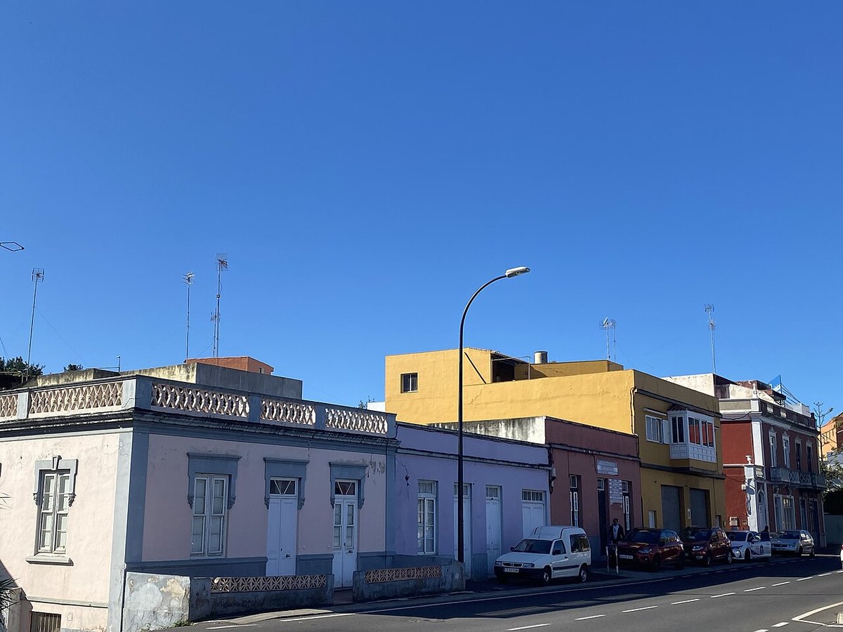
In the historic centre, that connection is still visible. Many older houses include interior courtyards, underground cellars or former pressing areas. These features are not always obvious from the street, yet they form part of the traditional domestic architecture. Streets leading down towards the main square gather several grand houses built between the 17th and 18th centuries, when wine trade with Europe, particularly England, gave the area a degree of economic momentum.
Calle de San Agustín concentrates much of this past. It includes an old hermitage linked to the earliest settlements after the conquest and the former Augustinian convent, which held an important place in both religious and agricultural life in the area for centuries. Opposite this group of buildings lies Hamilton Park, a historic garden created in the 19th century by a family of foreign merchants. Today it acts as a green space within the town centre, offering a pause among the surrounding streets.
The Santuario del Cristo de los Dolores
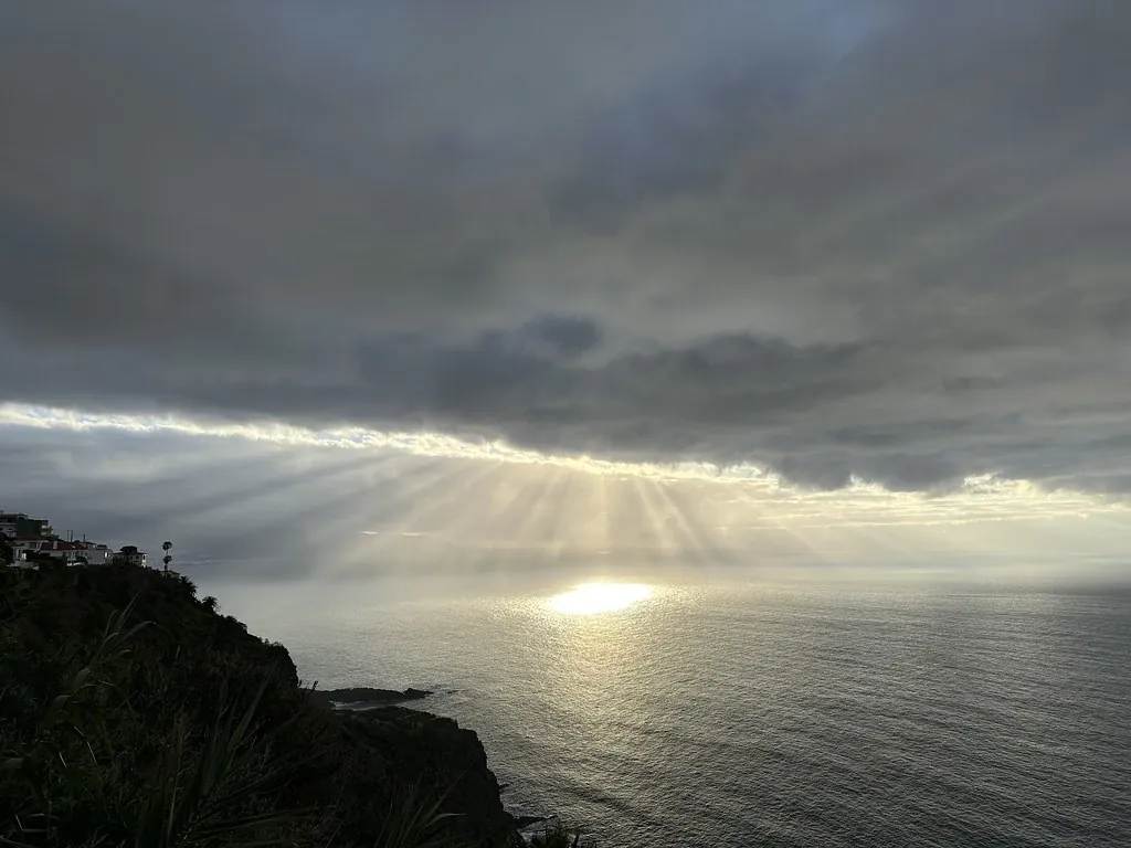
The best-known religious building in Tacoronte is the Santuario del Cristo de los Dolores. It stands on a slight rise overlooking much of the vineyard valley and, on clear days, the sea in the distance.
Devotion to the Cristo runs deep in Tacoronte and neighbouring towns. The image housed in the sanctuary is considered old and is usually associated with workshops from mainland Spain. Each summer, it becomes the focus of the municipality’s main celebrations, which include processions and ephemeral carpets laid across parts of the town centre streets. These carpets, made from coloured materials arranged directly on the ground, are a distinctive feature of local festivities.
Inside, the church is relatively restrained. A wooden roof, later altarpieces and a quieter atmosphere contrast with what the exterior might suggest. Outside, the atrium works almost as a natural viewpoint over the surrounding landscape, reinforcing the connection between the building and the territory it overlooks.
Agua García and the traces of ancient forest
Climbing towards the higher midlands, the landscape shifts quickly. In the area known as Agua García, remnants of the ancient laurel forest, or laurisilva, begin to appear. This type of humid woodland once covered much of Tenerife before agricultural expansion.
Several walking paths cross this area. The most well-known route passes through ravines where trees such as til and viñátigo grow, species typical of this ecosystem. Moisture is constant, and the ground is often covered with leaves and moss. The forest is not extensive, yet it offers a clear impression of what the island’s northern vegetation looked like before large-scale cultivation.
From certain clearings, views open out towards the La Orotava Valley and the coast. The contrast between the dense woodland and the cultivated slopes below makes the transformation of the landscape easy to understand. In a short distance, it is possible to see both the older natural environment and the later agricultural system shaped around vineyards.
A sweet winter tradition
Alongside wine, Tacoronte maintains a smaller tradition linked to turrón, a sweet typically associated with Spain. Here it appears mainly in winter and is made by hand using almonds and honey, following fairly old methods that involve slow toasting, mixing while hot and pressing into moulds.
This version differs from the more widely known types found on the mainland. It tends to be darker and has a pronounced honey flavour. During the festivities of San Antonio Abad in January, stalls often appear around the Plaza del Cristo where it is sold freshly made, keeping this local custom alive within a specific seasonal setting.
Moving through Tacoronte
The historic centre can be explored on foot without difficulty and without rushing. Attention naturally turns to the details of older buildings: wooden balconies, interior courtyards and wide doorways once designed for carts and access to cellars.
With a car, it becomes easier to combine the centre with the mid-altitude areas and the woodland of Agua García. Distances are short, though the roads can be steep, reflecting the terrain.
Tenerife North Airport is very close, which makes arriving and leaving straightforward. Even so, Tacoronte reveals itself best at an unhurried pace: walking its streets, looking across vineyard-covered slopes, and then heading upwards towards the higher ground where the forest begins.