Full Article
about Tejeda
One of Spain’s prettiest villages, set in a volcanic caldera with views of Roque Nublo and Bentayga.
Hide article Read full article
Morning light in the caldera
The sun takes its time reaching Tejeda. Early on, the slopes remain in shadow and the air carries a dry scent from the highlands, a mix of pine and volcanic soil. The village slowly comes into view inside the caldera, its white houses packed close together, ochre roofs catching the light once it finally clears the rocky ridges. From almost any corner, two familiar shapes stand out against the horizon: Roque Nublo and Bentayga, dark markers rising above everything else.
Tejeda sits in the centre of Gran Canaria at over a thousand metres above sea level. Deep ravines and steep slopes surround it, land that has never been easy to cultivate. The population is small and the slower rhythm is obvious. By mid-morning, the sounds are simple: cars making their way up the winding road, the occasional dog barking from houses on the outskirts, wind moving through the pines.
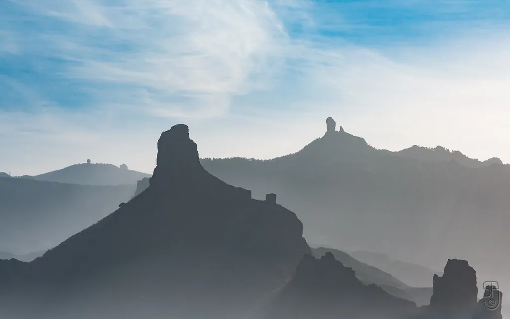
Volcanic forms: Roque Nublo and Bentayga
The path to Roque Nublo crosses rough ground scattered with loose stones and patches of pine. From the nearest car park, the walk is about three kilometres there and back. The final stretch climbs more steeply, and wind often picks up at the top. Even on warm days lower down, it is worth bringing something warmer.
At the summit, the basalt monolith rises from a pale rock platform. The view opens across the highlands of Gran Canaria: ravines dropping towards the coast, dark green pine forests, and on very clear days, the outline of Mount Teide far out across the sea on Tenerife.
Bentayga feels different. Its shape is more compact, and the area around it contains archaeological remains linked to the island’s early inhabitants. Old agricultural terraces are still visible on nearby slopes, showing how intensively this terrain was worked over centuries.
A quiet village centre
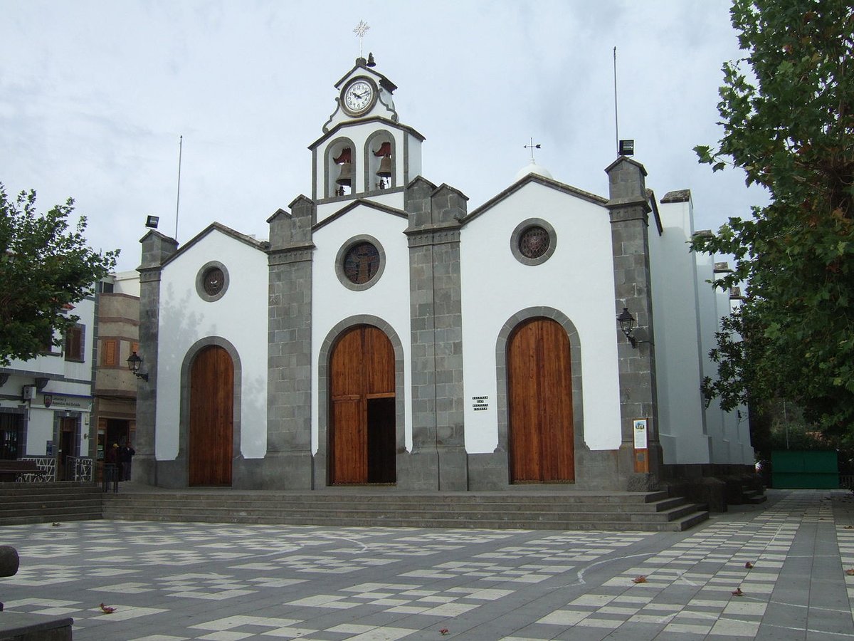
Tejeda’s main square is small and often calm in the early afternoon. The church of Nuestra Señora del Socorro occupies one side, its white façade and stone doorway standing out in the sun. From the square, several short cobbled streets lead off, lined with houses that keep their wooden balconies and small windows.
A slow walk reveals details that are easy to miss at first glance: plant pots set directly on the ground, a half-open door with the smell of firewood drifting out, the metallic sound of a shutter closing somewhere nearby. The centre does not take long to explore. In half an hour, it is possible to get a clear sense of the village’s size and layout.
Viewpoints across the highlands
The road that crosses the summit area is dotted with places to stop for a few minutes. At Degollada de Becerra, the landscape suddenly opens up, making it easier to read the island’s interior: long ridges, ravines falling away on both sides, and the sharply defined silhouettes of Roque Nublo and Bentayga.
What you see depends heavily on the day. Low cloud is common in these high areas, and the rock formations can appear and disappear into the mist. When the sky clears, the horizon stretches far enough to include Tenerife.
Walking trails and the taste of almond
A network of walking routes surrounds Tejeda, linking viewpoints, mountain passes and old agricultural paths. Some sections are straightforward, passing through almond trees and alongside dry stone walls. Others become rockier and require closer attention to footing. In summer, the sun becomes intense from midday onwards, so starting early tends to be more comfortable.
Almonds are a strong presence in the village. They are used to make traditional sweets such as bienmesabe, a rich almond-based dessert, and different kinds of marzipan. Several small shops in the centre still prepare them using very simple recipes. If you plan to buy any, it is worth having some cash, as card payments are not always available.
At night, when the sky is clear, the darkness of the highlands reveals far more stars than along the coast. The return drive, however, requires care. Mountain roads remain narrow and full of tight bends, so taking it slowly is part of the journey.
Getting there and choosing your moment
From Las Palmas, the route climbs via the GC-15 and then the GC-60. The journey takes a little over an hour, though the curves and viewpoints often encourage stops along the way. Parking in the centre can become difficult at weekends and on public holidays, when visitors arrive from other parts of the island.
Between autumn and spring, temperatures are more comfortable for walking in the highlands. In winter, the air can cool quickly once the sun drops. In summer, clear skies bring strong heat, especially around midday. There are also days of dense fog when the roques disappear completely. On those occasions, the most sensible plan is to stay in the village, wander its streets at an easy pace, and wait for the cloud to shift.