Full Article
about Breña Alta
Residential and farming municipality near the capital, known for its twin dragon trees and hand-rolled tobacco.
Hide article Read full article
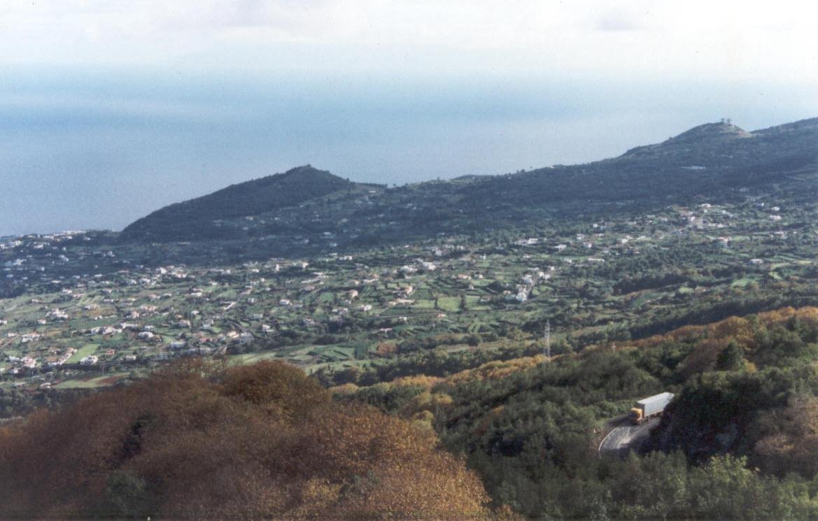
A landscape built on slopes
The road climbs from Santa Cruz de La Palma through banana plantations and scattered houses until the sea drops out of sight. That is where Breña Alta begins, one of the municipalities on the eastern side of the island. Here, the coast stays below and daily life unfolds on damp hillsides where agriculture, especially bananas, has shaped the landscape for generations.
Settlement took hold soon after the Castilian conquest at the end of the 15th century. Land and water were distributed across this part of the island, setting the foundations for how the territory would develop. What emerged was not a single, compact town. Instead, Breña Alta grew as a chain of neighbourhoods, each forming around paths, small chapels and agricultural estates. That pattern still defines how the place feels today.
San Pedro and the old centre
The parish church of San Pedro Apóstol remains the main point of reference. Its current form follows the traditional religious architecture of La Palma: a broad nave, a wooden roof and a square tower that can be seen from much of the valley.
Inside, different stages of the island’s artistic history sit side by side. The main altarpiece, from the early 18th century, features twisted Solomonic columns and abundant gilded decoration, typical of that period in the Canary Islands. In the side chapels, later altarpieces reflect a neoclassical taste. This mix is common in rural churches, where expansions and family donations gradually reshaped interiors over time.
Among the images, a dressed Virgin stands out, attributed to the La Palma sculptor Aurelio Carmona López, who worked on the island during the 20th century. These figures, designed to be clothed in fabric, are still a familiar presence in local religious processions.
Houses, families and private chapels
Around the church, several old houses remain, once linked to families who controlled land and water in the area. Some still preserve stone doorways and wooden balconies typical of domestic architecture on La Palma.
Within a number of these homes there were private oratories. For centuries, it was not unusual for estate owners to maintain small chapels inside their houses, particularly when farmland lay far from the parish church. Some of these spaces have changed over time, while others retain traces such as tiles or small altars.
Family names of European origin also appear in the area, tied to the early colonisation of the island. Merchants and military figures from places such as Flanders or Portugal received land here after the conquest, and some of those families remained for generations. Their presence forms part of the historical layers that still surface in Breña Alta.
Water from the hills
Breña Alta’s landscape cannot be understood without the water systems that descend from the island’s higher ground. Galleries and natural springs from the interior feed channels that cross the slopes before reaching the cultivated coastal areas. Walking alongside these irrigation routes, where paths allow, gives a sense of how water management shaped La Palma.
Along the way, there are old agricultural estates, dry-stone walls and remains of hydraulic infrastructure. Some properties still preserve mills or wind-powered mechanisms that were installed to draw water from wells as irrigation expanded between the 19th and 20th centuries.
Among the cultivated plots, isolated dragon trees appear. Some older specimens have become local reference points for the surrounding neighbourhoods, standing out against the agricultural setting.
The day of the crosses
Breña Alta changes completely on 3 May, during the Fiesta de las Cruces. Crosses placed across different neighbourhoods are decorated with flowers, fruit and small constructed elements, sometimes including moving parts.
This tradition dates back several centuries and continues thanks to neighbourhood associations and families who spend weeks preparing each cross. There is no fixed route to follow. People move between areas, asking where to find the next cross and making their way through the different neighbourhoods. That constant movement is part of the atmosphere of the day.
Finding your way around
The municipality stretches along the road that links Santa Cruz de La Palma with the south of the island, with turn-offs leading up to neighbourhoods higher on the slope. From the capital, the journey takes only a few minutes by car.
The terrain is often steep, and many agricultural paths still have volcanic stone paving. These surfaces can become slippery when irrigation water is running. Closed footwear is a sensible choice for walking between farms or along local paths.
To get a sense of Breña Alta, the easiest starting point is the square by San Pedro. From there, moving between neighbourhoods gradually reveals how the area fits together. Asking locals for directions remains one of the most effective ways to navigate, as many of the stories and references here still pass from word to mouth.