Full Article
about Villa de Mazo
A craft town known for its Corpus carpets and wine; home to the airport and archaeological sites.
Hide article Read full article
A Municipality of Neighbourhoods on the Eastern Slope
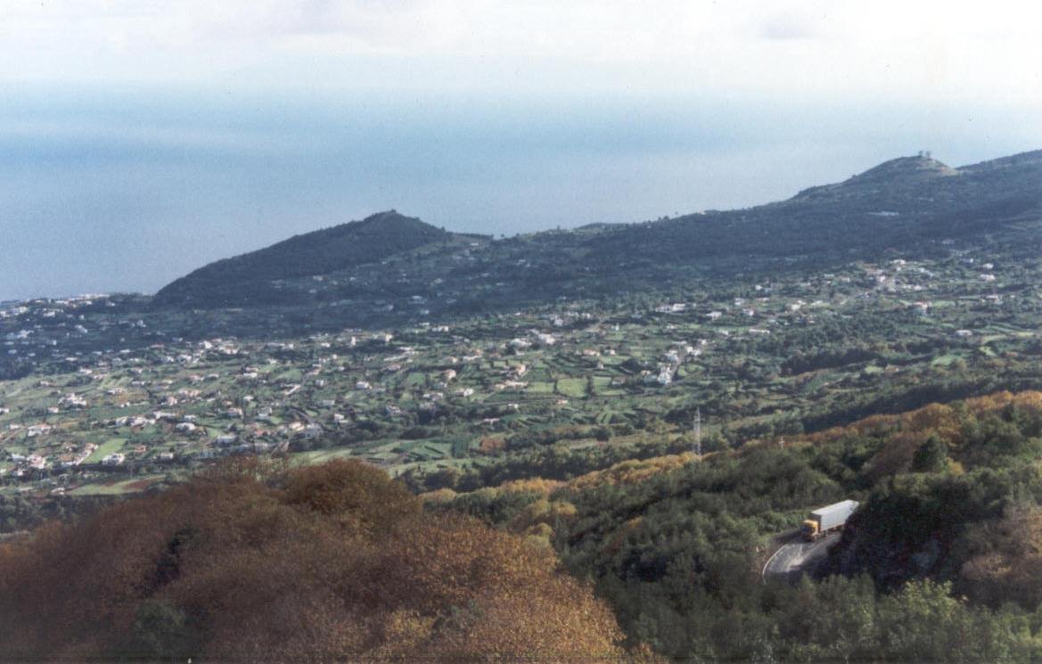
Villa de Mazo occupies a long strip of land on La Palma’s eastern flank, a terrain that descends from the mid-altitude ridges to the Atlantic coast. The municipality is not a single, concentrated town. It is a collection of scattered neighbourhoods, with the administrative centre, El Pueblo, clustered around its church and plaza. The geography here is a sequence of old volcanic flows, terraced plots, and vineyards, all tilted towards the ocean.
The view from El Pueblo is consistently oriented east, over the rooftops and down to the sea. That relationship with the Atlantic has been demanding. Historical records note significant damage from storms during the last century, which reshaped parts of the coastline and affected small cultivated areas near the shore. The current landscape speaks of adaptation: dry-stone walls delineate fields, and vines are trained low to the ground, a practical response to the wind.
The Parish and the Precedent
At the centre of El Pueblo stands the parroquia de San Blas. The building that structures the settlement today is the result of successive modifications over centuries, a common architectural narrative in La Palma. Its interior altarpieces and religious imagery indicate the historical importance this parish held within the eastern part of the island.
A short drive from the church lies the archaeological site of Belmaco. It was here, in the eighteenth century, that some of the first caves containing rock engravings by the island’s original Benahoarita inhabitants were formally documented. The site provides a necessary counterpoint, evidence that these slopes were inhabited long before European colonisation and the establishment of agricultural estates following the Castilian conquest.
Architecture of Return
The economic history of the Canary Islands is often written in its architecture. In Villa de Mazo, as in other parts of the archipelago, emigration to the Americas in the late nineteenth and early twentieth centuries left a visible legacy. Returning emigrants, particularly from Cuba and Venezuela, built houses that broke with local tradition.
The Casa Roja is the clearest example. With its exterior galleries, painted woodwork, and pronounced colour, it carries a distinct Antillean influence. Now used as a cultural space, it sits in contrast to the more subdued buildings around it. This structure, and others like it in the area, are physical markers of a social history defined by departure and return.
Landmarks of Subsistence and Symbol
In the midlands, several restored windmills stand as remnants of a domestic industry that persisted for much of the last century. They were used to grind grain for gofio, the toasted cereal flour that is a staple of Canarian cuisine.
The area around Belmaco combines volcanic cave formations with panels of rock engravings. The motifs—spirals, concentric circles, geometric patterns—are found in other sites across La Palma and are generally understood as part of the Benahoarita symbolic lexicon. The site’s interpretation centre details their discovery and context.
Viticulture and a Transforming Tradition
Vineyards remain a feature of Mazo’s mid-altitude slopes. They are planted in volcanic soils where nighttime humidity helps mitigate limited rainfall. The wines produced here fall under the island’s protected designation of origin.
One of the most significant events in the local calendar is Corpus Christi. For several days, residents from different neighbourhoods prepare elaborate carpets made from dyed sands, flowers, and plant materials, covering the streets of El Pueblo. It is a collective, generational effort that temporarily reconfigures the centre of the municipality.
Practical Notes
El Pueblo is easily navigated on foot. From the main square, short streets lead past the church, town hall, and a mix of older homes and more recent constructions.
The municipality is situated adjacent to La Palma’s airport, a few minutes’ drive from the terminal. It is also crossed by the GR‑130, the long-distance path that circuits the island. Several local trails connect the central neighbourhoods with higher hamlets and sections of the rugged coastline, providing direct access to the varied terrain that defines this part of La Palma.