Full Article
about La Guancha
Mid-elevation town with deep farming and craft roots; quiet, with sweeping views of the island’s north.
Hide article Read full article
Water first, everything else after
Tourism in La Guancha begins with an unusual issue for the north of Tenerife: water. The municipality relies on the Galería de Vergara, a long tunnel driven into the mountain to capture groundwater before it reaches the sea. For years the supply has faced difficulties due to excess fluoride, which has at times led to limits on its use for drinking or cooking. It is not a minor detail. In an agricultural area, water shapes almost everything, from what can be grown to how the settlement developed.
An upland town turned inward
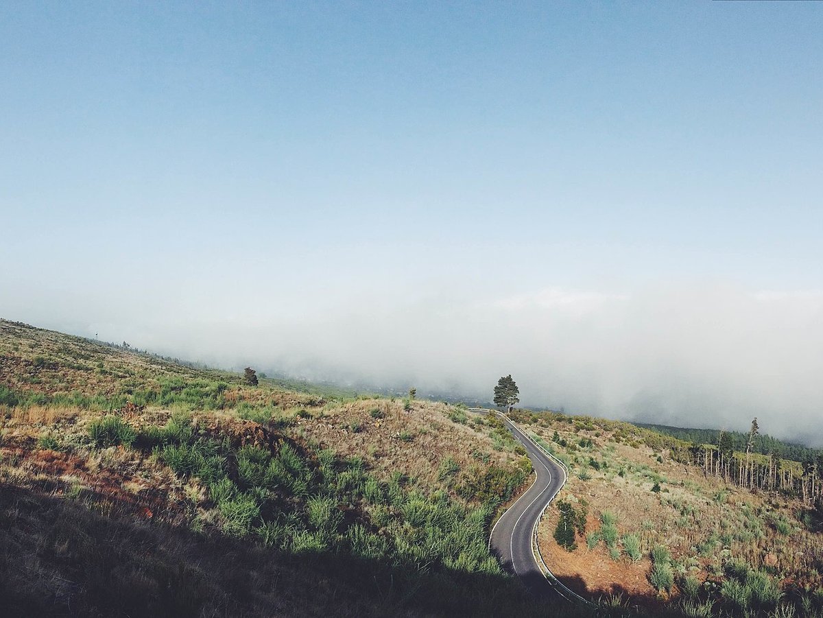
La Guancha stands at nearly five hundred metres above sea level, in a band of mid-altitude countryside that historically looked inland rather than towards the coast. The name is often explained through a small legend: a young Guanche woman, surprised by Castilian soldiers, is said to have thrown herself into a ravine beside a spring. It is not clear whether the story predates the conquest, and the place name appears in documents from the 16th century. Even so, it captures a moment when the indigenous world and the new colonial order were beginning to mix.
The settlement took shape in the early 16th century around a hermitage dedicated to Santa Catalina. Over time the parish of the Dulce Nombre de Jesús was established, and by the 19th century La Guancha had become an नगरपालिका in its own right. Part of the historical archive was lost in a fire towards the end of that century, so some early episodes are only known in fragments. For a long time communications were difficult, and daily life connected more naturally with nearby farmland than with the coastline.
Fields that define the landscape
Agriculture still leaves a clear mark on the municipality. Hillsides are cut into tajas de piedra, stone terraces that make cultivation possible on slopes, and much of the land is given over to banana plantations. Bananas have been one of the economic drivers of northern Tenerife for generations, and their presence is visible in ravines shaped for farming.
Water for these crops largely comes from galleries excavated into the mountain, a system widely used across the island since the 19th century. The same approach supplies the town itself.
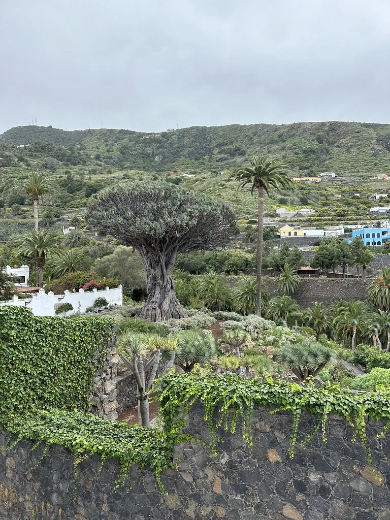
Among the cultivated plots, small patches of laurisilva survive. This humid forest once covered much of the north of Tenerife before land was cleared for agriculture. The route known as the ruta de los Castaños crosses one of these areas. It is a short and fairly easy path to follow, with damp ground for most of the year and dense vegetation. Tall ferns and old chestnut trees create a setting that feels noticeably quieter than busier parts of the island.
A coastline often overlooked
Although the municipality reaches the sea, most of the urban centre faces away from it. The best-known coastal spot is the Charco del Viento, a stretch of lava and rounded stones where the ocean has shaped small natural pools.
This is not an urbanised beach. Access involves walking along dirt paths between volcanic ravines and cardones, a type of large cactus native to the Canary Islands. For much of the year there is little signage and few services, which has helped the area remain largely unchanged. At low tide, flat lava platforms appear and calm pools form; when the sea is rough, it is better to keep a safe distance from the water.
Many local residents have known the place for years, yet beyond the municipality it tends to attract less attention than other beaches in northern Tenerife.
Food from the inland
Without a strong fishing tradition, local cooking relies mainly on inland produce. Conejo en salmorejo appears frequently on family tables: rabbit marinated with vinegar, garlic and spices, then slowly cooked.
Papas arrugadas, the small wrinkled potatoes typical of the Canary Islands, remain part of daily meals, as does gofio. This toasted cereal flour is eaten in dishes such as escaldón or alongside broths. Goat’s cheese is also common, often smoked using dried palm. Production is usually small-scale and often domestic, circulating more among neighbours than through visitor-focused channels.
Among sweets, bienmesabe has a long history on the island. Its base is simple: almond, sugar and egg yolk. In many cases the almonds come from family trees scattered across the midlands.
Finding your way around
La Guancha lies in the north of Tenerife, within the Icod-Daute region, and is reached by road from the northern motorway via Icod de los Vinos. The town centre can be explored at an unhurried pace in a short time. The square of the Dulce Nombre de Jesús, the parish church and several older houses are all within easy reach of one another.
In spring, festivities linked to San Isidro usually take place, closely tied to the agricultural calendar. During these days the streets fill with carts and traditional dress.
A trip down to the Charco del Viento calls for practical footwear and some water, along with attention to sea conditions. The path itself is straightforward, but the setting remains exposed to the Atlantic.