Full Article
about Alajeró
Southern municipality stretching from highlands to the coast; home to the airport, known for its arid landscapes and centuries-old drago.
Hide article Read full article
At nine in the morning, mist still clings to the terraces of Alajeró like a damp blanket. From the Chorrito viewpoint, Canary Island palms appear and disappear in the white, their grey trunks fading in and out of view. Down in the village, the first batch of bread is already in the oven. Its smell drifts up the cobbled slope and mixes with the dry scent of dragon trees.
Alajeró lies in the south of La Gomera, away from the island’s busiest spots. The land opens into deep ravines and slopes planted with vines, and the wind often carries cooler air than along the coast. At times it feels like a typical mid-altitude village. Then the mist lifts and the Atlantic shows itself in the distance as a still blue strip.
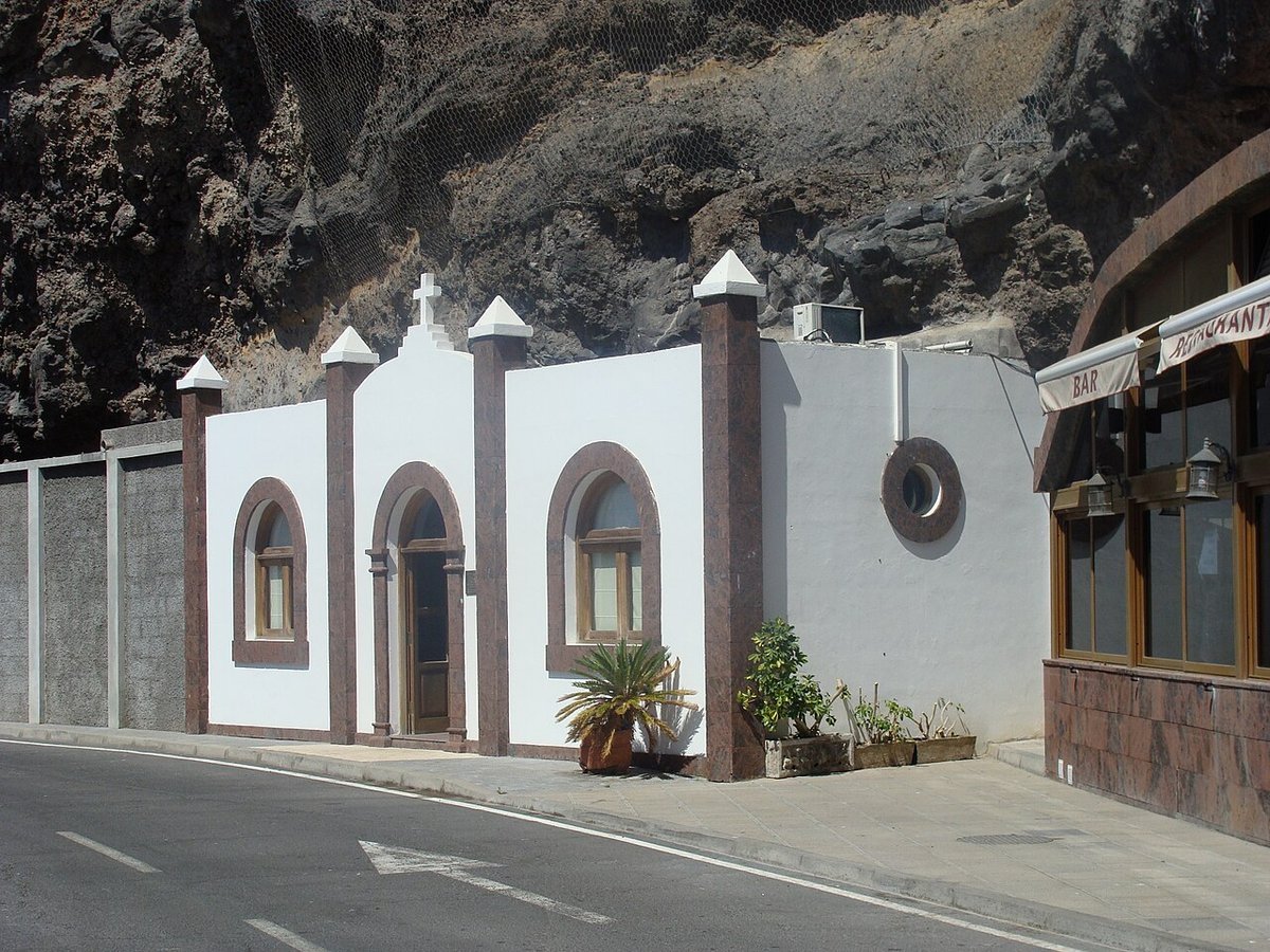
A church that turned its face
The church of El Salvador holds a Christ figure usually dated to the 16th century. The wood is darkened and cracked by age. The Renaissance-style portico keeps a firmer line; its columns are made of volcanic stone, rough to the touch, and seem to rise straight from the island’s black ground.
In the square, older residents will tell you the church did not always face this way. When it was expanded in the 18th century, they say, the façade was reoriented to open onto what had become the main street. The village changed its face.
Life continues around it without fuss. Short conversations take place in the shade of its walls. A wooden door closes with a solid thud. There is often the smell of freshly cut goat’s cheese in the air—a scent that brings together stable, grass and a hint of salt.
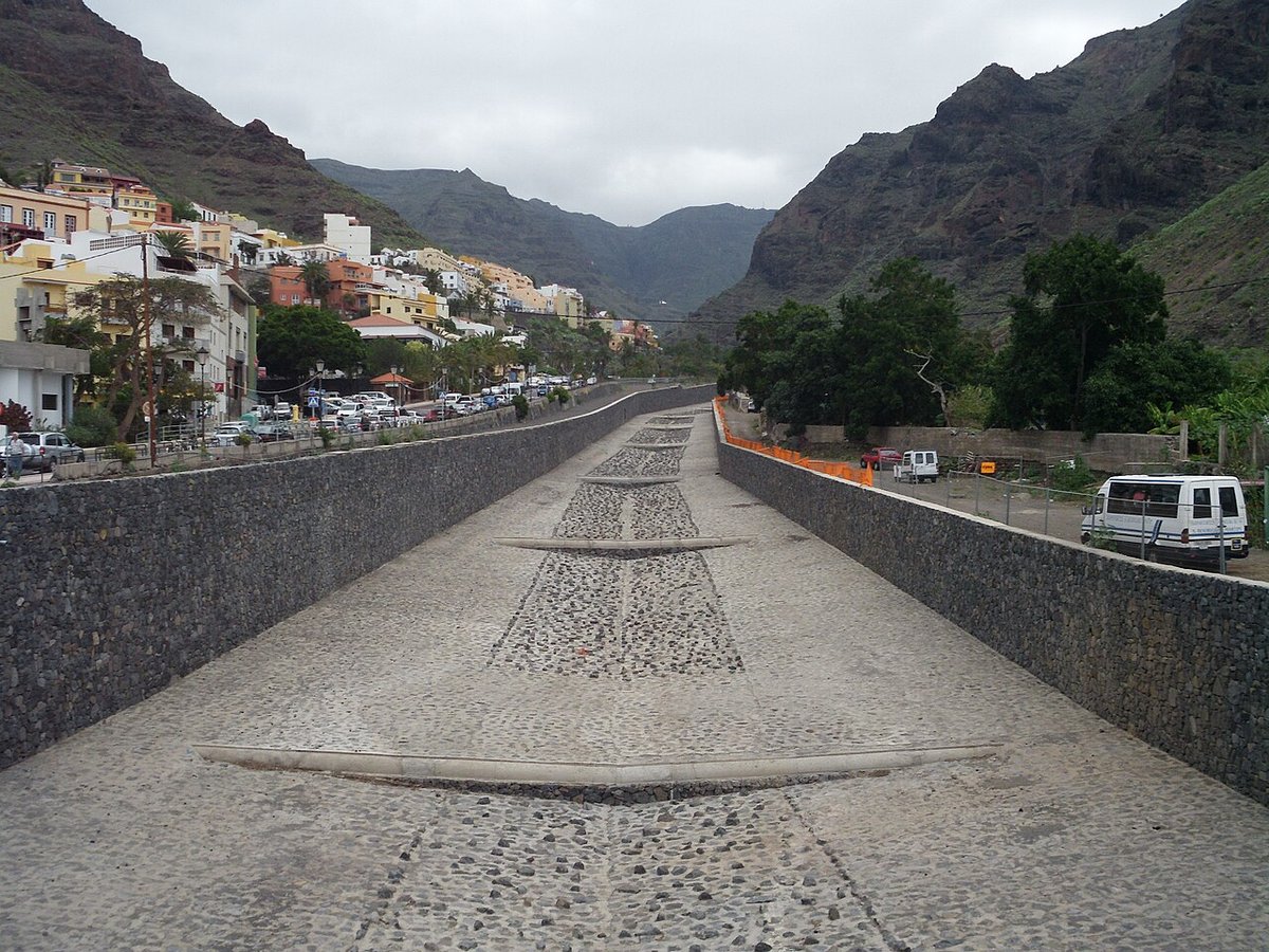
The ravine behind the houses
The ravine of Erque begins almost immediately behind the last houses. It cuts deep into the volcanic terrain, with walls that in some stretches close in so tightly that the sky is reduced to a thin blue line far above.
The hermitage of San Lorenzo stands on a rocky outcrop, its curved roof tiles bleached pale by the sun. From this point, the scale of the ravine becomes clear: old terraces, dry stone walls holding back nothing but cardones now, slopes where only tabaibas grow.
The path descends over loose stones. With each step, the sound changes underfoot: dry gravel gives way to brittle leaves, then to compacted earth. The smell shifts as well. Near the bottom there is dampness, moss and shade. Higher up, resin and warm stone return.
Go carefully after rain. The volcanic soil breaks apart easily underfoot, and some turns become slippery with clay.
The drago that stands alone
The drago of Agalán rises among agricultural terraces, set apart from everything else. There are no large facilities or elaborate viewpoints around it. It simply stands there, with a thick trunk and branches spreading like an uneven umbrella.
It is one of the largest dragon trees on La Gomera. Its exact age is hard to determine; with these trees, people speak in terms of centuries rather than years. Standing beneath it is enough to sense how long it has been part of this landscape, looking out over vineyards, stepped fields and the distant sea.
When the bark splits, a reddish sap appears slowly—sangre de drago, dragon’s blood. Some still remember its past use as a healing substance for wounds.
On clear days, you can sense the ocean from here even when you can’t see it. The air carries a faint salty note that blends with the smell of vines and warm soil.
The wind from the cliffs
The municipality’s cliffs drop sharply towards the Atlantic in abrupt sections. From some of the southern paths, you can make out lava platforms shaped gradually by the sea—tidal pools where water gathers, along with algae and small black crabs.
The wind here rarely stops. It arrives carrying salt and the particular smell of volcanic coasts: dried seaweed, warm rock and a mineral note that can recall sulphur.
In September, during the descent of the Virgen de El Paso, the rhythm of the village changes. Drums and chácaras are heard from early on. Many residents walk up towards the hermitage. Anyone visiting at that time will find more movement than usual. For the rest of the year, Alajeró keeps a steady quiet.
Light and layers
La Gomera Airport lies within the municipality. Even so, what you hear in the village are roosters, wind moving through palm fronds, little else.
Playa de Santiago sits much lower down, by the sea. The climate there is warmer and drier. In Alajeró, temperatures drop easily once evening comes, even in August. In winter, you’ll want a jacket after sunset.
If choosing a time to visit, October often works. The sea still holds summer’s warmth, and along the stone walls you’ll see figs darkening and vines beginning to yellow