Full Article
about Fuencaliente de La Palma
Southern tip of the island shaped by recent volcanoes and vineyards; features moon-like landscapes and traditional salt pans.
Hide article Read full article
Where lava meets the Atlantic
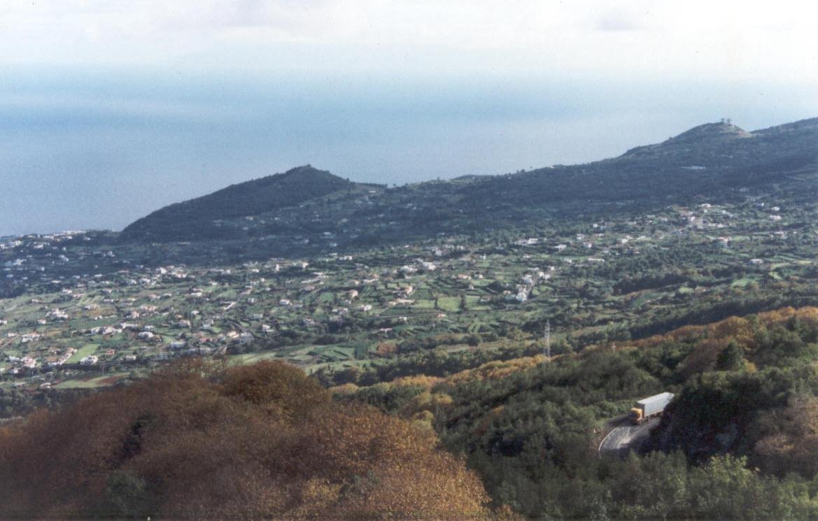
In Fuencaliente, the south wind often carries a salty edge by late afternoon. At that hour the lava looks almost black, as if it were still holding heat. The distance between the village centre and the coast is short, yet the landscape shifts quickly. Low vineyards sit on picón, the loose volcanic gravel, with patches of ash all around and the Atlantic breaking below.
Tourism in Fuencaliente de La Palma revolves around that contrast between sea and volcanoes. The Teneguía volcano, which erupted in 1971, left behind a sharply defined cone and lava flows that still look recent. This is not a green, gentle setting for a walk. The ground crunches underfoot, the wind can rise sharply on some days, and the light changes every few hours.
The municipality takes its name from former thermal springs that once existed in the area. Today, what remains is mainly local memory and references rather than places where people can bathe. Agriculture on volcanic soil, however, is still very much alive. Malvasía vines grow low to the ground, spaced apart among black stones that retain moisture overnight.
Walking across volcanic ground
Volcán de San Antonio offers one of the most accessible walking routes in the area. A path runs around the crater, where the soil is dark and fine, almost like compacted ash. On clear days, other islands appear on the horizon.
The walk is not long, though proper footwear helps. The loose picón can be deceptive, and the sun is strong even in winter. Conditions here depend as much on the terrain as on the weather.
Further south, the terrain becomes harsher. The lava flows from Teneguía moved towards the sea and created an uneven coastline. Walking here gives a sense of how recent these formations are in geological terms. The shapes feel unfinished, the surface still raw.
Salt flats and lighthouses at the island’s edge
The road more or less ends at the Salinas de Fuencaliente. Rectangular pools of saltwater reflect the sky when the wind drops. The contrast stands out clearly: white salt against black lava, with the deep blue of the ocean surrounding it.
Salt production here still follows traditional methods and depends heavily on sun and wind. Some days pass in near silence, broken only by the sound of waves a short distance away.
Close by stand the lighthouses that mark the southern tip of La Palma. From this point, the view opens wide. On clear evenings, the horizon turns orange and the sea takes on a metallic sheen.
Along the Ruta de los Volcanes
Fuencaliente marks either the end or the beginning of the Ruta de los Volcanes, depending on direction. This trail follows the southern ridge of the island for several kilometres, crossing volcanic cones, ash fields and older lava flows.
Completing the full route requires planning and favourable weather. Heat and wind can significantly affect the level of effort involved. Many visitors choose shorter sections near the municipality, which already offer a clear impression of the landscape.
At night, under a clear sky, the darkness is deep. Light pollution is low, and the sky fills with stars. A short distance away from the road is enough for your eyes to adjust and for the sky to come into focus.
Local life and celebrations
The main festivities honour Nuestra Señora de los Remedios, the patron saint of the municipality, and usually take place in September. Processions, music and neighbourhood gatherings fill the squares. The atmosphere stays calm, closer to village life than to large-scale events.
Other celebrations appear throughout the year, often linked to wine or agricultural activity. These moments reveal how the community continues to function beyond the occasional visitor.
Getting there and when to go
The journey from Santa Cruz de La Palma is around 50 kilometres along the LP‑2 road. The route winds up and down through curves, with stretches where the sea suddenly comes into view at the side.
Fuencaliente can be visited at any time of year. For walking, the milder months tend to fall between autumn and spring. Summer brings intense sun that reflects off the black ash, and there is very little shade.
Water, a hat and sturdy footwear are all useful here. Volcanic ground is uneven and can be tiring to cross. The distance between the village centre and the coast is only a few minutes by car, so it is worth moving slowly and stopping at the viewpoints along the road.
If time is short
A walk around the crater of Volcán de San Antonio offers a clear introduction to the landscape of southern La Palma. From there, heading down to the salt flats and spending some time by the sea helps explain how lava, wind and water have shaped this corner of the island.
Natural pools sometimes form among the rocks when the sea is calm. When there is a strong swell, the Atlantic becomes more forceful here. On those days, it is best to watch the waves from solid ground.