Full Article
about Santiago del Teide
Municipality home to the stunning Acantilados de los Gigantes; almond-blossom country and coastal tourism.
Hide article Read full article
The town where the lava stopped
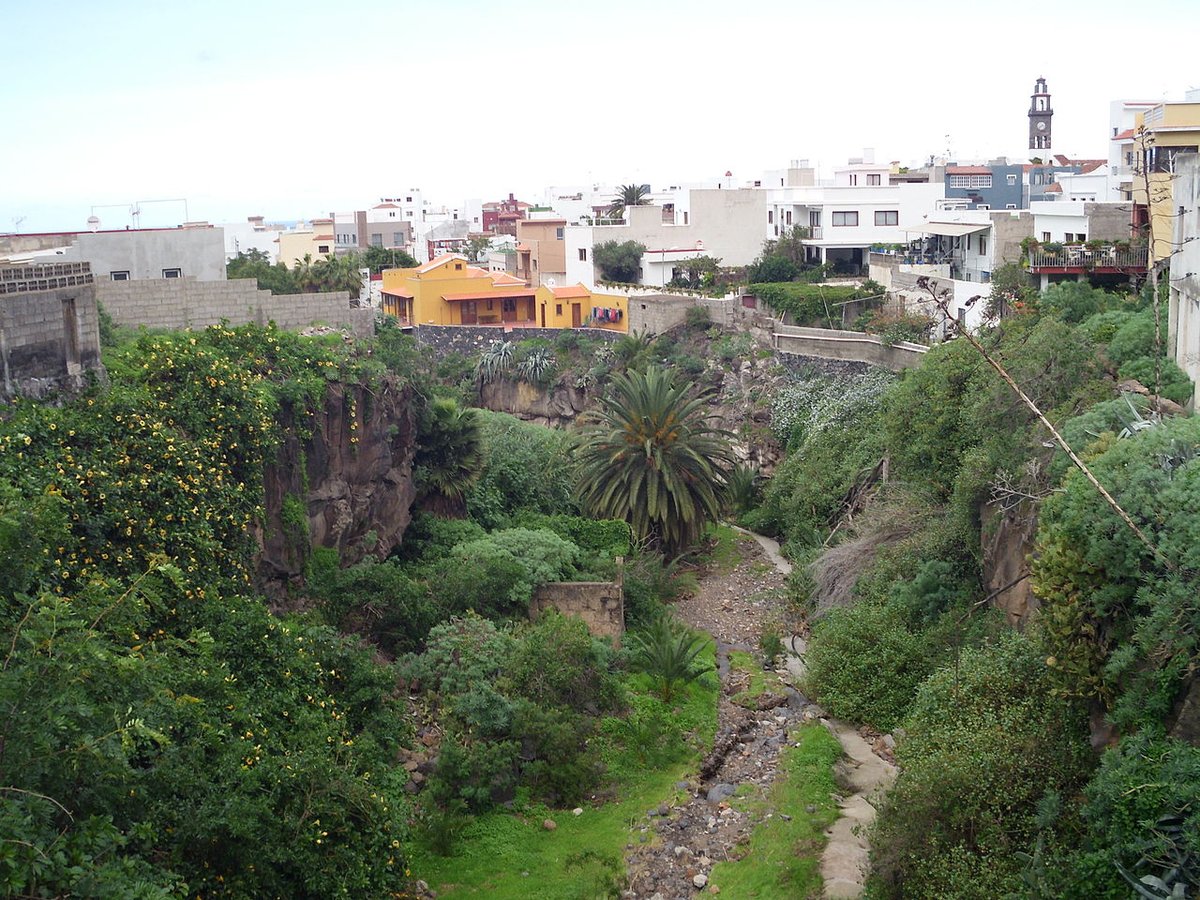
Los Gigantes cliffs tend to steal the spotlight. They rise like a sheer wall above the sea and appear in most photos of this part of Tenerife. Yet Santiago del Teide is more than that dramatic edge. At first glance, from the road, it can seem quiet, almost too still. That impression changes once you move around the municipality.
In 1909, the Chinyero volcano sent a flow of lava down the slopes towards the settlement. It advanced for days, burning what lay in its path, and then stopped just short of the houses. The village was spared when it seemed there was little hope left.
Locals connect that moment with a procession carrying the image of the Santísimo Cristo del Valle. Whether read as faith or coincidence, the event has stayed in local memory. Each November, several days of celebrations mark what people here call the “Milagro del Volcán”.
There is a certain irony in it. On an island shaped by volcanic activity, the story most often told in this municipality is about lava that chose not to go any further.
From the sea up to the heights
On a map, Santiago del Teide can look modest in size. In practice, it stretches across very different landscapes within a short distance. The municipality runs from the coastal area of Puerto Santiago up into high ground within the wider Teide environment.
The change in altitude feels gradual at first, then increasingly noticeable. Starting at sea level, with promenades and tourist areas, the road climbs in less than an hour towards pine forests, dark lava fields and steeper terrain.
At the coast sit the Los Gigantes cliffs. From the water, their scale is far more striking than from land. The stretch of sea between Tenerife and La Gomera is also known for frequent cetacean activity. Boat trips operate with that in mind. Sightings are not guaranteed, but dolphins and pilot whales are often seen.
This contrast between coast and upland defines the municipality. It is not a place built around a single centre, but a collection of zones that feel quite distinct from one another.
Food that comes from the land
Cooking here leans towards hearty, traditional dishes. These are meals shaped by rural life, by people working the land or the hills.
Rabbit in salmorejo appears regularly. It is a familiar Canarian dish, rich in flavour. Escaldón de gofio is another staple, more filling than it looks when it arrives at the table. Gofio itself, a toasted grain flour, is central to local cuisine.
For those who prefer spoon dishes, the puchero made with watercress and sweet potato in the area of Tamaimo is often prepared in season. It is simple, substantial food.
Desserts have their own character. Bienmesabe here tends to be thicker than in other parts of the island, with a strong almond base and a texture that suits small spoonfuls.
Cheese also plays a role. Smoked cheese, often made with local goat’s milk, is typical of the municipality. Its flavour has an intensity that stands out, with that slightly charred note that comes from the smoking process.
Walks that earn their views
The Masca ravine is probably the best-known walking route in the area. The path descends for several kilometres between steep rock walls until it reaches the sea. For years it was a fairly open excursion. Access is now usually controlled, with set conditions, to avoid overcrowding.
The route is not especially technical, but it is demanding. Reaching the beach at the bottom is only part of the plan, since the return requires some organisation, often by boat or arranged transport. It is something to think about in advance.
A quieter alternative is the circular route around the Chinyero volcano. This walk passes through lava flows from the 1909 eruption and stretches of pine forest. The landscape shifts between dark, almost lunar ground and patches of vegetation that break up the black surface.
In late winter, around February and March, almond trees come into bloom and change the look of the route. The contrast becomes softer, with colour appearing across the terrain.
When to go without overthinking it
The climate in this part of Tenerife is generally stable. Along the coast, temperatures tend to stay mild throughout the year. Higher areas are noticeably cooler.
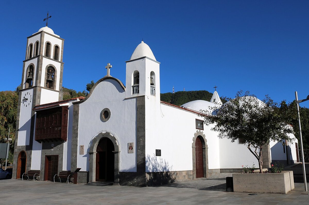
Local festivals are spread across the different parts of the municipality. In Arguayo, pottery traditions remain important, and certain dates bring activities linked to ceramics. In Santiago del Teide itself, romerías and patron saint celebrations still draw strong local participation.
There is no need to plan a trip around a specific date. If a local festival happens to coincide with a visit, it is worth taking a look. These events tend to reflect everyday life rather than being staged for visitors.
Getting a feel for the place
Santiago del Teide does not work as a single-stop destination where everything sits within a short walk. The municipality is spread out across coast, midlands and higher ground.
A straightforward way to explore is to combine different parts of it in one day. A walk in the morning can be followed by a descent towards Puerto Santiago or Los Gigantes. From there, it is easy to continue to Playa de la Arena, known for its volcanic sand, black in colour and quick to heat up under strong sun.
The day can end by the water, watching the light shift against the cliffs. It is a simple way to understand how varied this corner of Tenerife can be, even within a relatively small area.