Full Article
about Tuineje
Agricultural and livestock municipality with a tourist coast at Gran Tarajal; site of historic battles against pirates.
Hide article Read full article
A landscape shaped by wind and stone
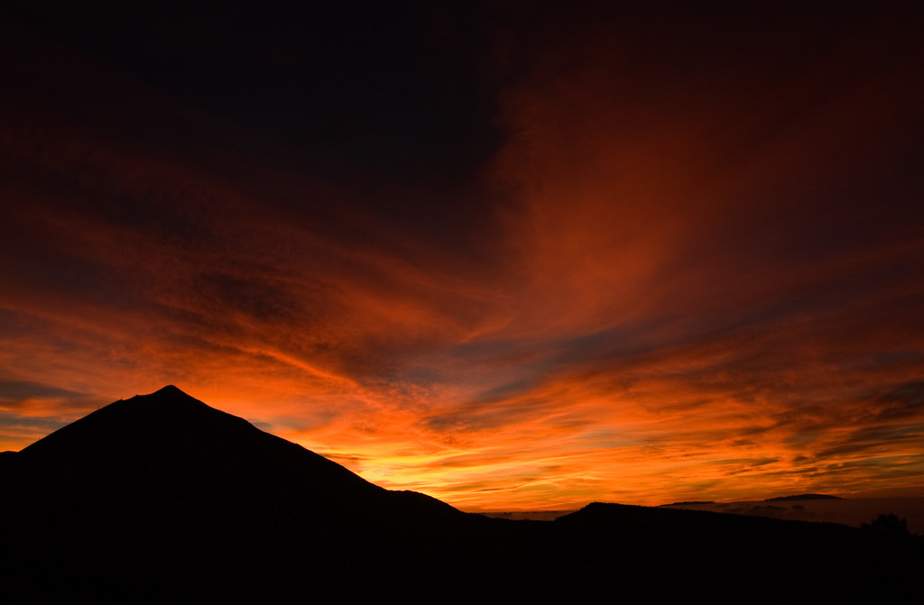
In Tuineje, the wind sets the rules. This is not a gentle breeze but the trade wind that dries the land, bends tomato plants and drives the native cabras majoreras to shelter among tabaibas. The landscape is not something to observe from a distance. It makes sense on foot, through volcanic rock, dust and salt that define much of southern Fuerteventura.
The municipality lies in the south-east of the island and covers a wide stretch of territory, often harsh in character. The volcanic processes that formed Fuerteventura are ancient, going back millions of years, yet their mark remains visible. The malpaís, fields of solidified lava that resemble a frozen sea, help explain why historic settlements grew in valleys and ravines where water sometimes flowed.
Part of Tuineje falls within the Parque Rural de Betancuria, which it shares with neighbouring inland municipalities. Today the dominant vegetation is dry scrub. Earlier descriptions mention denser plant life before intensive land use following the Castilian conquest. At the Caldera de Gairía, a heavily eroded volcanic cone rising from a stony plain, plant species survive that are adapted to very tough conditions. The contrast between the caldera and its surroundings gives a sense of the scale of the landscape in this part of Fuerteventura.
When the British landed
Local memory preserves the story of a British raid attempt in the mid-18th century. Troops linked to the privateer George Clifford came ashore near the coast with the intention of moving inland. Residents organised themselves into a militia and confronted them on the plains near the village. The clash ended with a British withdrawal.
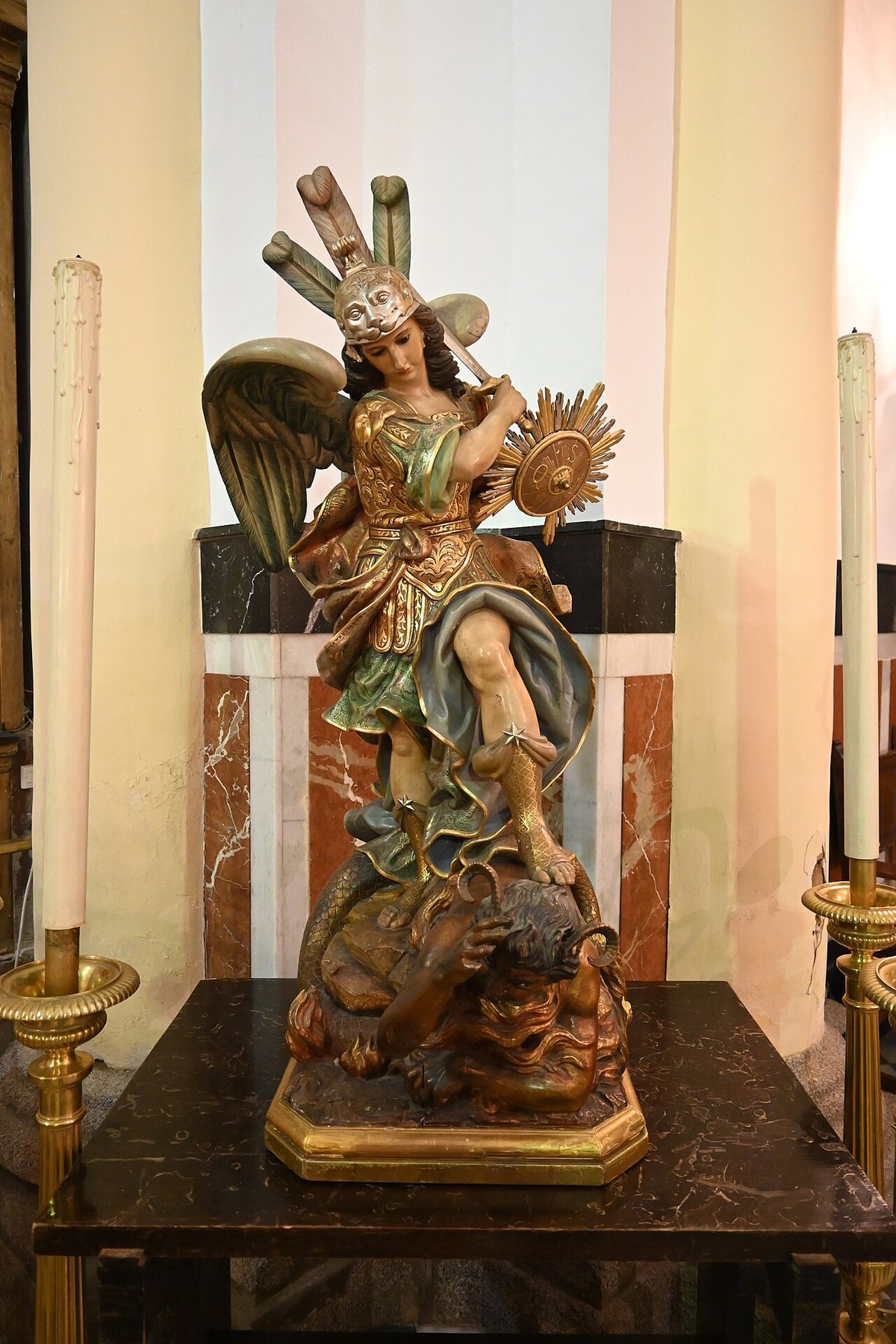
This episode became tied to devotion to San Miguel. According to tradition, the saint’s image was damaged during the fighting. Since then, the municipality has kept the Jurada de San Miguel, a collective vow renewed each year through religious acts and a popular re-enactment of the battle. It is not a solemn performance. Much of the village takes part, and the atmosphere leans more towards a shared act of remembrance than a staged spectacle.
A village built around its church
The town of Tuineje grew around the church of San Miguel Arcángel. The first structure was a small hermitage built at the end of the 16th century. Over time it gained parish status and gradually defined the centre of the settlement.
The current building largely reflects 18th-century alterations. It has a wooden roof made from tea wood and a simple interior. The Baroque altarpiece is not especially grand, yet the atrium stands out for its position. From there, the valley opens up, along with the old route to Gran Tarajal, a path that for centuries linked the livestock-based interior with the small coastal port.
Not far away stands the hermitage of San Marcos. It is a modest building from the modern period, set on the edge of the malpaís. Its isolated presence says much about the territory. Small religious structures once marked routes and acted as points of reference in an open landscape where many features appear similar.
Goat’s cheese, tomatoes and coastal habits
Goat farming remains one of the foundations of the rural landscape here. The cabra majorera is well adapted to dry terrain and produces a rich milk used to make queso majorero. This cheese gained denominación de origen status in the 20th century, although its production goes back much further. Traditional methods include the use of plant-based rennet, hand pressing and air drying, practices that have been passed down through generations.
Along the coast, especially around Gran Tarajal, greenhouse agriculture reshaped the area for decades. Tomatoes were one of the main crops grown for export. Agricultural structures can still be seen near the shoreline. At the port, another long-standing practice continues: preparing dried fish known as jareas, using the steady sun and wind.
Moving through Tuineje
Tuineje is just over half an hour by car from the airport in Puerto del Rosario. The road crosses an open volcanic landscape. Having a vehicle is useful, as settlements are spread out.
The centre of Tuineje itself can be explored quickly on foot. From there, it is possible to head down towards Gran Tarajal along the old slope that once connected the interior with the port, a route used by muleteers and fishermen. Walking is also common around the Caldera de Gairía or near the old windmills close to Tiscamanita. Shade is scarce on these routes, and the ground is usually stony.
Gran Tarajal functions as the coastal hub of the municipality. Daily life gathers along the promenade by the beach. From here, a road climbs up to the Faro de La Entallada, set on a high cliff. On clear days, the African horizon appears relatively close, separated only by a stretch of ocean.