Full Article
about Los Realejos
A town of lush nature and lively local fiestas, known for its black-sand beaches and paragliding launch sites.
Hide article Read full article
A calendar that never quite empties
Any look at tourism in Los Realejos tends to begin with the same idea: the calendar here is full of fiestas. That is not an exaggeration. Across the year, neighbourhood celebrations, romerías, religious processions and firework displays follow one after another. In a municipality of around forty thousand people, that means there is almost always a group preparing decorations or handling gunpowder.
This rhythm has deep roots. The area was the setting for the final stage of the conquest of Tenerife and one of the first places where the new colonial society took shape. That long history still echoes in how the town organises itself and in how often it celebrates.
Where the conquest came to an end
In 1496, the episode that closed the conquest of Tenerife took place here. Historical accounts place the Guanche menceyes, the island’s indigenous rulers, camped in what is now Realejo Bajo, while Castilian troops were based in Realejo Alto. Between these two settlements, the surrender that ended the conflict was formalised.
Soon afterwards, the hermitage of Santiago Apóstol was built. The structure seen today reflects later alterations, yet it remains one of the oldest Christian temples on the island. In the early years of Castilian rule, its surroundings functioned as the centre of the new settlement. Local tradition holds that several former Guanche leaders were baptised in its font following the conquest.
Inside, the main altarpiece is made of polychrome wood and follows a clear iconographic programme: Santiago as a symbol of Christian victory. It is not considered an outstanding example within Canary Islands Baroque, though it offers a direct insight into how that historical moment was presented from the perspective of the victors.
Two towns that still feel distinct
For centuries, there were two separate population centres: Realejo Alto and Realejo Bajo. Administrative union came in the mid 20th century, when both municipalities merged under the name Los Realejos.
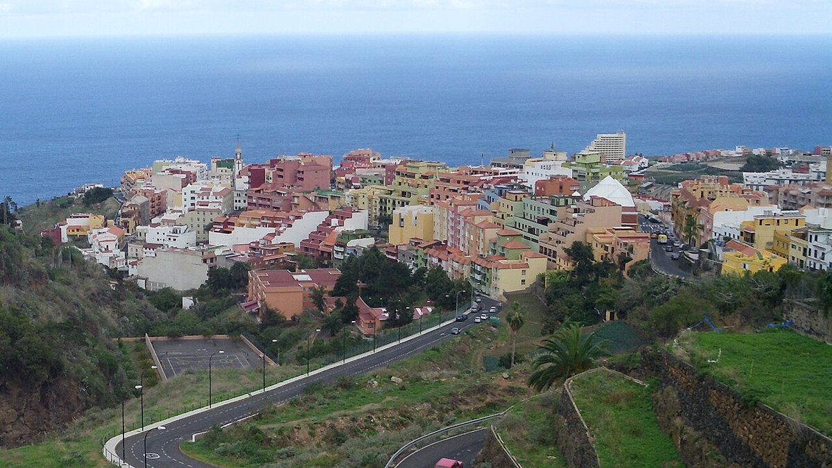
That merger did not fully erase their differences. The upper area historically concentrated the main parish church and several houses linked to the sugar economy of the 16th and 17th centuries. The lower area, closer to the sea, developed port activity alongside agriculture.
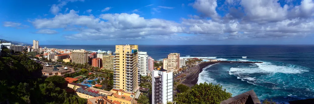
Geography helps explain this dual character. The municipality drops from the midlands down to the coast over just a few kilometres. That change in elevation creates varied landscapes: terraced farmland, scattered neighbourhoods along the slopes, and a coastal strip open to the Atlantic. In places such as Icod el Alto, daily life has long been tied to mid-altitude agriculture, while along the coast the relationship with the sea has been more immediate.
Fire from the rooftops
Each year on 3 May, during the festival of the Cross, that old rivalry between streets returns in symbolic form. In the town centre, well known firework “battles” take place between two traditional streets.
The fireworks are launched from rooftops and balconies in what becomes a kind of pyrotechnic exchange lasting much of the afternoon and into the night. Organisation usually falls to families and groups with a long-standing familiarity with gunpowder. Smoke and the smell of sulphur linger in the air long after it ends.
Rather than a display designed for visitors, this remains closely tied to local life. It reflects a way of celebrating that has been passed down and maintained within the community itself.
The Rambla de Castro and the northern coast
A significant part of the municipality lies within protected natural areas. Along the coast are some of the most recognisable landscapes in the north of Tenerife.
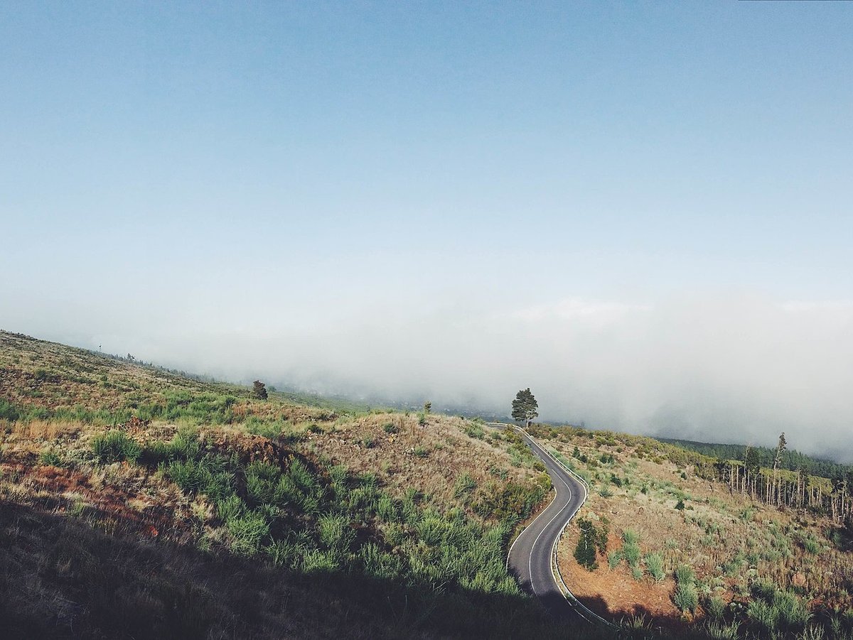
The Rambla de Castro is the most frequented route. It is a relatively short path that runs along the cliffs, crossing former agricultural land linked to historic estates in the area. Along the way appear palm groves, dragon trees and traces of old agricultural infrastructure that recall the valley’s past in sugar production.
From several natural viewpoints along the route, the rugged northern coastline can be seen clearly, along with volcanic formations that drop steeply towards the sea. The contrast between cultivated land and abrupt cliffs defines much of this stretch of coast.
Moving around and what ends up on the table
Los Realejos is a large municipality with noticeable changes in elevation, so travelling by car is often the most practical way to move between the upper areas and the coast. There are also regular guagua connections, local buses, linking it with Puerto de la Cruz and other towns in the valley.
Local cooking reflects long-standing domestic traditions in the Canary Islands. Dishes such as conejo en salmorejo, rabbit marinated and cooked with spices, or puchero served in clay bowls appear frequently. Desserts include bienmesabe, a sweet preparation based on almonds. In the midlands, older varieties of potato are still cultivated and are often simply boiled with salt and served with mojo.
With a day, it is possible to walk through the historic centre, follow the Rambla de Castro and continue down to the coast. When that visit coincides with a neighbourhood fiesta, something that happens regularly throughout the year, the atmosphere shifts completely. It becomes easier to understand how deeply these celebrations are woven into everyday life in Los Realejos.