Full Article
about Soba
Wild Pasiego valley
Hide article Read full article
A landscape that sets the pace
On a winter day, with the sky pressed low by cloud, silence settles over the valleys of Soba. It breaks only underfoot, the crunch of snow on boots, and by the steady murmur of the River Gándara as it slips between rock walls. This is part of the Asón‑Agüera region in Cantabria, northern Spain, where villages do not cluster together but sit apart, separated by meadows and bends in the road. A thin line of smoke from a chimney, the smell of damp wood, the distant sound of cowbells.
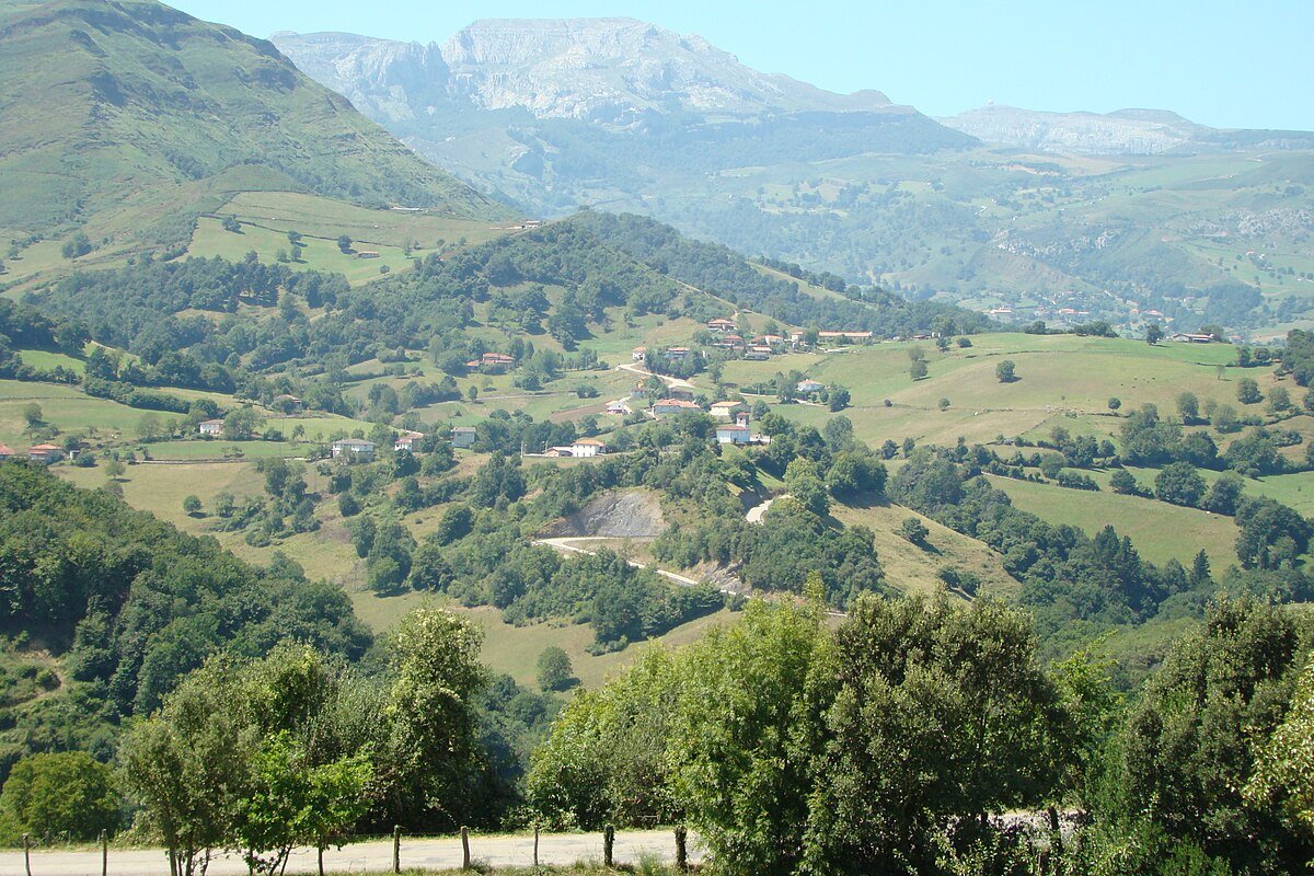
Just over a thousand people live here, spread across a patchwork of farmsteads, hamlets and small villages, some no more than a handful of houses. The municipality is wide and open, and the usual feeling is one of moving through a quiet valley where each settlement appears only when the road decides to crest the next rise.
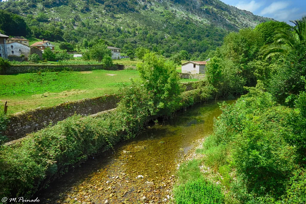
The landscape shifts between deep greens and the greys of stone. Dry-stone walls mark out sloping fields. Many houses follow the traditional montañés style of the Cantabrian mountains, with wooden balconies darkened by long winters. Light changes everything. In June the green almost shines. By August, midday softens the colour of the fields. Autumn brings ochres and browns across the hillsides. In winter, fog often lingers in the valley for hours, erasing the mountains until the sun gradually clears a window through it.
The Gándara valley and the Collados del Asón
Much of Soba’s territory lies within or around the Natural Park of the Collados del Asón. The mountains rise easily above a thousand metres, and forests, especially beech woods, climb the limestone slopes.
One of the best-known stretches is the Desfiladero de La Gándara, a narrow gorge where the road runs tightly between damp rock faces. Moss and ferns cling to the walls, and the sound of water follows almost the entire route. There are points where it makes sense to stop the car in a wider section and walk for a few minutes. Looking up reveals rock surfaces layered with vegetation, and sometimes birds of prey gliding through the air currents.
In villages such as Villar or La Gándara, large houses still stand with coats of arms on their façades and wooden galleries facing the valley. These buildings do not feel designed for a short stay. Their structure reflects long-term use: storing hay, drying clothes, watching over livestock. They belong to the rhythm of the place rather than to passing visitors.
Moving through the valley on foot
Walking is the most natural way to explore Soba. Livestock tracks begin from almost any neighbourhood, and footpaths lead into the hills. Some routes remain gentle, crossing meadows at an even pace. Others begin quietly and then climb steadily towards mountain passes where the whole valley opens out below.
Mobile signal cannot be taken for granted. In many areas it disappears altogether, especially at the bottom of the valley or within dense woodland. A downloaded or paper map remains useful here.
Wildlife often makes itself known by sound before sight. A sudden crack among hazel trees, tracks left in the mud of a path, or the abrupt flight of a bird when turning a bend. The environment feels active even when little is immediately visible.
Time spent in the villages
With only an hour or two, a short visit to the gorge and a brief walk along it can give a clear sense of the surroundings. Another slower option is to wander through one of the valley’s settlements, Veguilla for instance, or any nearby hamlet, and notice how the houses follow the slope of the land. In front of them, there are almost always meadows with cows or horses, divided by stone boundaries that have been in place for decades.
Soba does not function as a single village but as a territory made up of many small places linked by narrow roads with gentle curves. Distances on a map appear short, yet journeys often take longer than expected. It is easy to stop at a high point to look across the valley or pause on a bridge to listen to the river moving below.
When the valley feels at its best
Spring and early autumn tend to offer the most balanced conditions. The valley is green, and the light filters more softly between the mountains. In summer, the valley floor can become quite warm at midday, although temperatures drop quickly in the evening, particularly in higher areas.
After several days of rain, dirt paths turn slippery and some tracks collect mud. Without suitable footwear, it makes more sense to keep to short walks near the villages and leave longer routes for another time. Here, the terrain sets the terms, and the usual approach is simply to adapt to whatever the sky brings that day.