Full Article
about Val de San Vicente
Spectacular cliffs
Hide article Read full article
At the edge of Cantabria
Val de San Vicente sits at the far western end of Cantabria, right where the River Nansa opens out into the sea at the Tina Mayor estuary. It is a place defined by transition. To the east, the Cantabrian coastline begins to stretch out more openly. To the west, across the bridge at Unquera, Asturias begins.
That sense of being in between helps explain how the municipality has developed. Rather than a single town, it is made up of several villages and small settlements scattered across the lower Nansa valley and along a strip of coastline cut by cliffs.
Pesués acts as the administrative centre. It has the expected features of a small municipal capital: town hall, school, a handful of shops. Unquera, closer to the river and the main road, concentrates much of the daily movement. Between them, they share services and everyday life, something common in municipalities formed from many separate villages.
A valley shaped by the Nansa
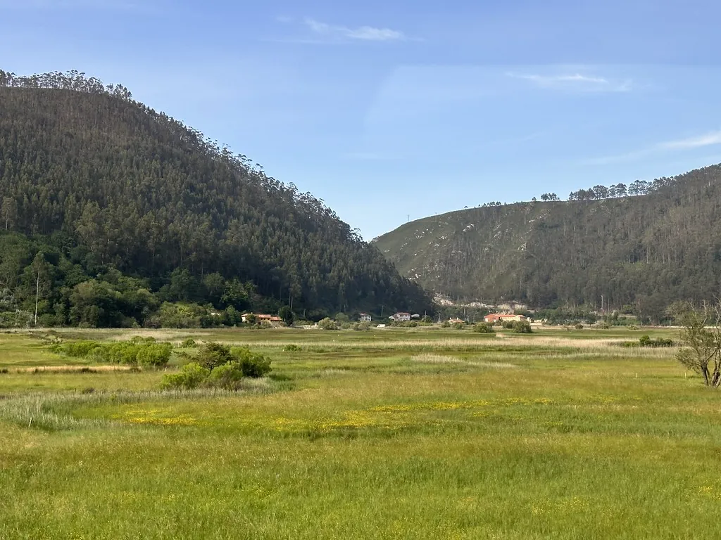
Val de San Vicente works as a network of places rather than a single urban core. There are fourteen villages in total. Some face the Cantabrian Sea, such as Pechón and Prellezo. Others stretch inland, following the course of the Nansa.
The river has always been the natural backbone of the area. Long before modern roads, the valley served as a corridor linking the coast with the mountains further inland. Old routes passed through here connecting Cantabria and Asturias. Remains of roadways and certain place names suggest very early origins, though their exact history is not always clear.
Pesués became the capital when modern municipalities were organised in the 19th century. Its relatively central position within the territory likely played a role in that decision. Even so, many residents associate everyday activity more with Unquera, which is now the most populated settlement and the main point of entry from the national road.
The Torre de Estrada and a watchful past
One of the most distinctive buildings in the municipality is the Torre de Estrada. It stands on a small rise, overlooking much of the surrounding valley. Its slightly truncated pyramidal shape is unusual among medieval towers in Cantabria, which has led to a range of local stories about its origins.
Some neighbours describe it as very ancient, at times linking it to Muslim presence or later reconstructions. Studies tend to place it in the Early Middle Ages, with modifications in later centuries. That pattern is common in rural fortifications of this kind. Whatever the precise date, its purpose is clear: to watch over a territory that for centuries functioned as both frontier and passage.
From the surrounding area, the landscape that defines Val de San Vicente becomes easy to read. There are enclosed meadows bordered by hedges, small scattered villages, and on clear days, the line of the sea to the north.
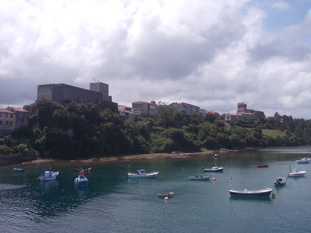
Cliffs, coves and the Asturian boundary
The coastal strip of the municipality has a different character from the interior valley. In places like Prellezo and Pechón, the land ends abruptly in cliffs broken by small inlets. Beaches such as Berellín and Amió, the latter very close to the Asturian border, sit between rocky platforms that are exposed when the tide goes out.
Just beyond, already in Asturias, lies the cave of El Pindal, known for its Palaeolithic cave paintings. Visiting it is often included in outings from Val de San Vicente, as access is only a short drive away. Along this stretch of coast, the landscape changes very little from one side of the estuary to the other. Dark cliffs, north-westerly winds, and paths tracing the edge of the sea define the scene.
Work, land and local food
In the coastal villages, there are still traces of activity linked to the sea. Traditionally, small canning operations and salted fish production played a role, often tied to family economies.
Further inland, livestock farming continues to shape the landscape. The meadows around villages such as Molleda and Muñorrodero are used for grazing. Much of the milk that supplies the wider area comes from these pastures.
Unquera is known across Cantabria for producing sobaos and other sweets. Several companies distribute them throughout the region, while smaller bakeries continue to operate within the village itself. Walking along the main street, the smell of butter is hard to miss.
Festivities and the rhythm of village life
Each village maintains its own calendar of celebrations. Most take place in summer, with romerías, open-air dances and communal meals that remain more about local gathering than attracting visitors.
In Pesués, the festivities of San Pedro, often called San Pedrucu, mark one of the liveliest moments of the year. Similar scenes unfold in other villages, each centred on its respective patron saint.
The Northern Way of the Camino de Santiago also crosses Val de San Vicente from east to west. Pilgrims typically enter the municipality from one side and continue towards Asturias, following a route that reflects the same role the valley has held for centuries: a place of passage between regions, shaped by movement rather than by a single centre.