Full Article
about Congostrina
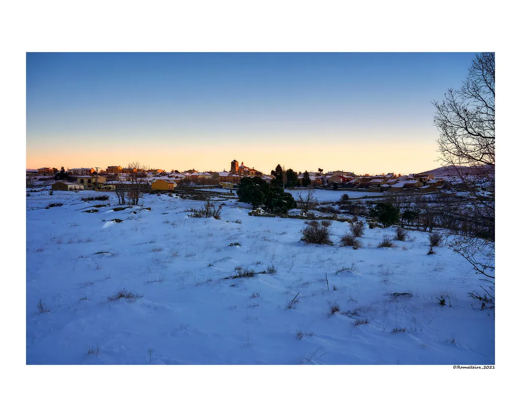
Small village at the foot of the sierra; views of the Alcorlo reservoir
Hide article Read full article
A small settlement on the edge of the Sierra
Congostrina sits at the northern tip of the province of Guadalajara, within the Sierra Norte and close to the line marked by the Sierra de Pela. Fewer than twenty people live here today. Like many villages in this part of Castilla‑La Mancha, its population declined over the course of the 20th century, when livestock farming and small-scale agriculture stopped providing enough to sustain the families who had lived in these houses for generations.
The village stands at just over a thousand metres above sea level. Its exposed position, open to the wind and subject to harsh winters, explains much of what you see in its buildings. Houses are constructed from limestone masonry, with thick walls and very few openings onto the street. Wood, often from juniper or other local species, appears in beams, doors and former animal enclosures. The result is a compact cluster of short, sloping streets shaped more by the need for shelter than by any decorative ambition.
Old haylofts and livestock buildings are still recognisable among the homes. They reflect an economy based on herding and small crops suited to the mountain environment. Even where these structures are no longer in use, they help make sense of how the village functioned when it had a much larger population.
The church and the village outline
The most visible building is the parish church, simple in its construction. Its bell gable rises above the rest of the village and can be seen from the tracks that approach Congostrina. It is not a monumental structure. Its interest lies in how it fits into the whole.
In small villages across this range, the church was more than a place of worship. It acted as a meeting point, a reference for the agricultural calendar and a space where community life was organised. That role still shapes how the village is understood today.
Around the built centre there are fountains and traditional paths that once linked Congostrina with neighbouring settlements. Many of these routes are still used, whether on foot or by agricultural vehicles, maintaining a quiet continuity with the past.
Landscape in the Sierra Norte
The immediate surroundings follow the typical pattern of this part of Guadalajara’s mountain country. There are open hills, narrow valleys and patches of scrubland mixed with pasture. On clear days, the lines of the Sierra de Pela are visible to the north.
Wildlife is what you would expect in sparsely populated upland areas. Roe deer are often seen at dawn or towards evening, and birds of prey regularly circle overhead, taking advantage of the air currents along the slopes.
Seasonal change is very noticeable here. Spring brings green meadows and flowers in the dampest areas. Autumn shifts the tones of the hills towards ochre. Winter is marked by frequent frosts and, in some years, snow that can cover the village for several days.
Paths and walks around Congostrina
Several rural tracks leave Congostrina and connect it with other small settlements in the Sierra Norte. These are straightforward routes, though many stretches are not specifically signposted, so they are easier to follow with a map or GPS.
Rather than organised trails, what exists here are old communication routes between villages. They include agricultural tracks, paths running between stone walls and sections that cross grazing land. They suit unhurried walking or cycling, with the emphasis on moving through the landscape rather than reaching a defined viewpoint.
Night sky and landscape photography
With very little artificial lighting, the night sky above Congostrina is notably clear. On cloudless nights, the Milky Way can be seen distinctly, something that is increasingly rare in more populated areas.
For landscape photography, the first and last hours of the day tend to work best. Low light at these times brings out the texture of the stone buildings and the gentle relief of the surrounding hills.
Eating, staying and getting there
There are no bars or accommodation open to the public in the village itself. For food or overnight stays, it is necessary to travel to larger towns in the surrounding area. There, traditional mountain cooking is common, tied to livestock and seasonal produce.
Congostrina lies in a relatively remote part of the Sierra Norte, reached by local roads that become narrower as you approach. Driving requires care, especially in winter, when frost can affect the road surface.
Spring and early autumn are usually the most comfortable times to explore the area. Summer brings dry, sunny days with cool nights. In winter the landscape changes completely, and it is not unusual to encounter ice or snow on the access roads.