Full Article
about Peguerinos
On the border with Madrid; surrounded by pine forests and reservoirs
Hide article Read full article
A village shaped by height and terrain
At over 1,350 metres on the southern side of the Sierra de Guadarrama, Peguerinos makes most sense when you look first at its setting. The village stands among extensive pine forests and granite outcrops, in a position slightly removed from the usual routes across the range. With just over 280 inhabitants, its layout follows a practical logic: shelter from the cold and make use of the available ground on a slope where winter is clearly felt.
The built environment reflects that same pragmatism. Stone houses with thick walls, wooden gates and tall chimneys form a settlement that does not aim for uniformity or eye-catching restoration. Many homes follow the natural incline of the hillside, grouped along short, somewhat irregular streets. The nearby pinewoods and the ready supply of granite explain most of the materials seen in the town centre.
Peguerinos has long been tied to the use of the surrounding land. Timber, grazing and small cultivated plots in more accessible areas shaped local life. On some slopes, old terraces can still be made out, now partly reclaimed by pine forest. They hint at a more intensive rural economy than the one visible today.
Stone, views and traces of older landscapes
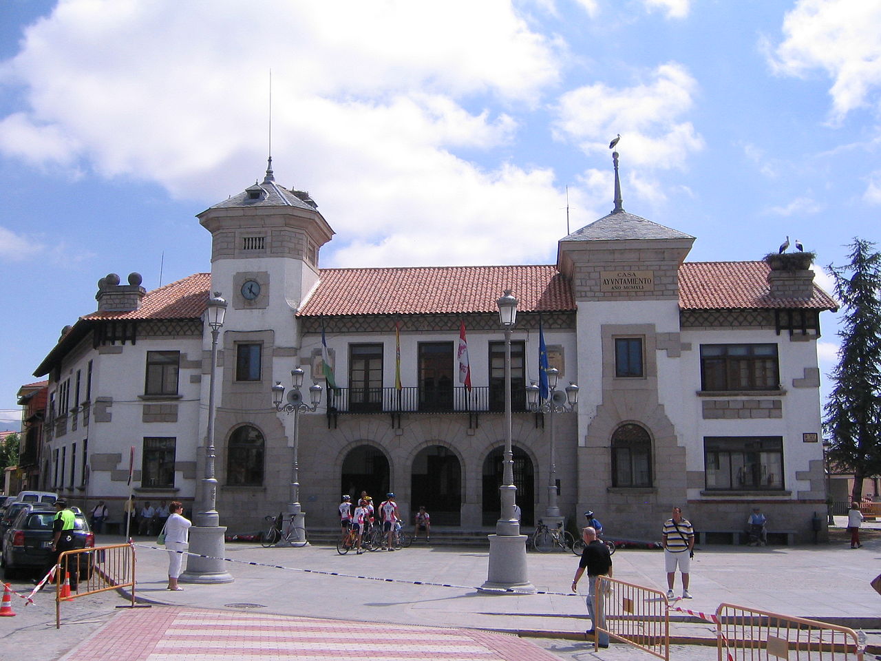
The parish church stands at the centre of the village and, like much of Peguerinos, is built in granite. It is not a monumental building, yet it reflects the construction traditions of the area clearly. Around the square and along nearby streets, several older houses remain. Practical details still stand out: large doors for storing firewood or tools, small balconies and roofs designed to cope with snow.
A few kilometres from the village lies Peña del Oso, one of the best-known elevations in the municipality. The granite formation creates an irregular silhouette that some people associate with the shape of a bear. Beyond that comparison, it works as a natural viewpoint over the pine forests and the slopes of the sierra on clear days. The ground is rocky and uneven, with noticeable gradients, so suitable footwear is advisable.
In an area known as Las Vueltas, old agricultural terraces are still visible. Forest has gradually taken over much of these hillsides, but the pattern of the terraces remains. It gives a sense of how the land was worked when every usable strip mattered.
Paths through pine forest and higher ground
Walking is the main way to explore the surroundings of Peguerinos. From the edge of the village, forest tracks and footpaths lead into dense pinewoods. In some stretches, the view narrows to straight trunks and a ground carpeted with needles.
Certain routes continue into the Sierra de Ávila and link with higher areas of the Guadarrama. These are longer outings, with significant changes in elevation in places, so it is worth checking distances before setting out. Granite terrain can also become slippery when wet or covered with snow.
Those who prefer gentler walks will find several forest tracks that circle the village. They allow for hours of movement through the pines without major difficulty. These paths are also used for managing the woodland and are generally easy to follow.
Wildlife tends to go unnoticed, though it is present. Tracks of wild boar are not unusual, and roe deer can sometimes be heard at dawn. In more open areas, birds of prey are often seen gliding on air currents rising from the ravines.
Autumn brings rain and, with it, people searching for mushrooms in the pinewoods. Collection is usually regulated, so it is sensible to check the rules beforehand.
Winter changes the landscape considerably. Snow can cover tracks and paths for days, which complicates both walking routes and road access. When conditions allow, some trails are covered with snowshoes.
Seasonal rhythms and local life
The main festivities take place in summer, usually in August, when many residents who live elsewhere during the year return. During those days, the village regains a sense of movement. Religious events, popular activities and family gatherings extend into the evening.
Outside that period, Peguerinos keeps the quiet pace of a small mountain municipality. The surrounding land continues to mark the seasons. Autumn centres on mushrooms, winters are long, and summers bring shade from the pine forest along with cooler air than the nearby plains.
A few practical notes
Peguerinos sits at a considerable altitude, and the weather can change quickly, even in summer. Light warm clothing and water are worth carrying when heading out on foot.
The village itself can be explored in a short time. Much of the interest lies beyond the built-up area, in the pinewoods, along forest tracks and across the granite slopes that define the municipality. Parking is usually straightforward at the entrances to the village, where several paths lead directly into the surrounding countryside.