Full Article
about Ucero
Gateway to the Cañón del Río Lobos with a Templar castle
Hide article Read full article
A village above the valley
By mid-morning in December, the walls of the Río Lobos canyon turn a bluish grey, shifting as the clouds move across the sky. Sound travels cleanly here: a branch cracking somewhere out of sight, the slow beat of a vulture’s wings, water running over stone. In this landscape, tourism in Ucero makes immediate sense. It is about walking, looking up, and accepting the silence of the valley.
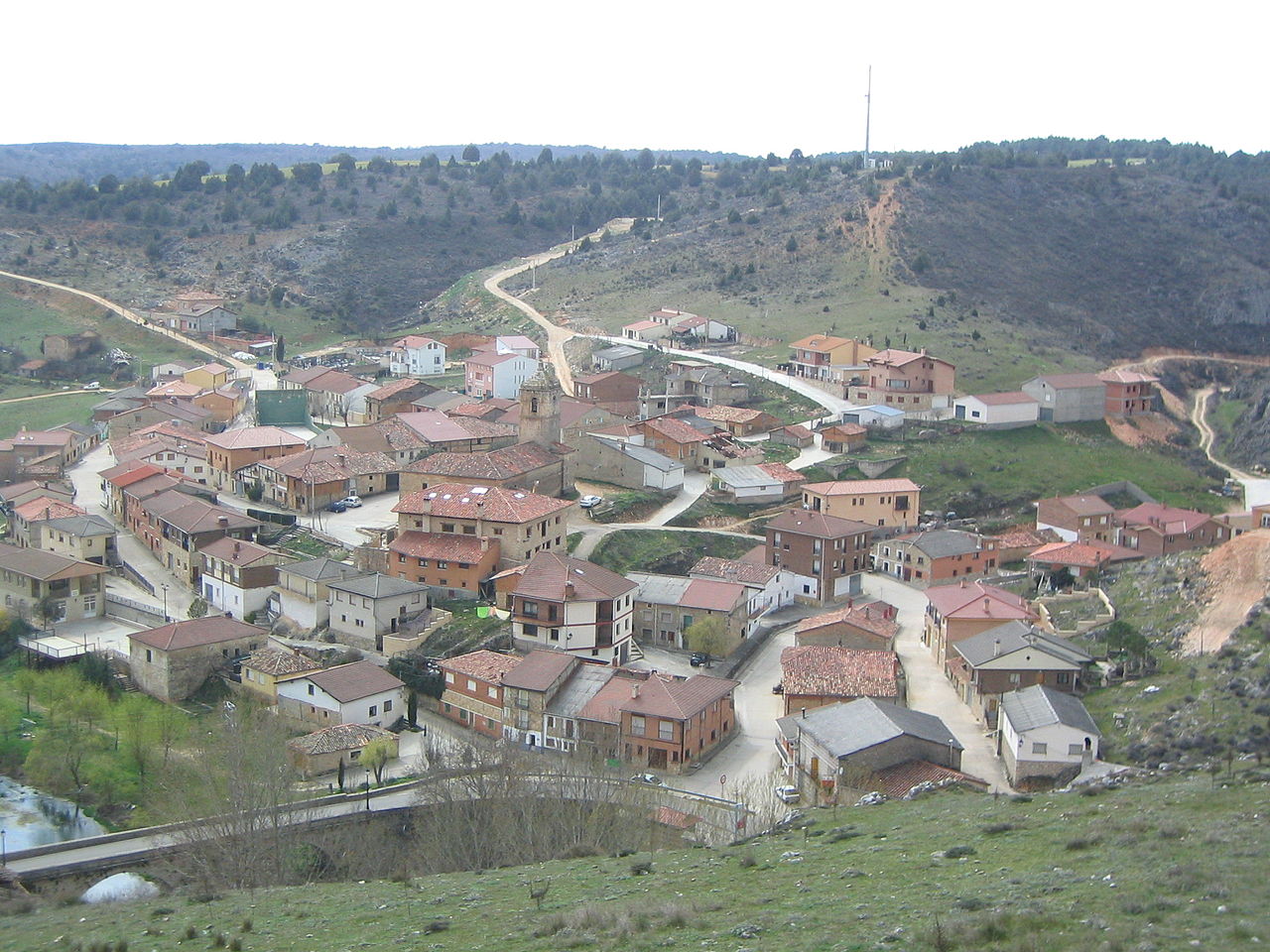
Ucero lies in Tierras del Burgo, in the west of Soria province, a little over an hour by road from the city of Soria. Around eighty people live here year-round. The village leans against the hillside, stone houses with dark roofs facing the valley of the river Ucero. Arriving along the SO‑960, the first thing to come into view is the castle. Sections of wall remain, along with a tower that still dominates the entrance to the valley.
In the centre stands the church of San Juan Bautista. Its current structure dates from the 16th century, though parts are older. The door is usually closed outside times of worship, something common in small Spanish villages, yet walking around it reveals the buttresses and the pale tone of the stone when it catches the late afternoon sun.
Gateway to the Cañón del Río Lobos
Ucero serves as one of the best-known access points to the Parque Natural del Cañón del Río Lobos. Within minutes, the landscape tightens. The valley narrows and limestone walls rise almost vertically, some of them more than one hundred metres high.
Junipers and twisted oaks grow from cracks in the rock. Underfoot there is a mix of sand, pebbles and exposed roots. In winter the air feels cold and dry. In summer, the canyon holds onto a little shade, but the heat builds towards midday. In August, it is wiser to start walking early.
After several kilometres on foot, the ermita de San Bartolomé appears. It stands alone, surrounded by meadow and stone. The site has traditionally been linked to the presence of the Knights Templar in the area, although studies do not always agree on the details. Even so, the scene is clear: pale stone, simple arches and the canyon closing in around it.
Along the river’s course
One of the usual routes follows the river from Ucero into the heart of the canyon. The full walk to the ermita is around thirteen kilometres there and back, depending on the exact starting point. For the most part, the ground is manageable, though after rain some stretches become muddy.
The river appears and disappears along the way. At times it runs openly between rushes. At others it slips beneath the rock and re-emerges further on in small springs. When the water flows strongly, it forms pools of greenish blue that stand out against the pale limestone.
Griffon vultures glide above the cliffs for much of the year. Even small binoculars are enough to pick them out when they pass close to the rock faces. On quiet days, red-billed choughs can be heard, and at dusk the call of an eagle owl carries down from higher ground.
Caves and autumn scents
The canyon’s karst system is extensive. Some caves can only be visited with permits and suitable equipment, as the interiors are fragile and easily altered. In the area there are usually companies that organise guided outings for those who want to enter safely.
Autumn changes the scent of the hillsides. Damp leaves, turned earth and mushrooms pushing through the forest floor. Níscalos, known in English as saffron milk caps, and other species appear in abundance in some years, though mushroom picking is regulated in several parts of the park. It is best to check the rules before setting out with a basket.
Village rhythms
The main celebrations revolve around San Juan Bautista at the end of June. They are small-scale affairs: a procession, neighbours gathering, music in the square when the weather allows. In August the village grows busier. Families who live elsewhere return, and walkers arrive drawn by the canyon.
Ucero no longer holds a weekly market as it once did, but livestock fairs still take place from time to time in nearby villages. There, flocks, old tractors and long conversations in the shade remain part of the scene.
When to go and what to expect
From Soria, the usual approach is to drive towards El Burgo de Osma and continue along local roads to Ucero. The landscape opens into wide fields and patches of juniper. The final kilometres hint at what is ahead, the ground beginning to fold and narrow.
Spring and autumn are often the most comfortable seasons for walking. In summer it helps to set off early and carry water. In winter, the cold is more noticeable inside the canyon, and some sections remain in shade for many hours.
As evening falls and light slides down the rock walls, the valley grows almost silent. There are few cars. A window glows here and there. The river continues its course through the gorges, and Ucero returns to its steady pace.