Full Article
about Casillas
Mountain village surrounded by vast chestnut forests; known for its chestnuts and green, humid setting.
Hide article Read full article
A village shaped by the mountain
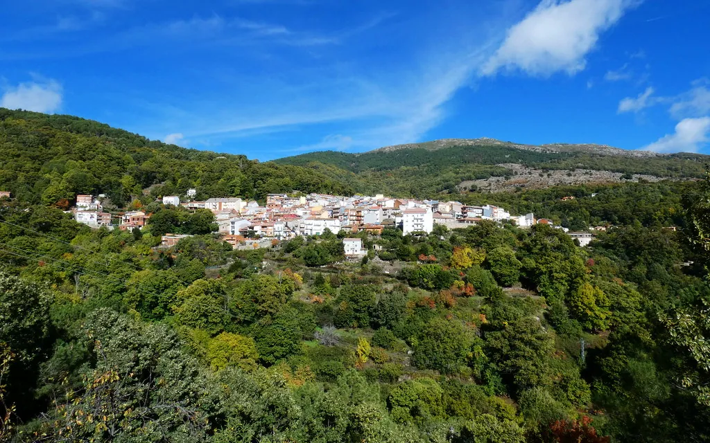
Any look at tourism in Casillas starts with its setting. The village lies on the southern slope of the Sierra de Gredos, within the Valle del Tiétar, a greener and more wooded strip that contrasts with the higher plateau above. At close to a thousand metres in altitude and with fewer than seven hundred inhabitants, Casillas keeps a close relationship with the surrounding hillside. Pine forests and, above all, chestnut groves have influenced local life for generations.
That landscape explains the layout of the village itself. Houses follow the slope and the old routes that once linked vegetable plots, meadows and areas used for forestry. Small terraced fields and stone retaining walls are still visible. They are not decorative remains but part of a way of working the land that was necessary here for centuries.
Older houses combine granite masonry with timber in balconies and open corridors. They are simple buildings, designed for cold winters and relatively mild summers. Some streets still reflect this mountain architecture, although many homes have been altered over time.
The church and the village centre
The parish church stands at the most recognisable point in the settlement. It is a restrained stone building, with thick walls and little in the way of ornament. Its design follows the pattern of rural churches common in this part of Ávila, where such buildings served both religious and social purposes.
Several of the main streets spread out from the area around the church. From here, the village unfolds in different directions, always following the incline. Walking through Casillas makes its gradual expansion clear, with development moving down towards gentler ground. Twentieth century houses sit alongside older constructions, creating a mix that reflects different stages of growth rather than a single planned layout.
The forest at the edge of the village
Contact with the surrounding woodland begins almost immediately. Within minutes of leaving the last houses, paths lead into areas of pine and chestnut. Many of these routes were originally working tracks, used to reach small plots, collect firewood or transport timber.
Chestnut groves hold particular importance in this part of the Valle del Tiétar. Some trees are old and notably large, indicating that chestnut cultivation has deep roots here. In autumn, the ground fills with spiny husks and activity in the forest increases as the season reaches its peak.
Small streams also descend from the sierra, feeding vegetable plots and public fountains. This steady supply of water helps explain why the valley supports denser vegetation than other parts of the province.
Walking through the surroundings
Walking is the most direct way to understand the area. Paths leave Casillas towards nearby passes, mountain meadows and stretches of chestnut woodland. Not all routes are signposted. Some cross private land or split without clear markers, which is typical of traditional rural paths.
Even a short walk reveals how the landscape is organised. Terraces step down the hillside, stone walls define boundaries, and small agricultural structures appear among clearings in the forest. With a bit of attention, it is also possible to spot birds of prey circling above the slopes or smaller birds moving through the trees.
In autumn, the hills attract those interested in wild mushrooms. In many parts of the sierra, collecting is regulated, so it is advisable to check the rules before heading out with that purpose in mind.
Local rhythms and a brief visit
Daily life in Casillas still follows the rhythm of the land and the forest. Chestnuts, firewood and small vegetable plots remain part of many households. These activities connect present-day routines with long-standing practices.
Local festivals usually take place in summer, when residents who live elsewhere return to the village. During those days, the pace changes and the streets become noticeably busier.
Casillas can be explored easily on foot. Distances within the built-up area are short, and the interest lies as much in the streets as in the paths that lead out towards the hillside. Those drawn to traditional architecture can focus on the wooden balconies and granite walls of older houses. Beyond the village, following any of the established tracks quickly shows how closely the landscape and daily life have always been linked here.
