Full Article
about Meranges
The highest village in the province (capital); access to Malniu lake
Hide article Read full article
A Village Shaped by Altitude
At 1,539 metres, Meranges occupies the upper part of La Cerdanya. The road up from the valley is a series of bends, a climb that feels more definitive than the distance suggests. With just over a hundred residents, the village operates on a different scale to the busier towns below.
The layout is typical of these Pyrenean hamlets: stone houses with dark slate roofs cluster around the church, and the streets climb at a gradient that feels purposeful. These were not designed for visitors. They follow the old logic of moving livestock and hay between the village and its meadows. You can still see the wooden balconies, many of them former haylofts, that speak of an economy built around cattle and what the mountain would allow.
Walk past the last house and the change is immediate. The enclosed lanes give way to open meadow, then to forests of black pine. Beyond that, the terrain turns stony. Outside of August or a heavy snowfall, the silence here is not an absence of sound but a physical quality of the place.
Sant Serni and the Logic of Stone
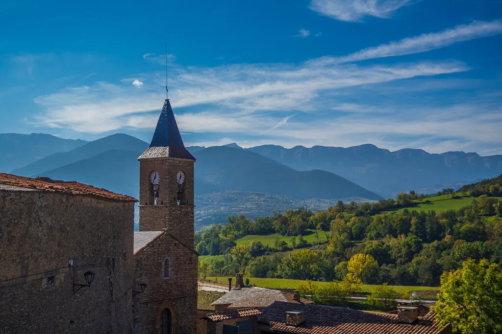
The church of Sant Serni sits at the village’s centre. Records point to an 11th-century origin, though like many in these valleys, it was rebuilt in later centuries—the 16th and then the 18th. The bell tower is simple, visible from most angles. The interior is not large; its interest lies in how it served a small, scattered parish community over centuries.
The surrounding houses are clearer documents. Traditional Cerdanya architecture here means two or three storeys, built from local stone with thick walls and steeply pitched roofs. The balconies almost invariably face south, a practical response to capture winter sun and block the north wind. The ground floor was for animals and tools, the upper floors for people and stored fodder.
From the village edge, the meadows stretch out. These were the reason for the settlement. On a clear day, the serrated line of the Cadí range marks the southern horizon, while to the north, the higher slopes form a wall.
Paths to Malniu and Puigpedrós
Most people arrive in Meranges to walk. A well-used track leads from the village towards the Malniu refuge and its lakes. The path climbs through pine forest before opening into high pastures, eventually reaching small glacial lakes that appear suddenly in the rocky basins.
For a full-day undertaking, the ascent of Puigpedrós (2,914m) often starts from this area. The route mixes defined paths with stretches of grazing land and pedra seca, the loose stone that gives the peak its name. Summer mists can roll in quickly here, obscuring the cairns that mark the way.
Winter redefines the landscape. The meadows disappear under snow, and the same paths become routes for ski touring or snowshoeing, requiring a different kind of preparation. The larger alpine ski resorts are elsewhere in La Cerdanya, which means this area sees fewer people, even in season.
Festivals and Continuity
The main festival falls at the end of August for Sant Serni. It follows a pattern common in these villages: a mass, a communal meal in the plaza, and music organised by residents. The population swells briefly as families return to second homes.
Winter celebrations are more private. Traditions like the tió—the log “fed” by children in the days before Christmas—are still part of domestic life here. In a municipality this small, such customs feel less like performance and more like ordinary continuity.
The annual rhythm is set by the altitude and the number of permanent residents. There is little staged for an audience. What you see is a settlement still shaped by its original terms: livestock, pasture, and a mountain that dictates the pace.
A Practical View
You can walk through Meranges itself in under an hour. For many, it functions as a starting point, not a destination with sights to check off.
Outside of peak summer, services operate on reduced hours. The bar may not be open on a Tuesday in October. It’s wise to plan for this, bringing what you might need for a day in the mountains.
What you find here is direct: a high village that hasn’t strayed far from its pastoral origins, immediate access to walking routes in the highest part of La Cerdanya, and a landscape that changes completely with the season. The experience is defined by that transition from stone street to open mountain, with little in between.