Full Article
about Bordils
A farming village on the Ter plain, known for its tree nurseries and plantations.
Hide article Read full article
A village shaped by the Ter
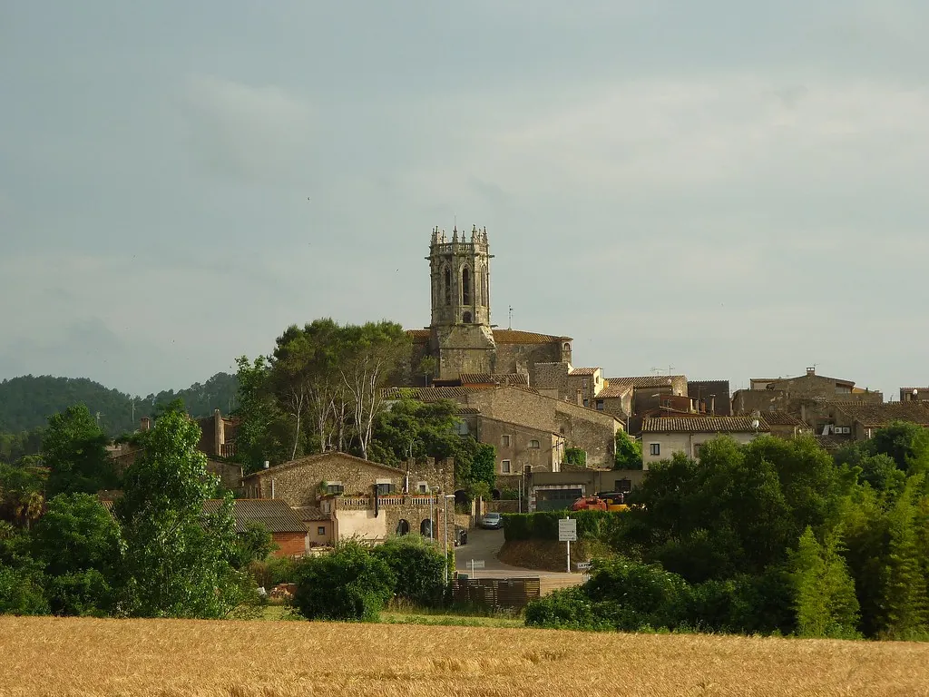
Bordils sits in the comarca of Gironès, about ten kilometres from Girona. It’s part of the broad agricultural plain that follows the lower course of the river Ter. With a population just under two thousand, the village occupies land that has been worked for centuries. A short visit shows that proximity to Girona hasn’t turned it into a dormitory town. Open fields, working tracks and a compact centre define it.
The Ter sets the tone. Its historical flooding and the richness of the alluvial soil encouraged intensive farming. That pattern continues: vegetable plots, seasonal crops and plant nurseries—viverismo is common here. The terrain is flat, not dramatic, but easy to read. Irrigation channels, straight tracks between plots and strips of riverside vegetation all point to the presence of water.
Scattered farmhouses, or masías, explain how this space was organised. Many follow the Catalan agricultural model from the 17th and 18th centuries: compact volumes, stone walls, pitched roofs. Some are still working farms; others have changed use, though their original structure is recognisable.
The parish and the agricultural landscape
The most visible building in the village centre is the parish church of Sant Martí. Its origins are medieval, though its current appearance comes from later alterations. On the plain, churches like this were rarely built to rival urban scale; their importance was social. A small square and a cluster of streets form the historic core around it.
The more significant heritage lies outside, in the agricultural landscape itself. Masías are spread across the municipality along paths that still structure the territory. Not all can be approached closely—many are private—but from public tracks you can see the relationship between house, fields and outbuildings.
Closer to the Ter, the scenery shifts. Riverside trees appear, along with damper ground and paths that follow the river’s course. This isn’t a wild environment. It’s a river integrated into a cultivated plain, shaped by continuous use.
Walking or cycling the plain
The flat terrain makes Bordils easy to explore on foot or by bicycle without much effort. Agricultural tracks link the village with other settlements and with Girona. These are calm routes, though they are used by farm machinery during working hours.
Following the Ter is one of the clearest ways to understand the area. Paths near the river connect with neighbouring municipalities and pass through narrow stretches of riverside woodland. They aren’t fully signposted hiking trails in every section; they’re part of the everyday network used for farming.
The landscape changes with the seasons. Vegetable plots, nursery fields and cultivated land shift in colour and texture. Spring and summer bring a dominant green; in autumn and winter, the view becomes more restrained, marked by turned earth and the lines of irrigation channels.
Festivities and local rhythm
The main annual celebration is the Festa Major, held around the feast day of Sant Martí, the patron saint. As in many municipalities in Gironès, the programme usually combines popular events, cultural activities and elements of Catalan tradition, like gegants (giants) or castellers (human towers) if local groups participate.
The festival functions mainly as a meeting point for residents and people from nearby villages. It reflects the social rhythm of a place where local ties still shape community life.
A practical visit from Girona
Bordils doesn’t require much time. Its appeal lies less in specific sights and more in walking or cycling its network of paths to see how this agricultural plain works. From Girona, it’s a few minutes by car, easy to include without detailed planning.
A visit here is about paying attention to details: the layout of fields, the irrigation channels, the positioning of masías, the steady presence of the river. It’s a place where the structure of the land remains visible, and where rural activity continues alongside the nearby city.