Full Article
about Canet d'Adri
Gateway to the Rocacorba mountains; known for its volcanic pools and nature.
Hide article Read full article
Between Plain and Hills
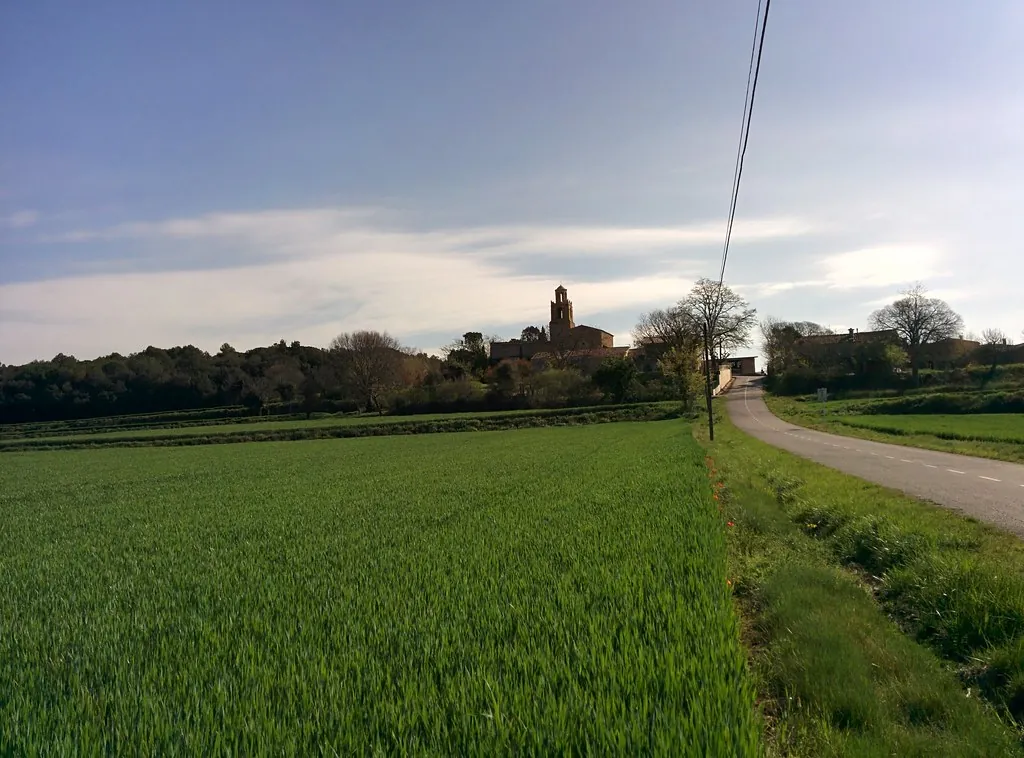
Tourism in Canet d'Adri makes most sense when you look at a map of the Gironès comarca, the county that surrounds the city of Girona in Catalonia. The municipality lies to the west of Girona, in a stretch of land where the flat plain begins to ripple. It is not mountain territory, yet it is no longer open farmland either. That gentle shift in relief explains much of what you see on the ground: holm oaks, small cultivated plots and tracks that rise and fall without ever becoming steep.
Just over seven hundred people live here. The municipal area is divided into several small settlements and scattered masías, the traditional Catalan farmhouses typical of this part of Spain. Girona is around twenty minutes away by car, and many daily journeys are made in that direction. Even so, the pace remains rural. Fields are still worked, and tractors continue to cross the narrow lanes.
Canet d'Adri did not grow around a grand monument or a defensive castle. It grew around the land. For that reason, the built landscape is dispersed. Houses, farmsteads and small clusters of buildings stand apart from one another, separated by fields and patches of woodland. The sense of space comes from that pattern as much as from the terrain itself.
Sant Esteve and the Rural Fabric
The village centre is organised around the church of Sant Esteve. The present building largely reflects reforms carried out in the early modern period. As in many villages in the surrounding area, there was probably an earlier church on the site, although later alterations changed its original appearance considerably.
The construction is sober. Stone walls, a compact volume and very limited decoration define its exterior. Inside, traces of different building phases can still be seen. They are modest details, yet they help explain how rural churches like this adapted over the centuries, responding to new needs and changing tastes without ever losing their essential character.
Beyond the main village, the municipality includes the nuclei of Sant Grau and the area of Adri and Torrents. Rather than compact villages with tightly packed streets, these are small groupings of houses and masías. This scattered settlement pattern is common in the interior of the Gironès and shapes how the territory is experienced. Movement between places is through open land rather than along continuous streets.
The masías give Canet d'Adri much of its identity. Many retain the classic structure: a rectangular ground plan, thick stone walls and a pitched roof covered with tiles. Nearby, threshing floors, animal pens or low dry-stone walls often appear. Some of these buildings are still used for agricultural work, maintaining a link between past and present.
The landscape around them combines Mediterranean woodland with cultivated plots. Holm oaks and cork oaks cover much of the slopes. Between the trees, fields open up, their appearance changing noticeably with the seasons. At certain times of year they are green and dense; at others they turn dry and pale, blending into the earthy tones of the surrounding hills.
Walking the Tracks of Canet d'Adri
The simplest way to explore Canet d'Adri is on foot, following its rural tracks. Many connect masías and small settlements. Others lead deeper into wooded areas.
Distances are not long, yet the undulating terrain makes itself felt. Carrying water and having a basic sense of direction is advisable. There is signage along some stretches, though it is not always continuous. This is not a network of fully waymarked tourist trails but a living system of agricultural and forest paths.
Some routes link several old masías. It is not an official itinerary with information panels. Instead, it is a way of moving through the landscape and observing how the territory was organised. The position of farmhouses, the layout of fields and the presence of dry-stone structures all speak to a way of life shaped by agriculture and woodland management.
For those travelling by mountain bike, there are forest tracks with moderate gradients. Some climb towards the higher parts of the municipality. From certain points, views open out over the Gironès and, on clear days, towards nearby mountain ranges. The perspective reinforces the sense that Canet d'Adri sits at a threshold, between the flatter lands around Girona and more rugged terrain further west.
Practical Notes for Visitors
Canet d'Adri is reached via local roads from Girona and from other nearby towns in the Gironès. The municipality is small and can be covered quickly by car.
For anyone planning to walk along the tracks, comfortable footwear is important. Consulting a map before setting out is also a sensible idea. Services within the municipality are limited, which is typical for villages of this size. Many visitors combine time in Canet d'Adri with visits to other places in the comarca, using it as part of a wider exploration of the Gironès.
In the end, tourism here is closely tied to landscape and rural architecture rather than to headline sights. The appeal lies in understanding how a small Catalan municipality functions between plain and hills, where fields, woodland and scattered farmhouses define the rhythm of daily life.