
Full Article
about Gombrèn
Mountain village tied to the legend of Count Arnau; wild landscape and ruined castles
Hide article Read full article
A Village Without a Centre
Gombrèn occupies a stretch of mid-mountain terrain in the Ripollès, its altitude consistently above nine hundred metres. With just over two hundred residents, it lacks a central plaza or a nucleated old town. The settlement pattern is one of scattered masías and small housing clusters, separated by grazing meadows and patches of woodland. This isn't a design choice but a consequence of geography and history: the land here, between the Freser valley and the Serra Cavallera, was always better suited to pastoralism than to a dense urban core.
The architecture is purely functional. You see stone farmhouses with steeply pitched roofs, wooden balconies facing south, and barns built directly into the slopes. These are buildings designed for long winters and a life tied to livestock. Gombrèn historically functioned as a zone of passage between mountain ports, not as a fortified town. That legacy of transit and dispersed settlement still defines its character today.
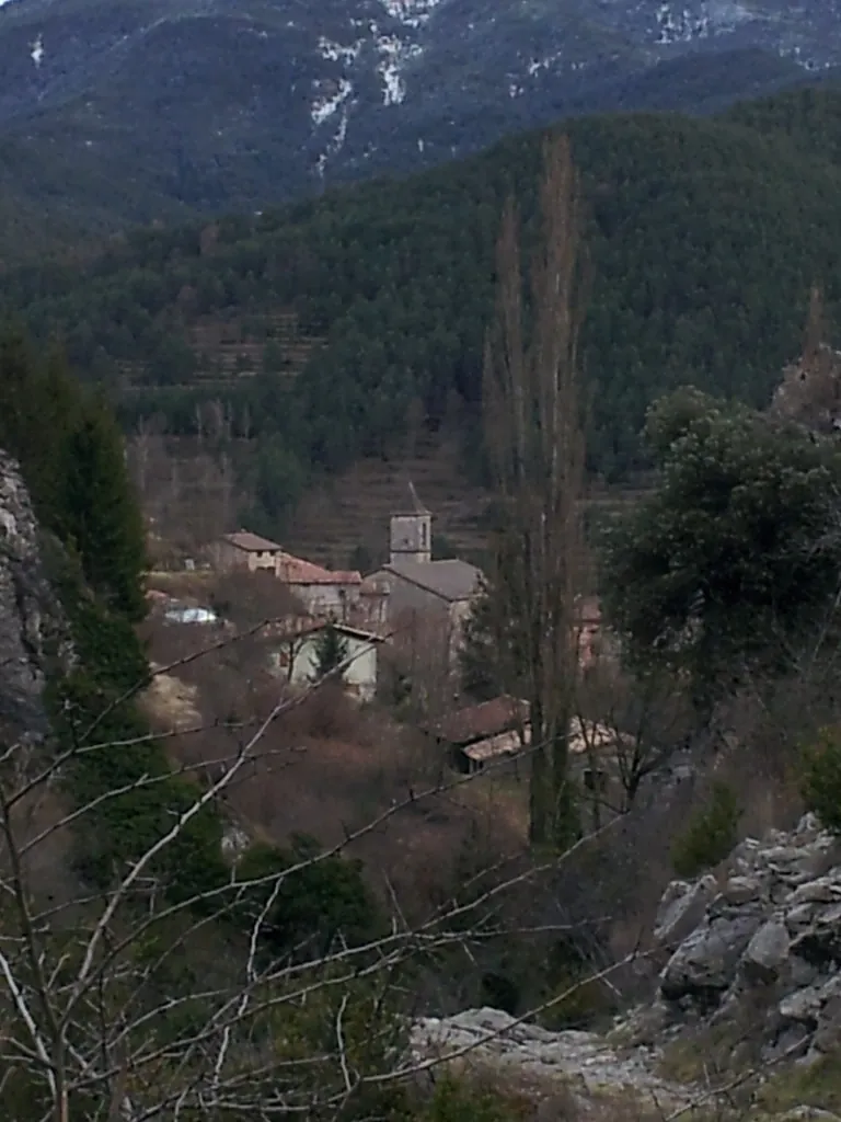
A Dispersed Parish and a Defining Ridge
The parish church of Sant Pere anchors what passes for a main nucleus. Its origins are medieval, though the current structure shows the modifications typical of rural Catalan churches over centuries. The bell tower is more a territorial marker than an architectural flourish, a useful reference point in a landscape where houses are often out of sight of one another.
The true landmark is the Serra Cavallera, the mountain range that rises directly to the north. Its rounded profile, dominated by the peak of Taga (over 2,000m), is a constant presence. The lower slopes are covered in Scots pine and beech, which turn decisively in late October. A short walk from the village leads to the Roca Foradada, a pierced rock that frames a view over the entire Freser valley. It’s a straightforward destination that gives immediate geographical context.
Paths, Not Streets
You don't stroll Gombrèn; you use it as a departure point. A network of old paths connects the scattered farmsteads and leads into the mountains. Many are now incorporated into waymarked hiking routes for the Ripollès.
The ascent of Taga is the most significant local trek. It’s a walk, not a climb, but the altitude gain is substantial and the weather on the summit ridge can shift abruptly. Other paths make gentler circuits through pine woods and pastures. Waymarking exists but can be sporadic; having a map or a GPS track is advisable.
In autumn, these same forests draw mushroom foragers. It’s a serious seasonal activity here, with specific local regulations on permits and quantities. In winter, the village can serve as a quiet base for accessing larger ski resorts further east, though the access roads require caution with snow or ice.
Rhythm of the Seasons
The annual rhythm is punctuated by the festa major in late summer, centred on Sant Pere. For a few days, the population swells, with communal meals and evening dances held usually near the church or the sports field.
Smaller events occur throughout the year, often organised by the local cultural association. These might be a guided botanical walk or a talk on pastoral traditions—activities rooted in explaining this specific place. The calendar here still follows the agricultural and pastoral cycle more closely than the tourist one.
Getting There and Practical Notes
Gombrèn is reached by a local road branching off from the C-26. There is no train station; the nearest is in Ripoll. By car, it’s about a 20-minute drive from there.
Given the dispersed layout, having your own vehicle is practical if you intend to explore different trailheads or neighbouring valleys. The village has basic services but limited options; planning for meals and fuel in advance is sensible. Mobile phone coverage can be unreliable in the smaller valleys and on certain mountain slopes.


