Full Article
about Soriguera
Large municipality with the abandoned village of Santa Creu, the highest from the medieval period.
Hide article Read full article
A valley of small settlements
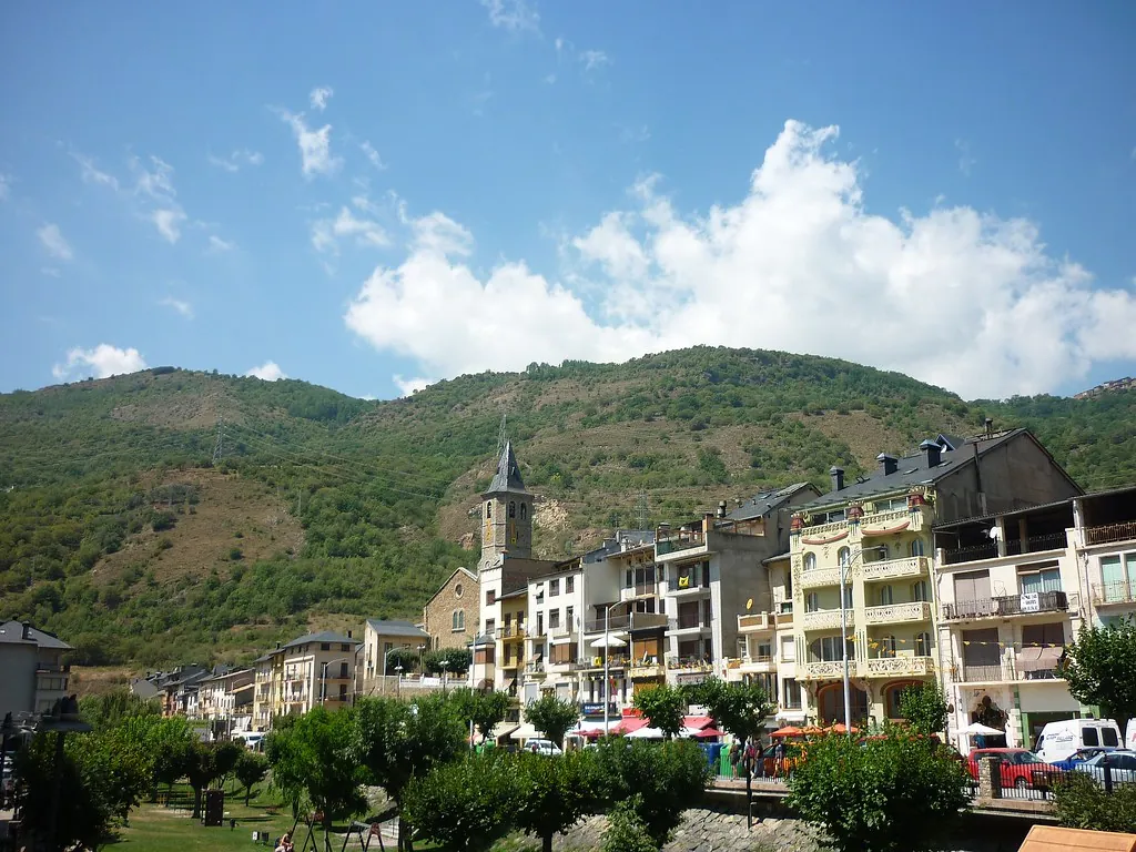
At the northern edge of Pallars Sobirà, Soriguera stretches across a side valley that opens towards the Noguera Pallaresa. It is not a single village but a collection of small settlements such as Estac, Arcalís and Vilamur, scattered across slopes and valley floors. Around five hundred people live here in total, and daily life still revolves around livestock and the use of the surrounding land. That connection is immediately visible: enclosed meadows, scattered barns and forests that climb steadily towards higher ground.
The architecture follows the same mountain logic. Houses are built from stone, with slate roofs and compact shapes designed to withstand long winters. Roofs often face south to catch the sun, a common feature across Pallars. There are no large monumental landmarks. Instead, the built environment is made up of practical, restrained homes constructed with local materials.
Romanesque churches on a modest scale
Several of these villages preserve small Romanesque churches. Santa Eulàlia d’Estac, usually dated to the 12th century, is one of the most frequently mentioned in the municipality. It reflects the simplicity typical of Pyrenean Romanesque architecture: a single nave, thick walls and a tower rising above the surrounding houses. The interior is quite austere, but the setting stands out. From its slightly elevated position, it looks out across much of the valley.
Other hermitages scattered across the area, including Sant Bartomeu de Gavàs, point to an older network of parishes and chapels that shaped rural life well into the 19th century. Many occupy elevated spots or sit along former routes, a common feature in mountain churches.
A walk through places like Estac, Morrano or Burgo reveals the true scale of these communities. Streets are narrow, slopes are pronounced and houses cluster together to shield against the wind. Some buildings have been restored in recent years, though the overall structure of each settlement remains much as it was when the local economy depended almost entirely on agriculture and livestock.
A landscape shaped by use
The surroundings of Soriguera are unmistakably Pyrenean. Conifer-covered slopes dominate much of the terrain, with beech forests appearing in wetter areas and open meadows wherever the land allows. In autumn, the contrast between deciduous woodland and the higher peaks becomes particularly striking. During winter, snow regularly settles on the upper elevations.
This landscape is not just a backdrop. For centuries it has been managed for timber, grazing and small-scale cultivation. That history continues to show. Herds still move through high pastures when the weather improves, following patterns that have long defined life in the valley.
Paths between villages
One of the defining features of Soriguera is its network of paths linking the different settlements. Many follow historic routes that once served as the main way of getting around. Walking between villages, for example from Estac to nearby hamlets, reveals why each one was established where it is: close to water, sheltered from wind or positioned on a sunnier slope.
The terrain is not always gentle. There are clear changes in elevation and stretches of uneven, stony ground, so some familiarity with mountain walking is useful. Shorter routes do exist, but even these reflect the natural contours of the land.
Forest tracks and certain paths are also used for mountain biking. Surfaces can be rough and climbs are often long, which is typical of this part of the Pyrenees.
Winter and nearby ski areas
Soriguera lies relatively close to the ski resorts of Port Ainé and Espot. Many visitors choose to stay in the municipality’s villages while skiing in the area, preferring accommodation away from the immediate surroundings of the resorts. Winter changes the landscape noticeably. Meadows are covered in snow and the mountains beyond remain white for weeks at a time.
Mountain produce and seasonal rhythms
Local food reflects what the land has traditionally provided. Meat from livestock, cured sausages, cheeses made from sheep or goat’s milk and seasonal mushrooms all play a role. Autumn draws particular attention, as damp forest conditions bring out fungi and attract people into the woods across the region.
Before setting off
Distances on the map can be misleading. Roads are mountain roads, with bends and narrow sections, and the settlements are spread out rather than clustered together. Journeys take time, and conditions can shift quickly, especially in winter.
Soriguera is not a place to cover in a single morning. It makes more sense to move gradually between its small villages, observing how they sit within the valley and noticing the details that explain life here: paths worn into the hillsides, Romanesque churches, enclosed fields. Together, these elements offer a clear sense of how people have lived in this part of the Pyrenees over centuries.