Full Article
about Montoliu de Segarra
Small municipality with the medieval village of Montoliu and Guardia Lada.
Hide article Read full article
An Agricultural Plateau in La Segarra
Tourism in Montoliu de Segarra begins with understanding where you are. La Segarra is an agricultural plateau in inland Catalonia, broad and dry for much of the year. Villages here tend to stand on slight rises, positioned to look out over the surrounding fields. Montoliu follows that pattern.
The village sits at around 689 metres above sea level and has a population of roughly 180. Around it stretch plots of cereal crops and a scattering of isolated masías, traditional Catalan farmhouses set apart from the main settlement. The landscape has changed very little in recent decades. There are no dramatic shifts in terrain, no sudden contrasts. Instead, there is continuity: fields, tracks, open sky.
This setting shapes the experience of the place. The horizon feels wide, the air dry for much of the year, and the settlement small against the scale of the plateau. Montoliu de Segarra is not separated from its environment. It is embedded in it.
The Old Core and the Church of Sant Pere
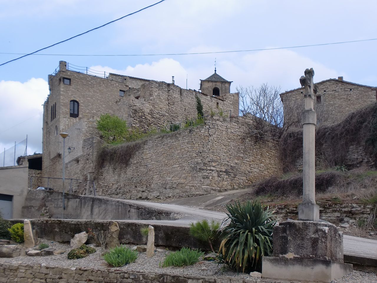
The village’s history is written into its old centre. Narrow streets wind between stone houses, following the layout typical of long-established rural settlements. Many of the buildings are constructed from stone taken from the surrounding area, giving the whole nucleus a sense of cohesion.
At the heart of Montoliu stands the parish church of Sant Pere. It has been documented since the 16th century, although it has undergone later alterations. Its bell tower rises above the rooftops and remains the most visible point when approaching along the agricultural tracks. In small villages such as this, the bell tower once had a practical role. It marked the rhythm of the day and served as a reference point in a territory that is largely open and uniform.
Walking through the streets, carved lintels and engraved dates can still be seen above some doorways. They do not form a grand monumental ensemble, yet they help trace how the village has taken shape over generations. There are also signs of more recent renovations. These changes make it clear that the houses are still in use, not preserved as a static heritage site but adapted to contemporary life.
From the higher part of the settlement, the view opens out across the surrounding fields. The position explains why villages were founded on these slight elevations. Even modest height provides a sense of oversight in such a horizontal landscape.
Fields, Light and Seasonal Change
Cereal crops occupy almost the entire municipal area. The landscape is flat and restrained in character. Variation comes from the network of paths, the small rises in the land and the scattered masías that punctuate the fields.
The colours shift with the seasons. In spring, green dominates as young crops begin to grow. At the start of summer, golden tones take over as harvest approaches. Later come the stubble fields and freshly worked earth. The changes are subtle rather than dramatic, but they define the rhythm of the year.
Agricultural tracks lead out from the village into this environment. Many follow older routes used by farmers and machinery. They can be explored on foot or by bicycle. Signposting is not always present, and the terrain is generally gentle, without steep gradients. The main factor to bear in mind is the sun, particularly in the summer months when shade is scarce and the plateau’s exposure becomes clear.
There is a simplicity to these routes. They are working paths first and foremost. Anyone using them shares space with the agricultural activity that still sustains the area.
Daily Life and Local Food Traditions
Services within Montoliu itself are limited. It is common for those passing through to continue to other villages in La Segarra for meals or shopping. This reflects the small scale of the settlement and its primarily agricultural character.
The cuisine of the area is based on dryland produce. Legumes and cereals form the backbone, accompanied by meat and traditional cured sausages. These are foods rooted in the local economy and climate, shaped by what the land can reliably provide.
Montoliu de Segarra does not present itself as a conventional tourist destination. There are no large visitor facilities or a concentrated offer of attractions. The village maintains its own pace, tied to agricultural cycles and the needs of its residents. Anyone arriving should expect a living rural community rather than a curated visitor experience.
Clear Skies and Summer Festivities
One of the most striking aspects of Montoliu reveals itself after dark. The population density in this part of La Segarra is low and artificial lighting is minimal. On clear nights, the sky becomes a prominent feature. A short walk away from the centre is enough to gain a broad view of the firmament, particularly during the drier months of the year when clouds are less frequent.
This sense of openness continues into the social life of the village. The main annual celebration, the fiesta mayor, usually takes place in August. During those days the community gathers for religious events, shared meals and dances. The festivities are intended above all for local residents and for families who return in summer.
These celebrations highlight the scale on which Montoliu operates. The village does not expand to accommodate large crowds, nor does it attempt to transform itself into something it is not. Instead, it reinforces existing ties.
Montoliu de Segarra functions less as a tourist destination and more as a small agricultural nucleus that has retained its dimensions and rhythm. Visitors will find a landscape typical of La Segarra and a village that continues to live from the land that surrounds it. The appeal lies in that continuity: fields stretching to the horizon, a church tower marking the centre, and daily life unfolding much as it has for generations.