Full Article
about Pina de Montalgrao
High-mountain village known for its pine forests and the Santa Bárbara hermitage on the summit; cool climate and clean air
Hide article Read full article
A mountain village above the valley
Set at over 1,000 metres above sea level, Pina de Montalgrao sits in the highest part of the Alto Palancia, in the interior of the province of Castellón. Up here, geography explains almost everything. The air is colder than down in the valley, and the surrounding hills of pine, holm oak and scrub shape daily life. With just over a hundred residents, it remains a very small mountain settlement where distances feel measured by paths rather than by kilometres.
The village is tucked into the sierra of the Alto Palancia and follows a simple layout. Houses cluster around the church and adapt to the slope of the land rather than imposing a rigid grid. Stone is the dominant material, with traditional curved roof tiles and façades designed more for practicality than display. From the edge of the village, the landscape opens quickly into gentle rises, expanses of pine forest and the occasional rocky outcrop emerging through the vegetation.
This is rural Spain at altitude, where settlement patterns reflect climate and terrain. Winters are harsher than on the coast, and buildings are constructed to shield against the cold and make the most of low winter sunlight. There is little ornamentation, but plenty of common sense in the way the place has evolved.
A compact centre and its parish church
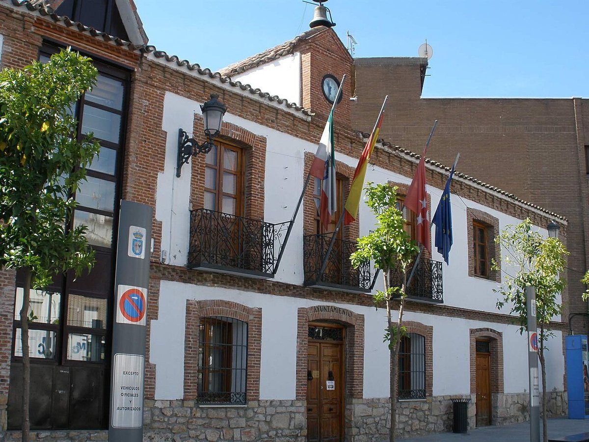
The parish church of the Inmaculada Concepción is the main landmark in Pina de Montalgrao. It is a restrained building of the kind erected in many inland Valencian towns during the modern and contemporary periods, once communities had grown enough to require a permanent parish. Its bell tower, visible from the access road, still acts as a point of reference when approaching the village.
The old centre can be explored without effort. Streets are narrow and, in some stretches, cobbled. Houses follow the typical style of the area: masonry walls, moderate heights and very few decorative flourishes. The architecture is not designed to impress. Its purpose is to keep out the winter cold and capture the light when the sun sits low.
There are no grand monuments or long lists of sights. The interest lies in the coherence of the whole: a small settlement shaped by centuries of adapting to altitude, isolation and the demands of mountain life.
Forest paths and the wider Alto Palancia
Step beyond the last houses and the terrain quickly becomes forest. Pine woods, scattered holm oaks and shallow ravines form a continuous landscape that connects with other mountains in the Alto Palancia. Not every path is signposted, yet many have their origins in former agricultural or livestock use and can still be traced on the ground.
Walking is the most direct way to understand the surroundings of Pina de Montalgrao. Forest tracks and traditional routes begin in the village itself, heading into the sierra and linking with neighbouring municipalities in the comarca. It is wise to seek up-to-date information before setting out, as signage can be inconsistent and some sections change over time.
The altitude and extensive woodland support the wildlife typical of these inland sierras. With patience, birds of prey or small mammals may be spotted, particularly in the early hours of the day. The quiet here is genuine. Outside weekends, it is common to walk for long stretches without encountering anyone.
For those interested in photography, early morning and late afternoon often provide the most favourable light. From the outskirts of the village, the undulating terrain is clearly visible, along with the shifting colours of the pine forest as the seasons turn.
As for food, the local tradition mirrors that of many inland areas. Expect hearty spoon dishes, stewed meats and cured sausages produced in the comarca. Given the small size of the village, it is sensible to plan ahead if travelling midweek or outside the busier months.
Traditions through the year
Like many small villages, Pina de Montalgrao sees its calendar come alive in summer. Many former residents return during the warmer months, and celebrations organised by local associations fill several days with popular activities. These gatherings reinforce ties in a place where much of the population lives elsewhere for most of the year.
The village’s patron saint is the Inmaculada Concepción, celebrated in December. Participation is usually more limited at that time of year, as winter has firmly arrived in this high part of the Palancia and the cold makes itself felt.
Seasonality is noticeable here. The rhythm of the year still follows climate and altitude, and the contrast between summer activity and winter quiet is marked.
Getting there and choosing your moment
Pina de Montalgrao lies inland in the province of Castellón, north of Segorbe. The usual approach is via the Autovía Mudéjar, the A‑23 motorway, followed by regional roads that climb into the sierra. The ascent makes clear how the landscape shifts from valley to upland.
Altitude has a strong influence on the climate. Winters are seriously cold, and frosts are not uncommon. Between spring and autumn conditions are more manageable, with summers milder than on the coast. Even so, nights tend to cool down, including in August.
Anyone planning to walk in the hills should carry water, footwear with good grip and a light extra layer. Weather can change quickly in these mountains.
What often goes unsaid
Pina de Montalgrao can be seen in a short time. It is not a destination defined by major monuments or an extensive checklist of attractions. Its appeal lies elsewhere: in understanding how people have lived for centuries in this elevated corner of the Alto Palancia, where woodland, cold and distance from large urban centres have always shaped the way the land is inhabited.
A short walk through the surrounding hills reveals more about the village than any map. The terrain, the silence and the simplicity of the built environment all point to the same conclusion. Here, life has long been adjusted to the mountain rather than the other way round.