Full Article
about Benifairó de les Valls
Birthplace of Alonso Sánchez Coello and municipality in the Les Valls subregion.
Hide article Read full article
A valley shaped by water and history
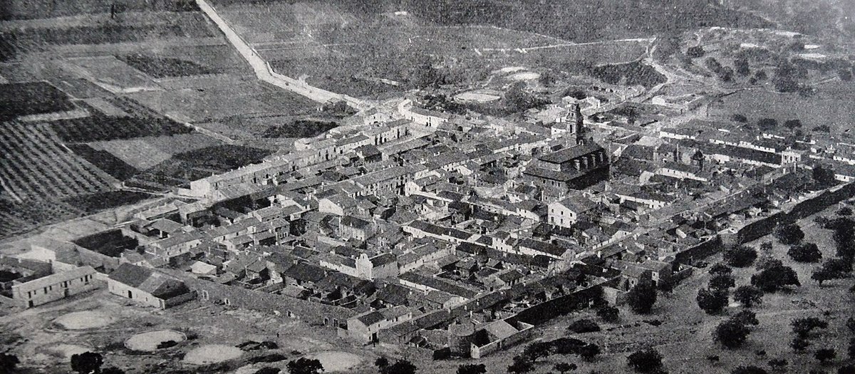
Benifairó de les Valls sits in the Vall de Segó, a small agricultural valley in the Camp de Morvedre area, just a few kilometres from Sagunto and the Mediterranean. The name itself points clearly to an Andalusí past. In many place names, the prefix Beni refers to a lineage or family group, suggesting that before the Christian conquest under Jaume I, there was likely a rural settlement here tied to irrigation systems that still organise the landscape today.
That origin still shapes the town’s layout and its relationship with the surrounding land. The built-up area leans against the first foothills of the Serra Calderona, while to the east the terrain opens into cultivated plains. Citrus groves dominate now, yet the network of acequias, traditional irrigation channels, is much older and follows a hydraulic logic inherited from the Islamic period.
Streets that follow the land
Walking through Benifairó helps explain how villages in this valley function. The central streets keep an irregular layout, with two-storey houses and fairly restrained façades. It is not a place defined by grand monuments, but by a human scale where everything lies within a short walk.
At the centre stands the parish church of San Miguel. The current building reflects several phases of construction, something common in churches across this region. Its presence shapes the rhythm of the square and nearby streets. Rather than drawing attention for specific artistic features, it works as a reference point for how the town expanded from the early modern period onwards.
Not far away, a few houses still show stone doorways and heavily worn family coats of arms. These details are easy to miss, yet they hint at families who once held a certain importance in the valley’s agricultural economy.
Up to the ermita and across the valley
A path leaves the town and climbs gently towards the Ermita del Buen Suceso. The route is not long and passes through areas of cultivated land and terraced plots. The hermitage is closely linked to local devotion to the Virgen del Buen Suceso, a figure with strong roots in the community.
The building itself is simple, in line with many rural hermitages in the Valencian region. It has a rectangular nave, a pitched roof and a small open space in front that acts as a meeting point during celebrations. The main reason to come up here, though, is the view.
From this point, the whole Vall de Segó opens out: a stretch of green fields filled with orange trees, set between the mountains of the Calderona and the coastal plain. On clear days, even the line of the sea can be made out. It offers a clear sense of where Benifairó sits within the valley and how closely the town is tied to the land around it.
Festivities and shared traditions
The festivities dedicated to San Miguel mark one of the key moments in the local calendar. As in many Valencian towns, they combine religious acts with band music, processions and open-air evening gatherings known as verbenas. These celebrations are mainly shaped for residents and for those who maintain family ties to the village.
Devotion to the Virgen del Buen Suceso remains very present and is linked directly to the hermitage on the hillside. Traditionally, romerías, or pilgrimage walks, and gatherings are organised around this space. It acts as a symbolic point for people across the valley, not just within the town itself.
The pace of an agricultural town
With just over two thousand inhabitants, Benifairó de les Valls still follows a rhythm closely tied to agricultural work. Many residents now commute to Sagunto or nearby towns, yet the surrounding orange groves continue to define the yearly cycle.
In spring, the valley fills with the scent of orange blossom. At that time, the agricultural paths see regular use for walking and cycling. These are straightforward routes that run between acequias and terraced fields, where small tool sheds and modest irrigation structures still appear along the way.
The landscape is not only productive but also legible. The irrigation system, the layout of plots and the position of the town itself all reflect a long continuity between past and present.
Getting your bearings
Benifairó lies a short distance from Sagunto and can be reached by car in a matter of minutes from the motorway that connects Valencia with Castellón. From the road, the town appears at the foot of the Calderona, with the bell tower acting as a clear visual marker.
Once there, the most straightforward way to understand the place is on foot. Walking through the centre, then heading out towards the orchard paths or up to the hermitage, gives a complete sense of the area. There is no need for a long checklist of sights. The key lies in observing the valley, the acequias and the agricultural landscape that has supported the community for centuries.