Full Article
about Chiva
Large municipality with mountains and the famous Torico de la Cuerda
Hide article Read full article
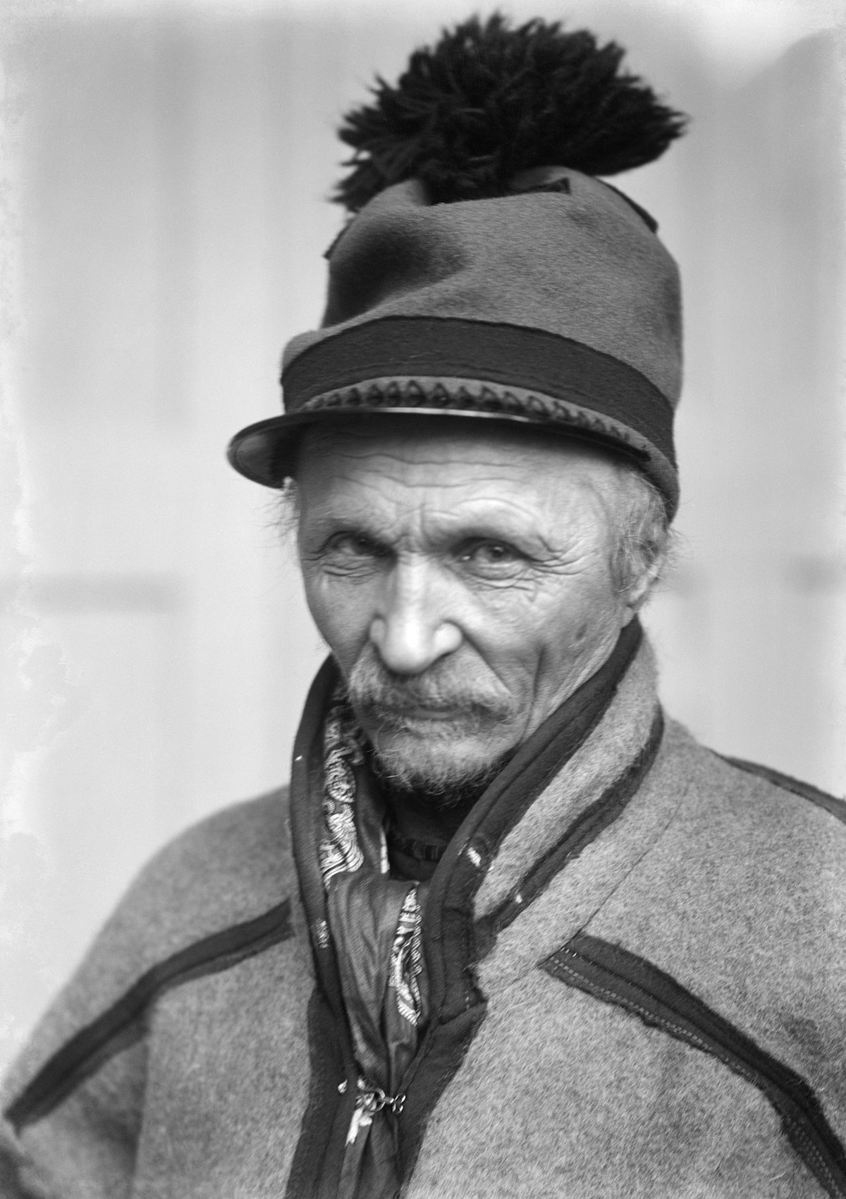
A rope, a bull and a long memory
At first light on 17 August, a bull appears in the streets of Chiva’s old quarter, held by a hemp rope that dozens of men pull and release as it moves forward. This is not a typical bull run. The animal advances with the rope kept taut, and every metre is negotiated between those handling it and the people watching from doorways and balconies.
The event is known as the Torico de la Cuerda, a fixture in the town’s collective memory since the 18th century. Local tradition says that shepherds from Teruel once paid with a bull for the right to spend the winter with their flocks in these hills. Whether or not the story can be proven, the scene still reflects how Chiva operates: deeply rooted customs sustained by the community itself.
A hill without a castle, and a tower that remains
Climbing to the Plaza del Castillo makes sense even though there is no castle there. On the highest point stands the church of San Juan Bautista, an 18th-century Baroque building occupying the same hill where an earlier Islamic defensive tower once stood. A fragment of that earlier structure survives in the form of la Torreta, probably built between the 11th and 12th centuries.
The location was no accident. From here, the land opens towards the natural passage linking the Valencian plain with inland routes towards Castile. For centuries this was a lookout over a shifting frontier between Christian and Muslim territories.
After the conquest of Valencia, James I granted these lands to Berenguer de Entenza. Over time, the hill lost its military role and became the centre of the town’s religious life. The current church replaced an earlier temple, and according to local accounts, its dedication changed thanks to financial support from an archbishop of Manila with family roots in Chiva.
Rock shelters beyond the usual route
Beyond the urban centre, the municipality of Chiva contains several rock shelters with schematic prehistoric art. The best known are la Alhóndiga, Cofia and Barranco Grande, sites that tend to be overlooked if one stays within the town itself.
The area can be explored along a circular route of around eight kilometres starting at the fuente de la Horteta. From there, the path follows a ravine with reddish walls. Inside the shelters are very simple figures such as archers and goats, along with geometric shapes. These paintings are generally dated between 3000 and 2000 BC.
The sets are not especially large, yet they show that these limestone outcrops were already used as shelter thousands of years before the town existed. Natural light inside the cavities is limited, so a torch is useful. Informational panels nearby help with interpreting what can otherwise seem minimal at first glance.
The aerodrome that reshaped the surroundings
During the Spanish Civil War, a military aerodrome was set up in the plain of the river Magro, in what was then agricultural land on the edge of Chiva. Republican aviation used the runway, and surviving records indicate that several fighter squadrons and repair workshops operated there.
Today, very little remains visible. There are fragments of metal structures, some traces of signage, and a commemorative plaque. For years after the war, the land continued to serve agricultural flights, before industrial expansion altered the landscape.
Among older residents, the area is still commonly referred to as “l’aeròdrom”, a name that preserves the memory of that period even as physical traces have faded.
Hearty dishes and festive baking
Food in Chiva reflects rural routines and seasonal rhythms. The olla de la plana appears in many homes when temperatures drop. It combines white beans, chard, cardoon and meat from traditional pig slaughter, including black pudding and pork belly. It is served straight from the pot and designed to sustain a long day of physical work.
In February, around San Blas, aniseed doughnuts are prepared and often sold near the church. The proceeds help fund the pilgrimage held on the first Sunday of May, when the Virgen del Castillo is brought down from the hilltop sanctuary into the town.
The image is usually transported in an old car decorated with rosemary branches, a detail that has become part of the ritual. The day ends with a shared outdoor meal near la Torreta. Long tables are set out, and people gather to eat savoury cocas and locally made cured meats, with wine from the area.
Getting there and timing your visit
Chiva lies about 30 kilometres from Valencia along the A‑3 towards Madrid. Access to the town centre comes from one of the exits linking to the local road network.
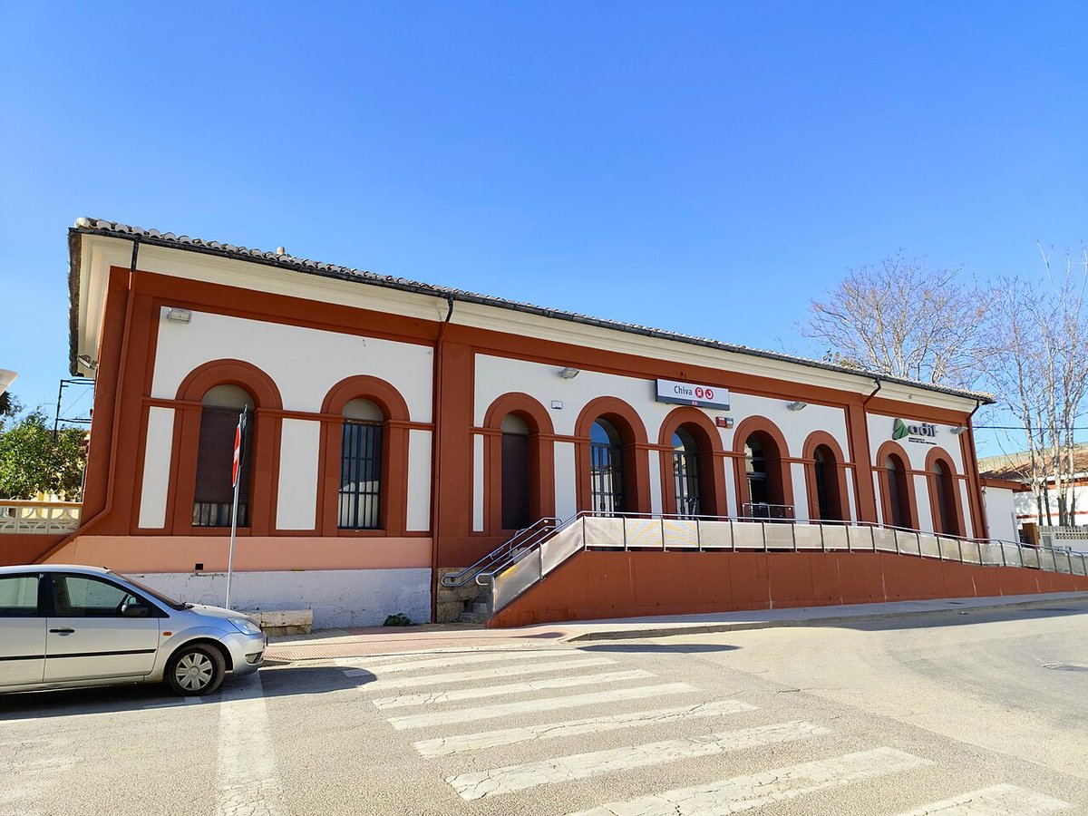
There is also a Cercanías railway station connecting Chiva with Valencia and other inland towns, with several services throughout the day.
Spring is often the most comfortable time to explore the surrounding landscape. The ravines retain some greenery, and the heat is still moderate compared with the height of summer. Anyone visiting during the Torico de la Cuerda in August should be aware of what the event involves. It is not designed as a performance for visitors, but as a local celebration. Closed footwear and a bit of patience tend to make the experience easier to follow.