Full Article
about Cabanes
Large municipality stretching from inland to the coast; known for its Roman arch and the Prat de Cabanes-Torreblanca natural park.
Hide article Read full article
An arch in the orange groves
The arch appears without warning, set among orange groves. The old Vía Augusta runs beside it as a dirt track. There is barely any signage, and nothing built up around it. Just this 2nd-century funerary monument, raised next to the Roman road that once crossed the Plana. The scene says a lot about how Cabanes relates to its past: the important remains are still there, absorbed into the working landscape.
The Arco Romano is one of the clearest traces of Rome in this part of Castellón. It was built alongside the Vía Augusta, likely commissioned by a landowner of some local standing. It served both as a funerary monument and as a visible marker along the route. Its inscriptions were lost in the 19th century, at a time when heritage protection was minimal. Today it stands alone among cultivated fields, with little intervention around it.
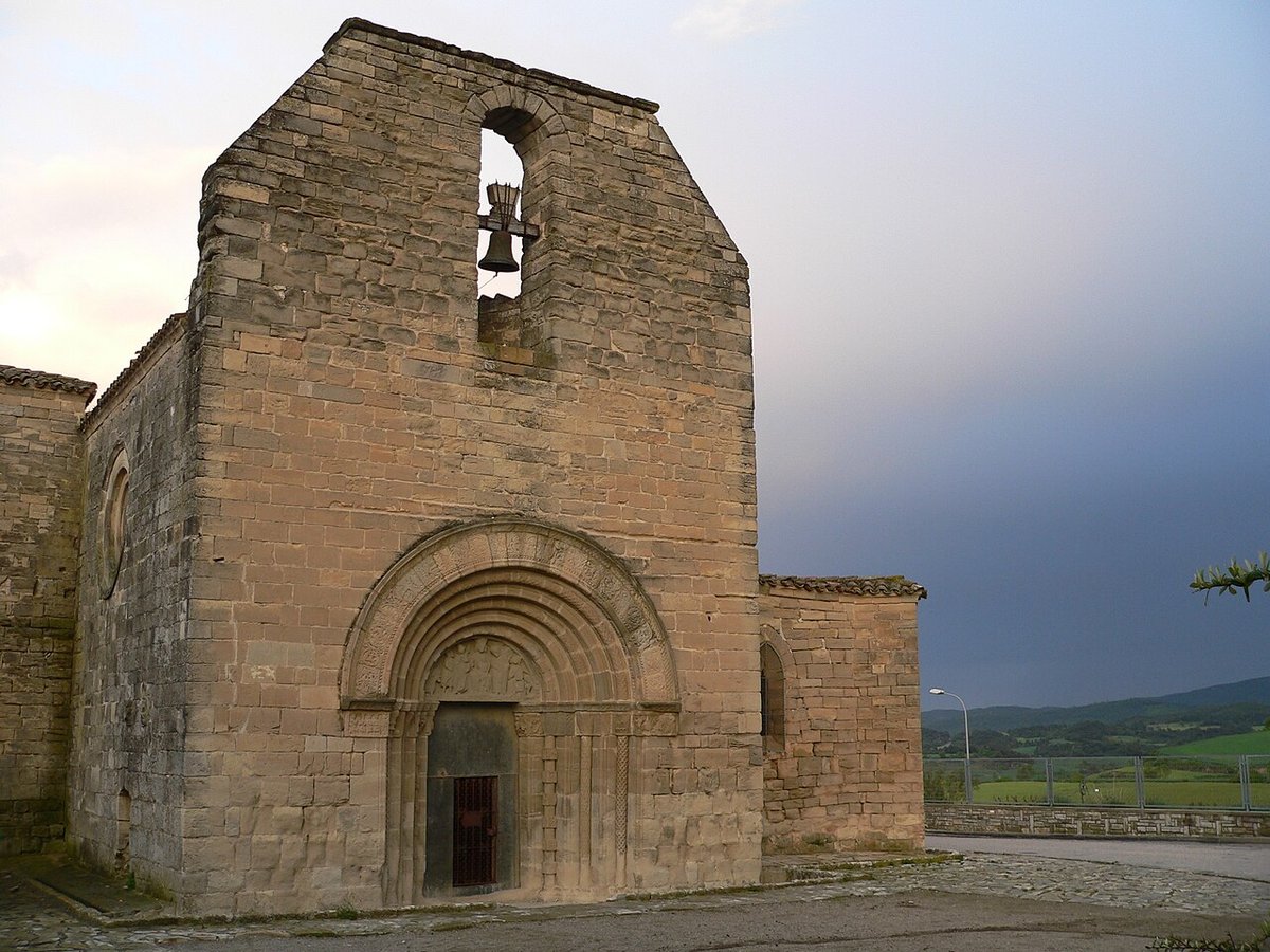
Around four kilometres from the town centre sits the Castell de Miravet. The visible fortification dates to the Islamic period, around the 11th century, although the hill had been occupied earlier. During the campaigns of Rodrigo Díaz de Vivar along the eastern Iberian Peninsula, the capture of the castle is mentioned, around 1090. What remains today includes stretches of wall, the bases of towers, and the remains of the church of San Martín y San Bartolomé, built after the Christian conquest. From this height, the logic of the site becomes clear: a wide view over the plain that opens towards the Mediterranean.
From marshland to monastic hills
The municipality of Cabanes sits between two very different landscapes. To the east lies the Prat de Cabanes‑Torreblanca, a coastal wetland of fresh water that is unusual along the Castellón shoreline. Its lagoons and reed beds provide a stopover for many migratory birds travelling between Africa and Europe. The land is flat, crossed by irrigation channels and old drainage systems that point to a long relationship between farming and marshland.
Inland, the terrain shifts. The Desert de les Palmes is a massif of limestone covered with scrub and pine woodland. Discalced Carmelites settled here in the 17th century in search of isolation. The name “desert” does not refer to sand or extreme dryness, but to the idea of spiritual retreat away from populated areas.
Along the coast are the beaches of Torre de la Sal and Ribera de Cabanes. Access is via tracks and rural paths. There are wide stretches of sand, dune vegetation and few buildings. The Torre del Rey, built in the 16th century, formed part of a defensive network against corsair raids. From here, the coastline was monitored and nearby settlements warned of danger.
A kitchen of field and coast
Local cooking combines inland produce with what comes from the Mediterranean. The olla de la Plana is a winter stew of chickpeas, vegetables and cured meats, found in many households during colder months. The so-called gazpacho cabanero has nothing to do with the Andalusian cold soup: it is made with cooked wheat, beans and pork. It was field food, especially during the threshing season.
Cocas cabaneras use thin dough bases with simple toppings. Sometimes onion, sometimes chickpeas or seasonal vegetables. Among the sweets are borrachos de mistela, sponge cakes soaked in sweet wine. These recipes reflect a modest pantry shaped by cereals, market gardens and small-scale livestock.
Practical notes for a visit
Cabanes lies about twenty-six kilometres from Castellón. The most direct approach is usually via the CV‑10 and local roads. The town centre itself can be explored easily on foot.
To reach the Arco Romano or the areas of the Prat, it is worth wearing comfortable footwear and carrying water, as there is little shade and the paths are open. Anyone interested in ancient history can spend time following the route of the Vía Augusta in the surrounding area. Some sections are still recognisable between cultivated fields. It offers a way to understand why this town stands where it does. Here, landscape and history have moved along the same path for many centuries.