Full Article
about Utiel
Major wine hub with underground cellars and the Asunción church.
Hide article Read full article
A Plateau Shaped by Vines
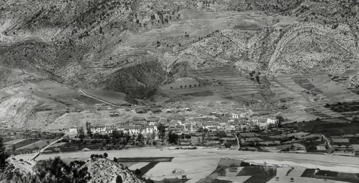
Utiel stands on the Plana de Utiel‑Requena, an open, windswept agricultural plateau in inland Comunidad Valenciana where vineyards define the horizon. Here, tourism in Utiel tends to revolve around the same themes: wine, historic routes and a town centre that still preserves traces of its medieval layout. The arrival of the high‑speed train changed the way people reach the town, but not its pace. Life continues to move slowly, following the rhythm of the grape harvest and the winters that settle over the nearby sierra.
The town’s documented origins are usually linked to a carta puebla granted by Pedro I in the 14th century. The settlement itself, however, predates that moment. Its name comes from the Andalusí period, when much of the Iberian Peninsula was under Muslim rule, and part of the old street plan appears to descend from that era. Streets climb towards the hill where the castle once stood, and even today they encourage a slower, steadier walk.
The Castle Hill and a Town’s Independence
The old castle occupied the highest point of Utiel. Only scattered remains survive, yet the position still makes sense of the town’s defensive logic. From here the wide plain of vineyards is visible, along with the natural routes leading towards Valencia.
At the end of the 14th century, Utiel bought its freedom from the feudal lordship to which it belonged, paying a considerable sum to secure its independence. That decision shaped much of what followed. During the Castilian wars of the 15th century, the town supported Isabel in opposition to the powerful Villena lineage. In time, Utiel was granted the title of city.
The old quarter retains stretches of wall built into later houses and several gateways that recall this earlier period. It is not a single monumental ensemble, but walking through it reveals distinct layers: medieval streets, alterations from the early modern centuries and more recent expansions. The town’s form reflects that gradual evolution rather than a single grand design.
Plaza Mayor and the Church of the Asunción
For centuries, Plaza Mayor has functioned as Utiel’s civic centre. It is not especially large, yet it gathers together several significant buildings and remains the natural meeting point of the town.
On one side stands the church of the Asunción. Construction of the current building began in the 16th century and it underwent later reforms. Inside, late Gothic elements coexist with Baroque additions, a combination often found in churches that were expanded over time. The structure of the vault, unusual in its design, tends to catch the attention of those entering for the first time.
Close by is the 19th‑century bullring known as La Utielana. It has traditionally been linked to the September festivities dedicated to the Virgen del Remedio. During those days, the town fills with visitors from across the surrounding comarca, or district, and the atmosphere shifts noticeably from the rest of the year.
Wine and the Economy of the Altiplano
To understand Utiel, it is necessary to look beyond the streets and towards the vineyards. The comarca forms one of the largest wine‑producing areas in inland Valencia, and the bobal grape dominates much of the landscape.
In the 19th century, the arrival of the railway made it possible to send wine to the port of Valencia and on to external markets. That period consolidated an economy based on cooperatives and family‑run wineries. Unlike in some other regions, the structure here remains largely local in character.
For many years bobal was considered a bulk grape, used mainly for large‑scale production. In recent decades it has regained prestige. Many of the area’s rosés and young reds are made from this variety. In traditional cooking it accompanies hearty inland dishes such as gazpacho manchego, prepared with game meat and flatbread pieces known as torta de pan. The combination reflects the agricultural setting of the plateau, where robust food suits the climate and the work of the fields.
Caves, Mills and Historic Routes
Beneath several houses in the old quarter lie caves dug into the rock. Many were opened from the 15th century onwards to store wine or grain. Before modern refrigeration, the stable underground temperature made them practical storage spaces. Some are still used today as private cellars.
The surrounding countryside offers straightforward routes that follow old agricultural tracks. One of the best known passes by former hydraulic mills built alongside ramblas and seasonal watercourses. Although only scattered structures remain, they are enough to suggest how milling functioned before industrialisation transformed production methods.
Utiel also appears along the route known as the Camino de la Lana. This historic corridor once connected the interior of the peninsula with the Mediterranean. Merchants and muleteers transported wool towards ports in the north and east. Present‑day walkers use the same natural passage across the plateau, following a path shaped by centuries of trade and movement.
Finding Your Bearings Today
The centre of Utiel can be explored easily on foot. From Plaza Mayor, the castle hill is only a few minutes away, and the older streets are best understood by wandering without a fixed plan. The scale is manageable and the changes in level reveal how the town adapted to its terrain.
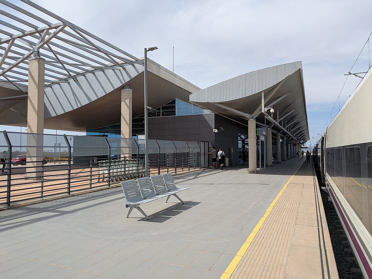
Utiel is well connected by road to Valencia and Madrid. There is also a railway station on the outskirts. Those arriving by car generally find parking without too much difficulty.
The grape harvest at the beginning of autumn transforms the atmosphere. Activity intensifies around cooperatives, and tractors move steadily along the rural tracks. In winter, calm returns to the altiplano. Wood smoke rises from chimneys and the vineyards stand bare, waiting for the next season. The landscape and the town settle back into their slower rhythm, shaped as ever by the vine and the plateau that sustains it.