Full Article
about Fortaleny
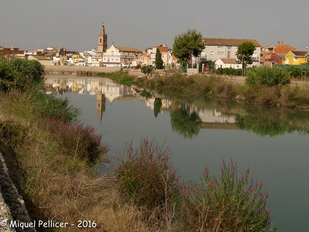
A village on the Júcar surrounded by rice fields, typical of the Ribera Baixa
Hide article Read full article
Fortaleny: A Village on the Júcar Plain
Fortaleny sits on the alluvial plain of the River Júcar, a few metres above sea level in the Ribera Baixa. Its history and layout are a direct product of water management and cultivation. For centuries, the landscape has been shaped by market gardens, citrus orchards, and, in the lowest areas, rice fields connected to the local marjal wetlands. This is not a village of isolated monuments, but one where the built environment is secondary to the agricultural system that sustains it.
With just over a thousand inhabitants, the scale is resolutely rural. While Valencia is roughly 40 kilometres north, the view from the edge of town is one of small plots, active orange groves, and a grid of irrigation channels. The village feels inserted into the fields, not separate from them.
The Parish Church and Village Structure
The centre of Fortaleny is compact. The parish church, dedicated to San Pedro Apóstol, has been modified over time and its exterior reflects those successive interventions. Its significance is more social than architectural; it serves as the community's focal point. The surrounding streets are lined with one- and two-storey houses, mostly from the late 19th and early 20th centuries. You can still see the wide doorways designed for cart access, a practical feature from when daily life was organised around the harvest.
The Engine of the Landscape: Water and Tracks
To understand Fortaleny, you walk out of it. A network of rural tracks follows the acequias, the irrigation channels that distribute water from the Júcar. This is a highly organised, centuries-old system. Each channel has a specific function, and the tracks provide access to the cultivated plots in a regular, geometric pattern. The landscape is functional, maintained, and entirely flat—suited for walking or cycling without any defined route.
The interest here is in observing the system at work: water flowing along channels, the boundaries of plots, the occasional barraca (a traditional rural storage building) still in use. During the farming season, the rhythm of work is visible. Birdlife common to wetlands and irrigated fields is often present, especially near the marjal zones.
Festive Rhythm and Agricultural Time
The festive calendar follows agricultural time. The main celebrations are for San Pedro Apóstol at the end of June, with religious events and community-organised activities. In January, the festival of San Antonio Abad involves the blessing of animals and street bonfires, a custom found in many Valencian farming towns. These summer verbenas and winter rituals are organised by local associations, reflecting a close-knit community. They are a pause in the agricultural routine, not a spectacle designed for outsiders.
A Practical Visit
Fortaleny is about 40 kilometres south of Valencia, reached via local roads that cross the agricultural plain. Spring brings the scent of orange blossom from the groves; autumn sees a return to visible activity in the fields after the summer heat.
You can see the village centre quickly. The substance of the place lies outside it, along those irrigation tracks. A visit clarifies the direct relationship between a settlement and its sustaining landscape—a relationship that here, on the Júcar plain, remains visibly intact.

