Full Article
about Herreruela
In the heart of the Sierra de San Pedro; a haven for hunting and nature lovers
Hide article Read full article
A small village shaped by the land
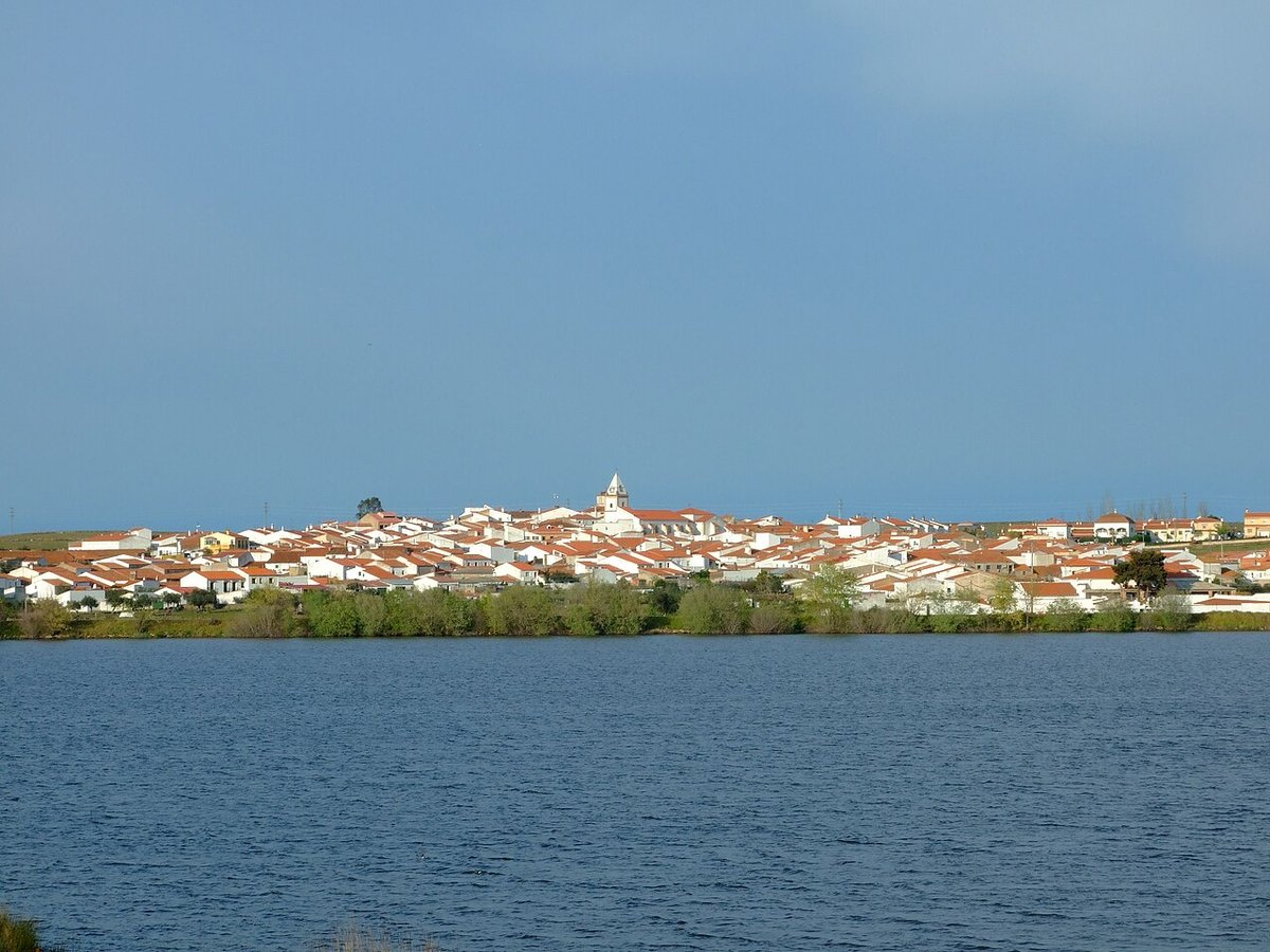
Tourism in Herreruela means coming to a small village in the Tajo-Salor area where the landscape matters more than monuments. It lies in the west of the province of Cáceres, in a wide and sparsely populated stretch of dehesa. Just over three hundred people live here, and daily life remains closely tied to the countryside.
The name of the village recalls old trades. Blacksmithing once had a certain presence, and it still survives in local memory and in some place names. That is not unusual in villages that grew around small rural economies, where each trade had its place and practical role.
Herreruela does not present itself as a destination of grand sights. Its appeal rests instead on its scale, its setting and the continuity between the built village and the surrounding fields.
The church and the shape of the streets
At the centre of the village stands the parish church of the Asunción de Nuestra Señora. Construction began in the 16th century and later alterations took place, probably in the 18th century. It is not a monumental church, yet its tower defines the outline of Herreruela when approaching along the surrounding tracks.
The streets spread out around the main square. They are short, with some stretches still paved in stone. The houses follow a simple architectural style: whitewashed walls, stone in the older sections and tall chimneys. Many properties retain corrals or rear patios. In several cases it is easy to see where there were once stables or small spaces used to store tools and animals.
A walk through the centre takes less than an hour at an unhurried pace. A circuit around the square, a turn past the church and a few detours into nearby streets are enough to understand how the village is laid out. The structure is compact, with everything close at hand, reflecting a way of life organised around work in the fields and livestock.
The dehesa around Herreruela
Beyond the last houses, the dehesa begins almost immediately. Holm oaks and cork oaks stand scattered across open pasture, forming the typical landscape of this part of Tajo-Salor. The dehesa is a traditional agro‑pastoral system in south-west Spain, shaped over centuries by livestock grazing and careful use of woodland resources.
This is a territory moulded by herding and by the management of the monte, or scrub and woodland. The result is an open landscape with long views, where trees provide shade for animals and seasonal changes are visible in the grass and undergrowth.
The river Salor runs through the wider district and creates narrow strips of denser vegetation along its banks. Ash trees, willows and oleanders grow in these areas. With patience, herons or kingfishers can often be spotted near the water. At dusk it is not unusual for wild boar or deer to appear in quieter spots.
The sky feels broad here, with little to interrupt the horizon. Birds of prey take advantage of the open terrain. Buzzards and kites are frequently seen gliding above the fields, scanning for movement below.
Rural tracks and open countryside
Several agricultural tracks and old livestock routes lead out from Herreruela. They are not signposted walking trails, yet they allow for rambles through dehesa, olive groves and fenced grazing land. Most of these routes are fairly flat, though it is sensible to get your bearings before setting off.
The experience is straightforward: dirt paths, dry stone walls in places, gates marking the edges of grazing areas. The setting remains consistent, shaped by agriculture and livestock rather than by tourism infrastructure.
Climate plays an important role in planning any walk. In the hotter months it is best to start early, as the summer sun in this part of Extremadura becomes intense quite quickly. Spring and autumn are generally the most pleasant seasons for walking. The pastures are green and temperatures are moderate. Summer requires adjustments to daily routines because of the heat, while winter days can feel quieter and somewhat damp. Even then, the dehesa keeps a sober tone that has its own interest.
Home cooking and produce from the fields
Food in Herreruela reflects what the surrounding land provides. Dishes such as migas, caldereta de cordero and recipes linked to the matanza del cerdo remain part of many households. Migas, made from breadcrumbs cooked with oil and other simple ingredients, have long been associated with rural work. Caldereta de cordero is a lamb stew prepared slowly and shared on family occasions. The matanza refers to the traditional pig slaughter, an annual event that supplied meat and sausages for much of the year.
These are straightforward recipes, designed for long working days. Olive oil from nearby groves is used in almost everything. Seasonal vegetables from kitchen gardens also appear in stews and salads when available. The cooking is direct and practical, closely connected to the rhythm of agricultural life.
There is no elaborate gastronomic scene here. Meals reflect continuity rather than innovation, and they remain rooted in the resources of the dehesa and surrounding farmland.
Practical notes for visiting
Herreruela is a small municipality with no notable tourist infrastructure. It is best reached by car, both for access to the village itself and for exploring other nearby settlements in the comarca. Public services are limited, in keeping with its size.
The compact urban centre can be explored easily on foot. After a short walk through the streets, the most rewarding option is often to head out along the surrounding tracks and spend time observing the landscape.
Tourism in Herreruela is therefore less about ticking off sights and more about understanding a rural environment in western Cáceres. The church of the Asunción de Nuestra Señora anchors the village visually. The dehesa defines it spatially. Between the two lies a community that continues to live at a pace set largely by the land.