Full Article
about Salorino
In the Sierra de San Pedro; bird special-protection area and border
Hide article Read full article
A landscape that sets the tone
Tourism in Salorino begins before reaching the village itself. The surroundings explain it straight away: open dehesa, with holm oaks spaced across grassland and low stone walls marking out plots of land. This is a traditional Iberian landscape shaped by farming and grazing, and it defines everything that follows.
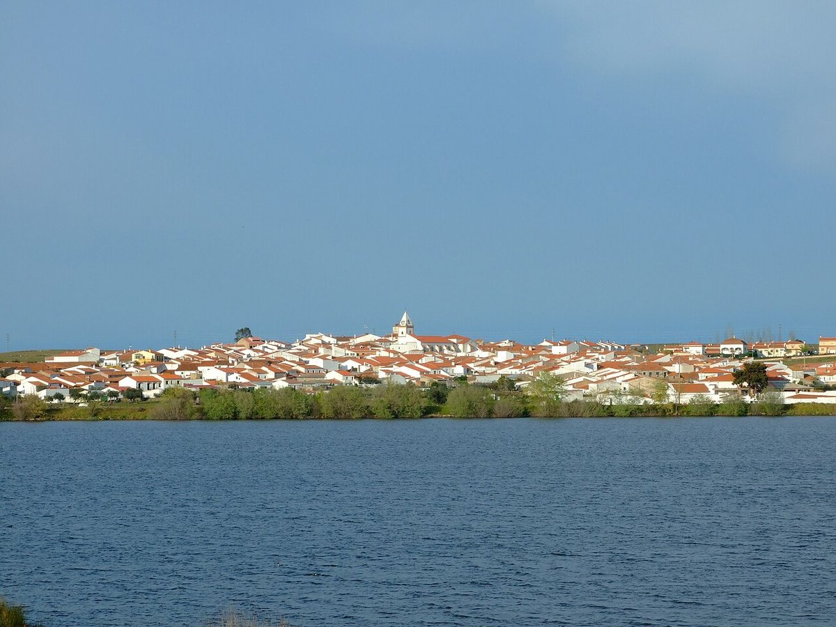
Salorino lies in the Tajo‑Salor comarca, at around 323 metres above sea level. It is a small place, with roughly 520 residents, and its size is immediately apparent. There is no sense of expansion or sprawl. The scale remains close to the land it depends on.
The built fabric reflects that rural economy. Houses are one or two storeys high, with whitewashed masonry walls and wide gateways that once allowed carts and livestock to pass through. Many still have rear yards or corrals. Nothing here is designed to impress. It is simply the architecture required by a community whose daily life has long revolved around agriculture and livestock.
In a few spots, old fountains and washing places still stand. They recall how life was organised before running water reached every home. These are not prominent landmarks, yet they help explain how the village functioned through much of the twentieth century.
San Bartolomé and the shape of the village
The parish church of San Bartolomé occupies a central position in Salorino. The current building is usually dated to the sixteenth century, though it has undergone later alterations. Its exterior is restrained: whitewashed stone walls, a rounded arch doorway and a bell tower of modest proportions.
Inside, there is an eighteenth-century Baroque altarpiece. It is not monumental in scale, but it reflects the kind of artistic renewal that many rural parishes experienced during that period.
Much of the urban layout is organised around the church. Streets run fairly straight and remain narrow, lined with houses that combine stone, lime and iron in their grilles and balconies. Some doorways retain old metal fittings, and wooden beams are still visible in places. These small details point to different phases of extension and adaptation over time.
Walking through this part of the village gives a clear sense of continuity. The layout has not been reshaped to suit modern planning ideas. It still follows the logic of a settlement built gradually, responding to practical needs rather than design.
The dehesa beyond the houses
The wider municipal area is dominated by dehesa made up of holm oak and cork oak. This is a landscape worked over centuries. Extensive livestock farming remains central, alongside cork harvesting where cork oaks grow, and small agricultural plots.
Several rural tracks leave directly from the village and lead into these estates. After a short walk, stone enclosures, livestock ponds and traditional fencing come into view. The link between the village and its surroundings is immediate and direct. Salorino exists because the dehesa exists.
This connection is not abstract. It is visible in the way the settlement opens towards the countryside, and in how quickly the built area gives way to fields and grazing land.
The open nature of the terrain also makes wildlife easy to spot. Birds typical of this environment are common here. Hoopoes, Iberian magpies and kites can often be seen nearby, especially early in the day when activity is higher and the light is softer.
Seasonal changes in the landscape
Spring and autumn are the most comfortable times to walk the nearby tracks. In spring, grass covers much of the dehesa, bringing a softer appearance to the land. Autumn shifts the palette towards drier tones, and activity in the countryside increases again with the montanera, the seasonal period when livestock feed on natural resources such as acorns.
Summer tends to be harsh from midday onwards. Visits at that time of year are better suited to early morning or the final hours of the afternoon, when temperatures ease. In winter, the landscape becomes more austere, though the low evening light works well across the open terrain, highlighting the shapes of trees and stone walls.
Each season changes the feel of the same place, but the underlying structure remains constant: a working landscape tied closely to the rhythms of agriculture.
A short visit that explains a lot
Salorino can be explored in a relatively short time. A walk starting from the church and continuing through the surrounding streets is enough to understand the village itself. From there, it is worth heading out briefly along one of the tracks leading into the countryside.
That short transition from street to field is key. It reveals how the settlement and the dehesa depend on each other. The village is small, and there are no major monuments or fixed visitor routes. What matters here is observation.
Looking closely at how houses are arranged, where corrals appear, and how the built area gradually opens into farmland provides a clearer picture than any formal itinerary. The real story of Salorino lies in that relationship between people, buildings and land, shaped over time by the demands of rural life.